216 m away
Couloir Moos North

Short add-on to the Moos couloir route with steep tree skiing.
Difficult Freeride Skiing
- Distance
- 1.1 km
- Ascent
- 0 m
- Descent
- 258 m
A nice line in the woods, requires walking a bit
Freeride Skiing Moderate

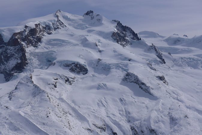
This is a popular freeride skiing route which is generally considered to be moderate. It's remote, it features medium exposure (e2) and is typically done between December and March. From a low point of 1.8 km to the maximum altitude of 2.3 km, the route covers 1.9 km, 56 vertical metres of ascent and 495 vertical metres of descent. It's graded 2.2 and Labande grade 3. You'll need skins to complete it safely.
This line is nicely steep and hidden in the woods. Not often skied thanks to the fact that requires 15 minutes walking, usually good snow can be found here. Pay attention not to go too far up the ridge because there is a big cliff there and a fall could be very dangerous.
Moderate
Slopes become slightly steeper at around 25-30 degrees.

As well as the slope itself, there are some obstacles (such as rock outcrops) which could aggravate injury.
Away from help but easily accessed.
216 m away
Short add-on to the Moos couloir route with steep tree skiing.
Difficult Freeride Skiing
449 m away

A steep couloir close to the slope
Moderate Freeride Skiing
503 m away

Ample slopes but needs a little walk at the beginning
Difficult Freeride Skiing
520 m away

Easy terrain to practice off-piste skills on a powder day.
Difficult Freeride Skiing
586 m away

Tree skiing below the gondola.
Moderate Freeride Skiing
965 m away

A straightforward ski in some remote and captivating scenery.
Difficult Freeride Skiing
1.2 km away

Enjoyable and steeper alternative to the Leisch canyon.
Difficult Freeride Skiing
1.4 km away

steep woods
Moderate Freeride Skiing
1.4 km away

Awesome scenery down a deep canyon between high cliffs.
Difficult Freeride Skiing
1.4 km away

Steep tree skiing for powder days only - a longer alternative to Jolanda.
Difficult Freeride Skiing
12 routes · Freeride Skiing