33 m away
Tour du Mont Blanc: Lavancher to La Fouly
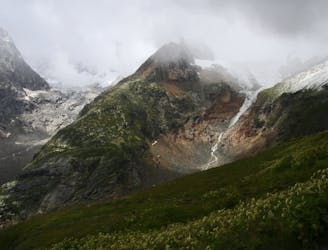
Day 6: The second border crossing and the highest col on the main Tour du Mont Blanc route.
Difficult Hiking
- Distance
- 18 km
- Ascent
- 871 m
- Descent
- 962 m
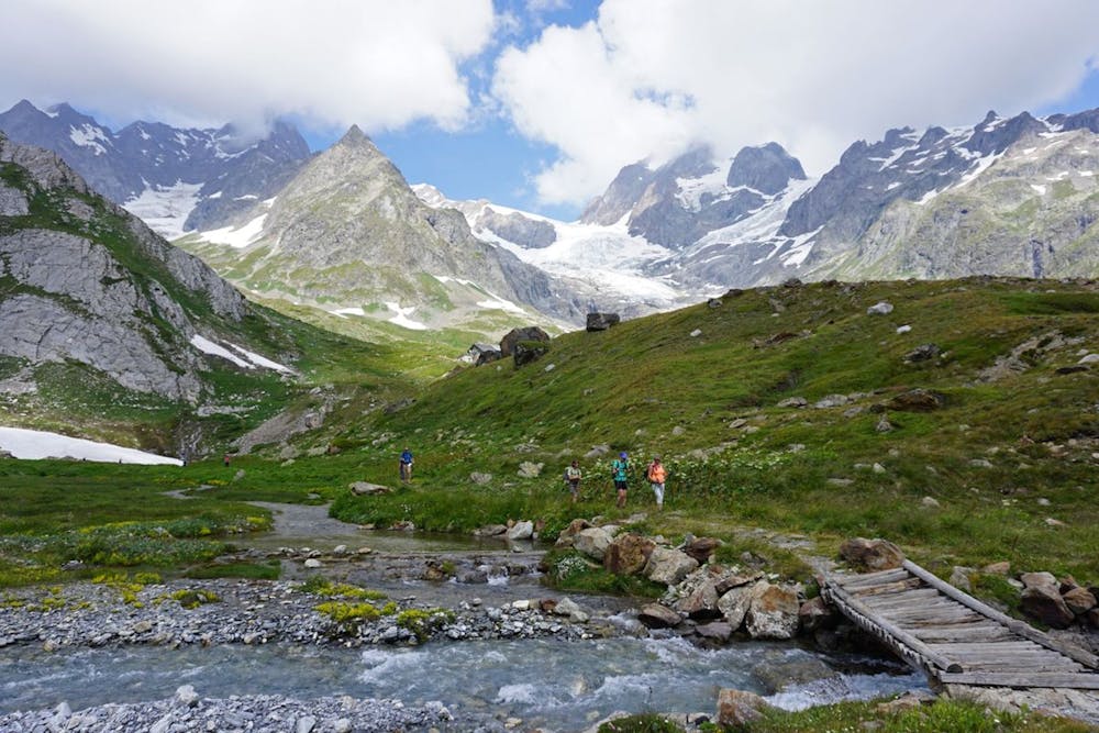
L'un des meilleurs panoramas des faces sud du massif du Mont-Blanc !
Hiking Moderate

Aujourd'hui, vous traverserez la frontière pour rejoindre le Val Ferret en Italie. Assurez-vous d'avoir chargé la batterie de votre appareil photo pour le paysage d'aujourd'hui.
Vous commencerez à marcher jusqu'au Rifugio Bonatti. Continuez sur un sentier en balcon qui vous mènera au refuge Rifugio Bertone.
Vous aurez l'un des meilleurs panoramas sur les faces sud du massif du Mont-Blanc, en particulier sur les célèbres Grandes Jorasses.
Vous redescendrez ensuite vers Courmayeur à travers une forêt alpine.
https://www.outdoorvoyage.com/adventures/guided-tour-mont-blanc/5162
Moderate
Hiking along trails with some uneven terrain and small hills. Small rocks and roots may be present.
33 m away
Day 6: The second border crossing and the highest col on the main Tour du Mont Blanc route.
Difficult Hiking
4.1 km away
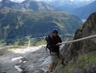
An exceptional, adventurous hike featuring some sections of easy via ferrata and exposed terrain.
Extreme Hiking
8.1 km away
Day 5: Although this day is more of a detour than anything, it is a wonderful one in good weather. If the weather is bad or you're pushed for time, get the bus from Courmayeur to Arp Nouva to join stage 6 and skip out this stage.
Difficult Hiking

14 routes · Hiking

9 routes · Alpine Climbing · Hiking

10 routes · Alpine Climbing · Hiking