885 m away
Tour du Mont Blanc: Lavancher to La Fouly
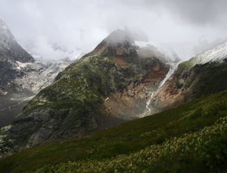
Day 6: The second border crossing and the highest col on the main Tour du Mont Blanc route.
Difficult Hiking
- Distance
- 18 km
- Ascent
- 871 m
- Descent
- 962 m
From the popular Rifugion Bonatti to the local secret of Planaval and the Petite Bergerie
Hiking Difficult

The Bonatti Rifugio is popular for good reason. As well as being on the classic TMB (Tour du Mont Blanc), it's very comfortable by alpine hut standards and in a beautiful spot. But you set off from this well known treasure en route to the well kept secret of the Petite Bergerie - a favourite with the locals in the Aosta valley.


Follow the picturesque alpine trails to the Col Entre Deux Sauts and continue winding your way up to the increasingly alpine terrain of the Col du Bataillon. From here the trail takes you steeply down to the Grand Plan and Chambave before winding back through the forest to the delightful Planaval, where you would be well advised to stay for dinner or even the night.
Difficult
Hiking trails where obstacles such as rocks or roots are prevalent. Some obstacles can require care to step over or around. At times, the trail can be worn and eroded. The grade of the trail is generally quite steep, and can often lead to strenuous hiking.

The trail contains some obstacles such as outcroppings and rock which could cause injury.
Away from help but easily accessed.
885 m away
Day 6: The second border crossing and the highest col on the main Tour du Mont Blanc route.
Difficult Hiking
4.1 km away
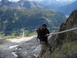
An exceptional, adventurous hike featuring some sections of easy via ferrata and exposed terrain.
Extreme Hiking
7.7 km away
Day 5: Although this day is more of a detour than anything, it is a wonderful one in good weather. If the weather is bad or you're pushed for time, get the bus from Courmayeur to Arp Nouva to join stage 6 and skip out this stage.
Difficult Hiking

14 routes · Hiking

9 routes · Alpine Climbing · Hiking

10 routes · Alpine Climbing · Hiking