2.9 km away
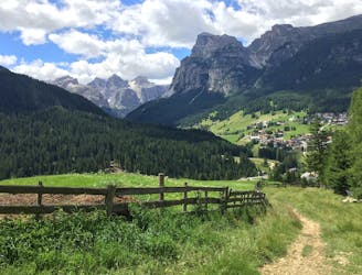
La Villa - Val di Fanes - Sennes - Pederü - Val Badia.
A beast of a ride through some of the best scenery in the Alps!
Difficult Mountain Biking
- Distance
- 103 km
- Ascent
- 3.3 km
- Descent
- 3.3 km
Fun singletrack riding through stunning Ladin valleys.
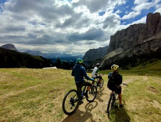
Mountain Biking Moderate

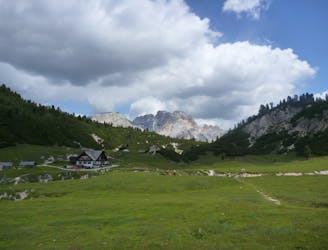
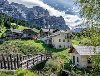
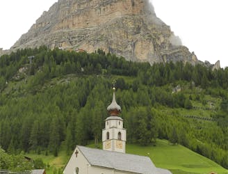
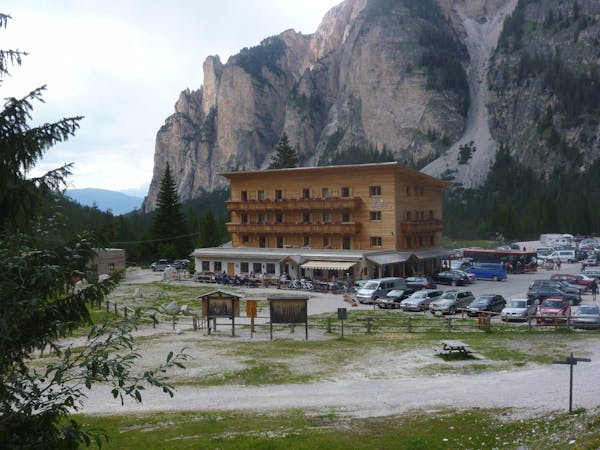
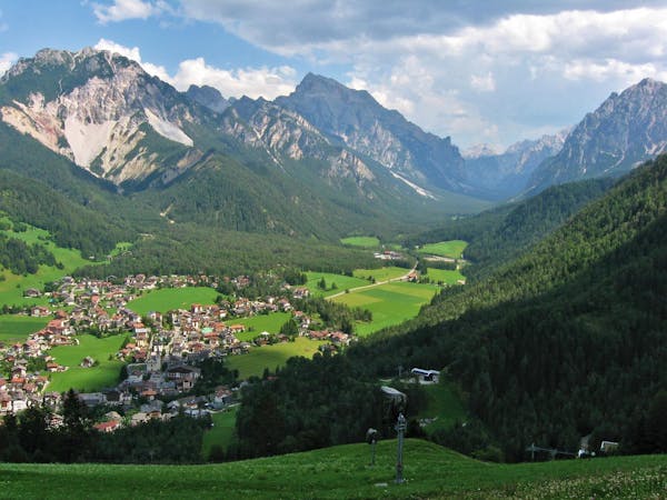
A classic ride through some the heart of Ladin country, this is a must do for any intermediate rider who wants to know what the Dolomites is all about. The ride starts and finishes in Badia - a lovely little village which is worth a bit of your time before or after your adventure.
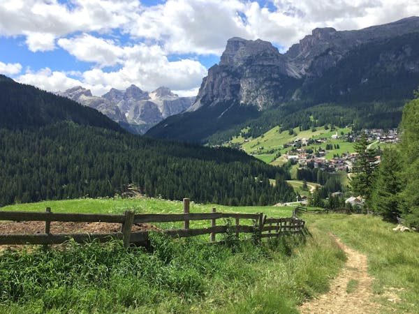
Start out by heading to Costa on an easy singletrack next to the road. Cross a tarmac bridge then more singletrack leads you down to the bottom of the valley. The track is quite steep at times but never technical so whilst it's slightly intimidating, it's never "hard".
Once in the valley floor, follow the river on a stoney gravel track to Pidrô. The track finishes on a bridge but just keep following the valley on tarmac for a couple of kilometres to a bridge on the left in the village of Preroman.
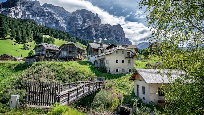
Go straight ahead until you reach a big house in the middle of a field. To the left of the house is a singletrack trail - follow this with no significant obstacles up to the road in between Rozo and Crostelles.
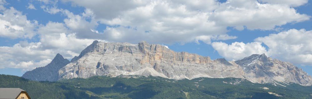
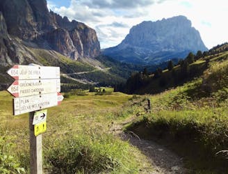
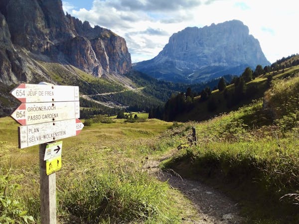
Follow the road to Lungiarü then cross the town to where the tarmac finishes and then follow signs for Juel onto a gravel track. Follow the track, always following signs for Juel, to the top of the Juel pass, which enjoys a huge view across some classic Dolomites rock walls.
Go down another easy gravel track to Pescol, where the track becomes tarmac again. Follow this tarmac road back to Badia.
Moderate
Mostly stable trail tread with some variability, with unavoidable obstacles 8in/20cm tall or less. Other obstacles such as rock gullies and steep sections may exist. Ideal for lower intermediate riders.

The trail contains some obstacles such as outcroppings and rock which could cause injury.
Away from help but easily accessed.
2.9 km away
A beast of a ride through some of the best scenery in the Alps!
Difficult Mountain Biking
5.4 km away
A scenic cruise through a famous Ladin valley.
Moderate Mountain Biking
5.7 km away
A big day out involving amazing scenery and fabulous riding.
Difficult Mountain Biking
6.6 km away
One of the longer climbs on the clockwise Sella Ronda followed by a fun descent.
Difficult Mountain Biking
7.1 km away
A lovely cruise on gravel roads, occasional tarmac and some very easy singletrack.
Easy Mountain Biking
7.1 km away
A wonderful journey beneath some epic Dolomitic scenery.
Moderate Mountain Biking
8.7 km away
A long and scenic descent beneath some magnificent mountain architecture.
Difficult Mountain Biking
9.6 km away
A long, varied and beautiful descent through a famous valley
Difficult Mountain Biking
3 routes · Mountain Biking
4 routes · Mountain Biking
3 routes · Mountain Biking
5 routes · Mountain Biking
6 routes · Mountain Biking · Hiking
5 routes · Mountain Biking
6 routes · Mountain Biking