1.6 km away
Pravasivo – Teregua – Bormio
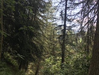
A technically challenging, steep ride through the forest.
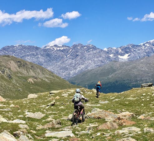
Difficult Mountain Biking
- Distance
- 9.9 km
- Ascent
- 350 m
- Descent
- 481 m
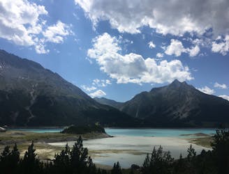
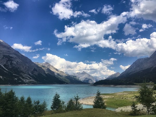
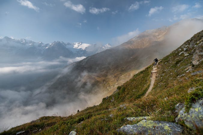
An intense climb to the wonderful Cancano Lakes and a thrilling descent back down to Bormio.
Mountain Biking Difficult

The climb from Bormio to the Cancano Lakes is notoriously tough. The average gradient of the slope is 6.9%, the maximum gradient is 8.5%, and the vertical gain is almost 800 m. Originally a mountain bike trail, the track up to the lakes has now been paved over and become very popular for road bikers. Around Cancano Lakes you definitely need a mountain bike, and if you want more, there are many fun and challenging mountain bike trails branching off of the main lake circuit.
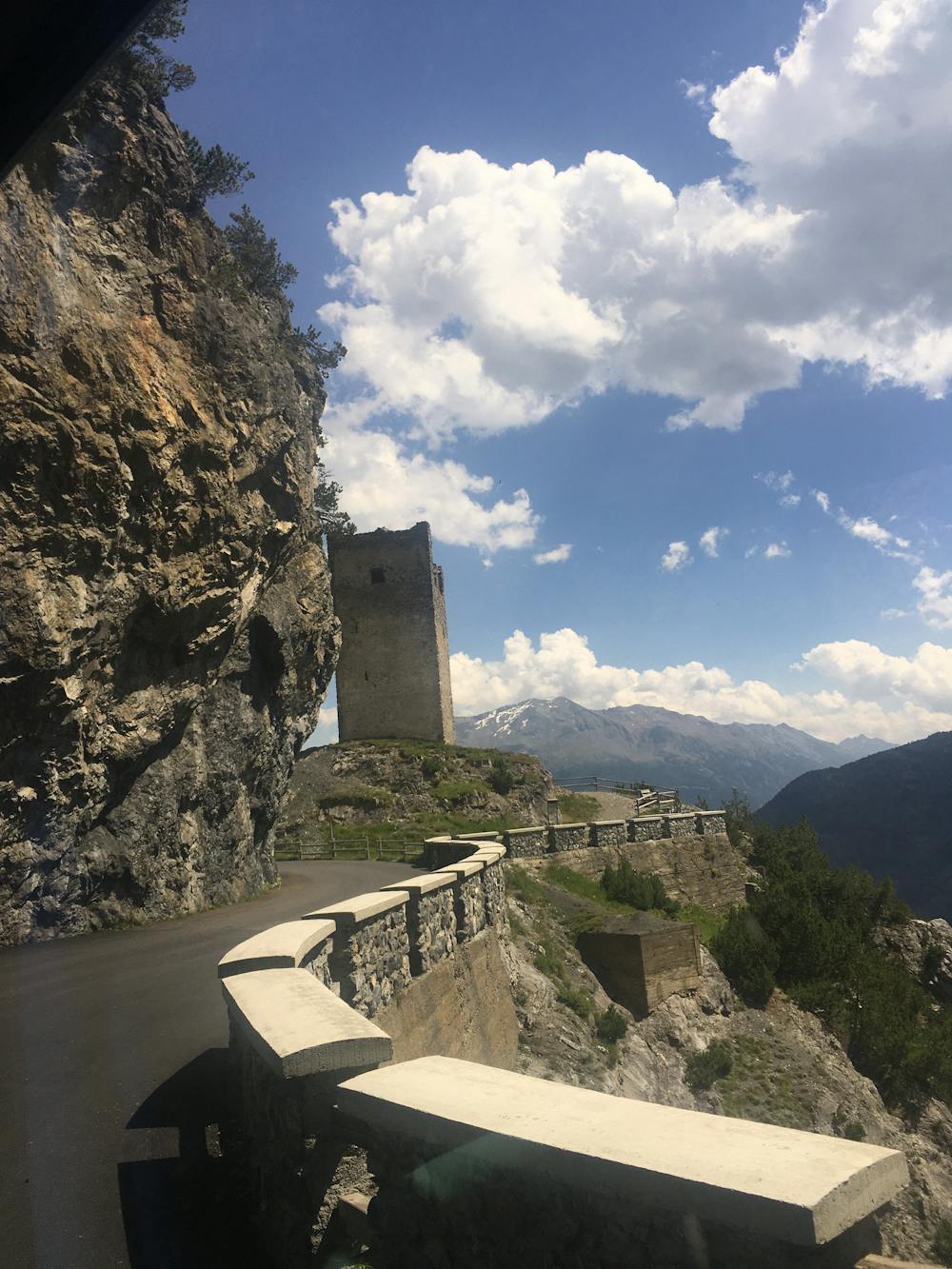
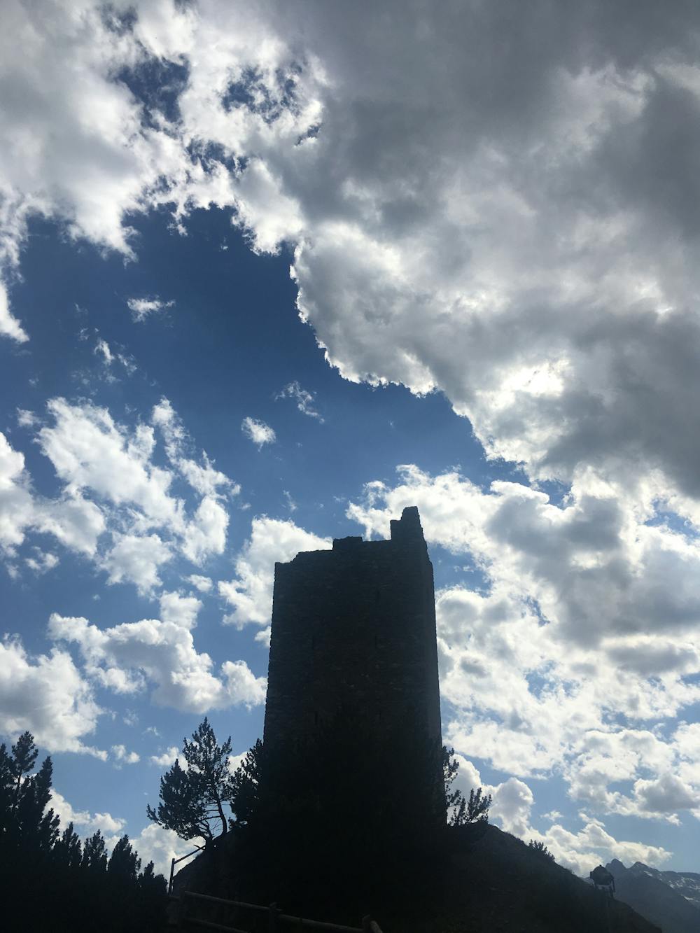
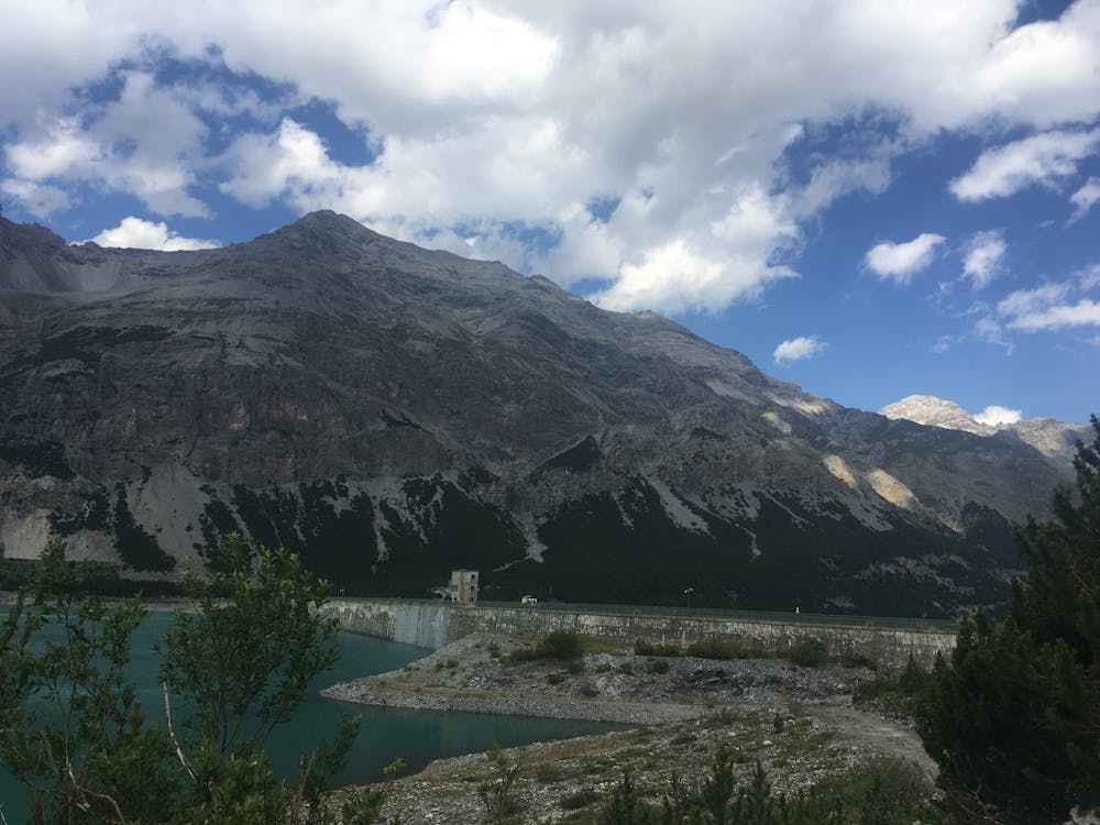
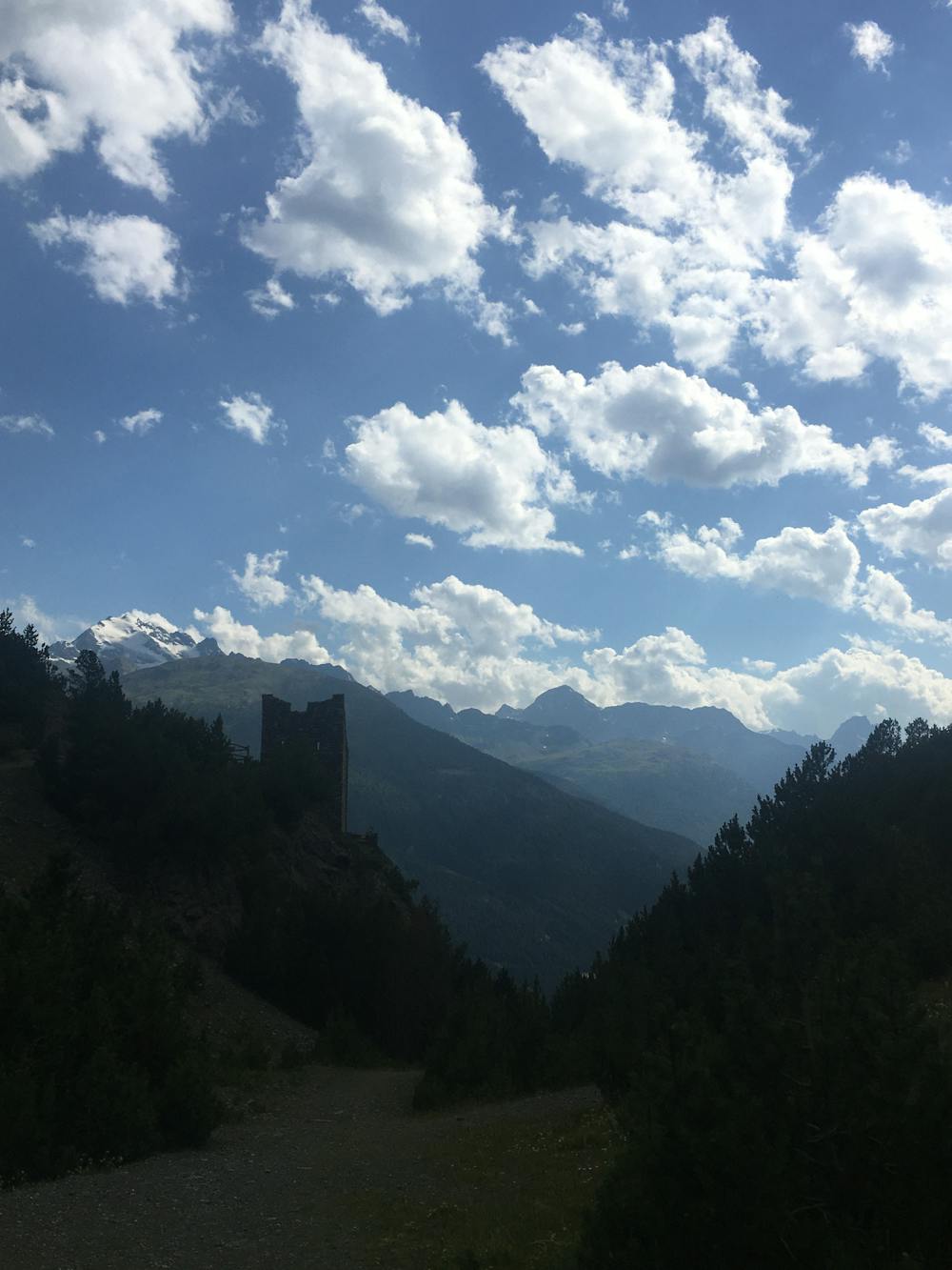
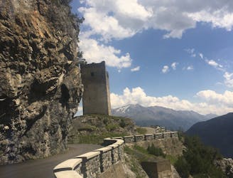
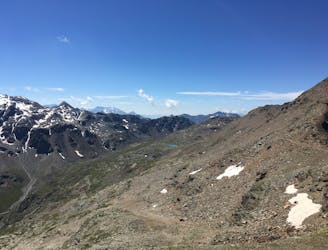
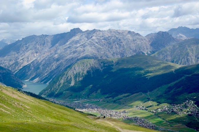
Beginning in Bormio, head in the direction of Fior d’Alpe via the SS 301. The start of the ride is relatively easy-going, with the real climb beginning with a series of hairpin bends that take you over the Valdidentro area. You will come to a couple of narrow tunnels through the mountains before hitting a picnic area and the Fraele Towers, two ancient military towers on the edge of the Cancano plateau.
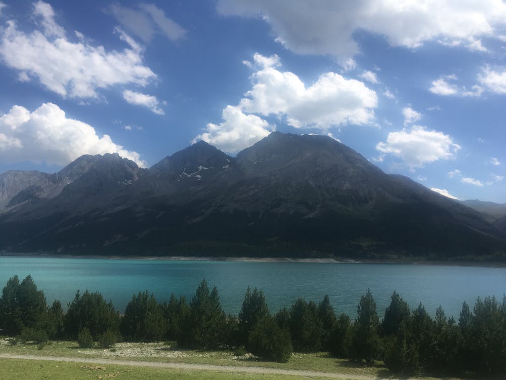
The next part of the ride around the lakes is one of the most popular trails in the area and one for all mountain bikers. It's around a 20km circular tour and it's pretty much flat the whole way around. You also have the option of making the trail shorter by cutting across the dam which divides the two artificial lakes of Cancano and San Giacomo. You will probably want to spend as much time up at the lakes as possible though because they are absolutely sublime. The bright blue waters of the lakes combined with the giant circle of mountains protruding directly out of them create a fantastically beautiful scene. The area is also very peaceful as traffic is banned from most of the lakeside and the only people around are hikers and mountain bikers.
Once finished at the lakes, head back down to Bormio on the route you climbed up. It's a fantastic knuckle-whitening descent with sweeping views over the Valdidentro area.
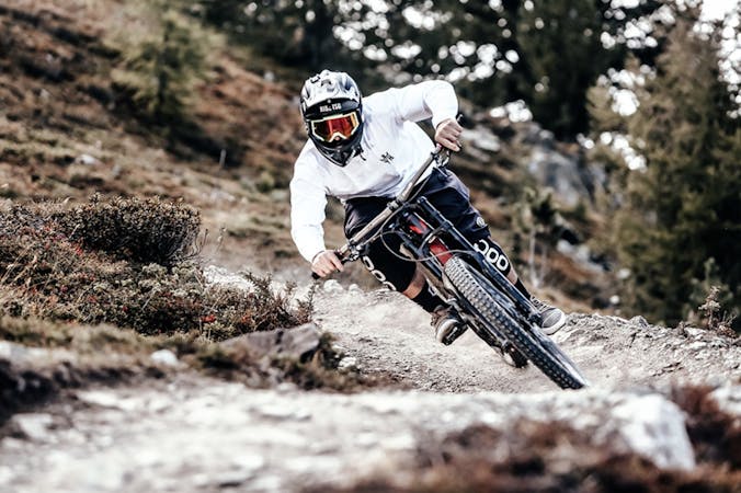
Difficult
Mostly stable trail tread with some variability featuring larger and more unavoidable obstacles that may include, but not be limited to: bigger stones, roots, steps, and narrow curves. Compared to lower intermediate, technical difficulty is more advanced and grades of slopes are steeper. Ideal for upper intermediate riders.

Some trail sections have exposed ledges or steep ascents/descents where falling could cause serious injury.

Away from help but easily accessed.
1.6 km away
A technically challenging, steep ride through the forest.
Difficult Mountain Biking
3.3 km away
Head up the Bormio 2000 for a tonne of interlaced mountain biking routes taking you down Bormio’s most loved mountain: the Cima Bianca.
Difficult Mountain Biking
6.3 km away
A challenging ride from the beautiful Cancano Lakes to the second highest paved mountain pass in the Alps.
Severe Mountain Biking
6.4 km away
The best way to experience the beautiful Cancano Lakes.
Easy Mountain Biking
6.4 km away
Head up the Bormio 3000 for serious challenge and insane views.
Severe Mountain Biking
8.9 km away
Amazing high alpine trails with insane landscapes.
Severe Mountain Biking
9.3 km away
An endless trail from a 3000m peak all the way down to the valley!
Severe Mountain Biking
4 routes · Mountain Biking
5 routes · Mountain Biking
4 routes · Mountain Biking · Hiking
9 routes · Mountain Biking
7 routes · Mountain Biking