1 km away
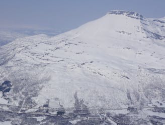
Rostakulen West Couloir
A Stunning Couloir just West of Tamokdalen
Difficult Ski Touring
- Distance
- 4.6 km
- Ascent
- 1.1 km
- Descent
- 1.1 km
A stunning Couloir just outside of the Tamokdalen Valley
Ski Touring Severe

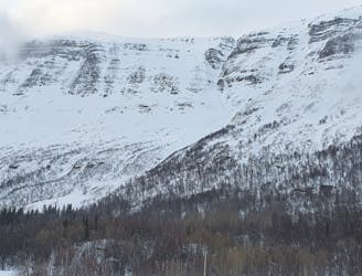
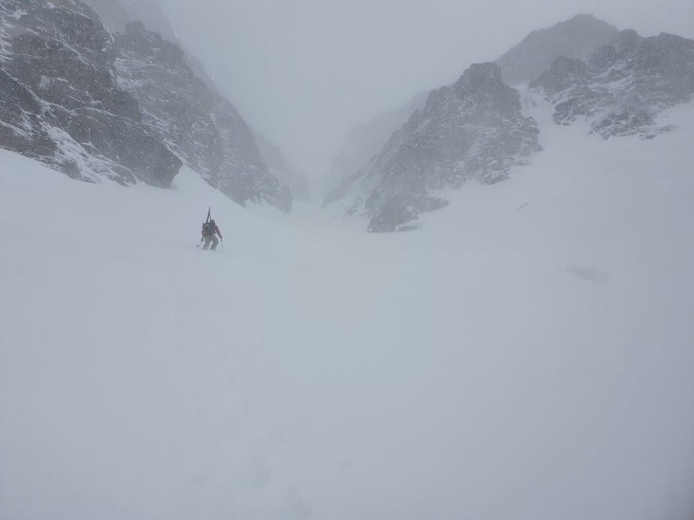
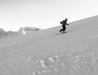
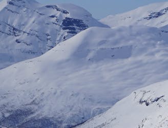
From the moment I saw the west facing couloir off of Rostafjellet I put it on my list of potential ski tours. Being over 3,000 feet from top to bottom it is an incredibly aesthetic line as well as a unique feature within the Tamok backcountry. Being on the Western side of the range and beyond the pass this area gets less snow and a better chance of sunshine if a storm is raging in the Tamokdalen Valley. We were filling okay with the snowpack as there had been a bit of fresh snow but the snow under it was solid. With favourable conditions we decided it was time to go check it out. It is a steep chute so must be accessed with caution.
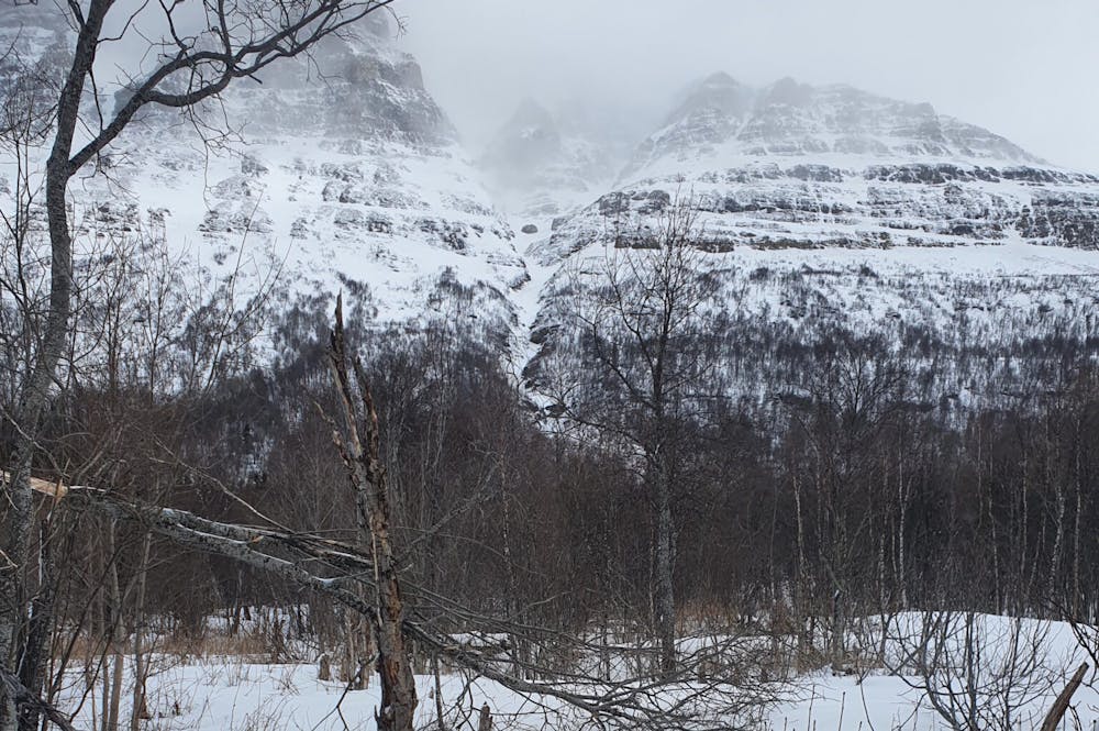
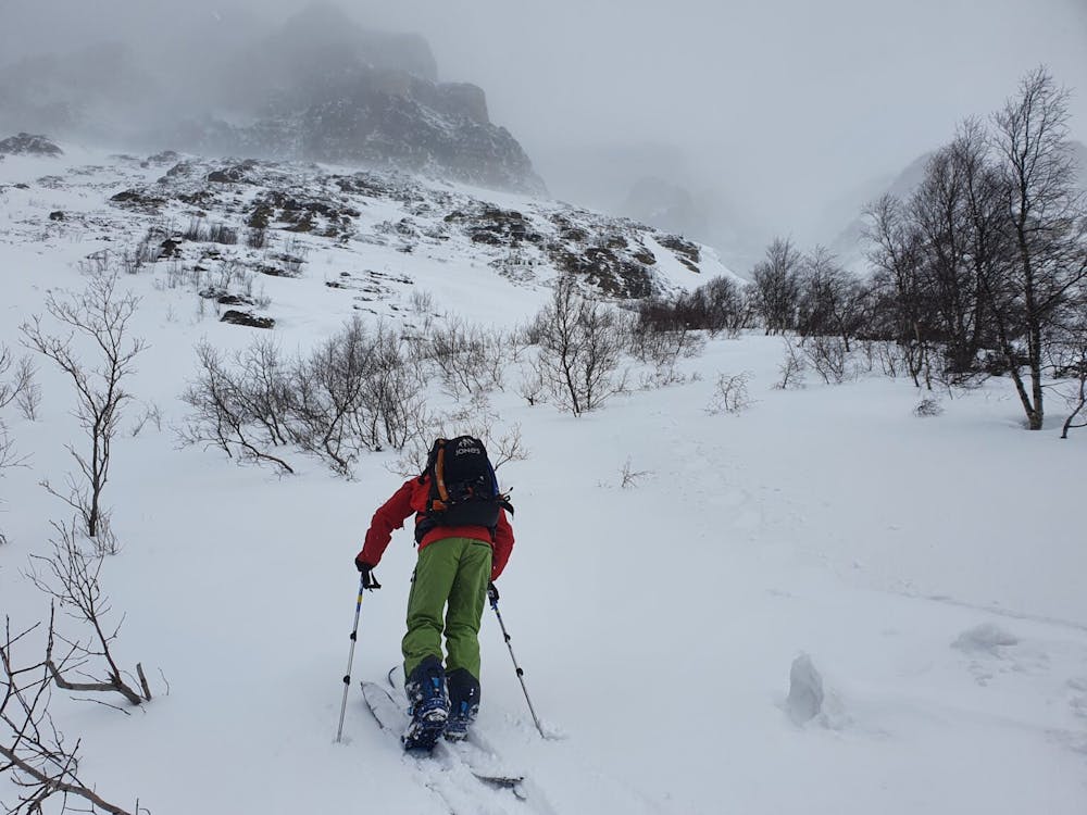
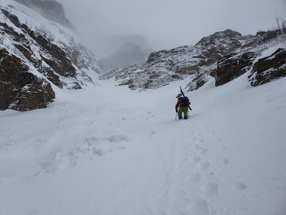
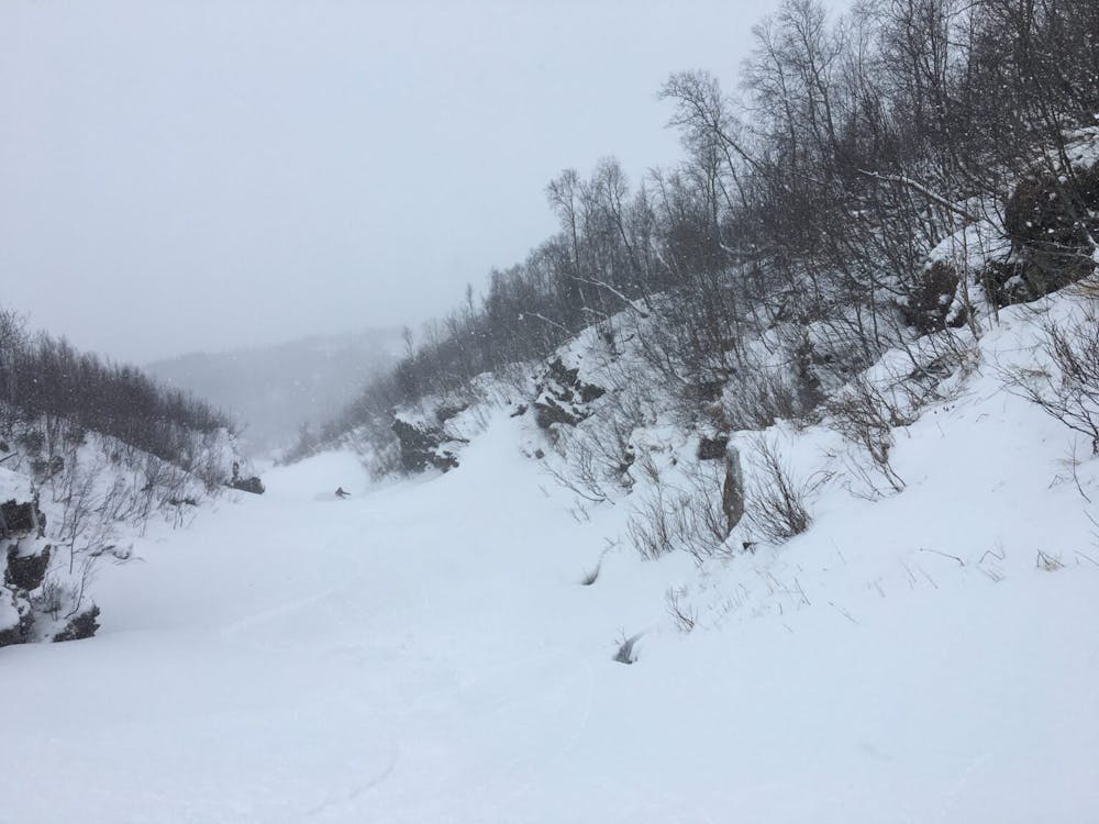
Driving among the East shores of Rostavatn make your way to Skredbekken creek where you can park within a few feet of your ascent route. At first follow the creek skinning right up the gut. Before long you will reach an impassible waterfall where we decided to head lookers left into the dense trees and claw our way up. Once near the top and just below a the massive rock headwall you can easily traverse back into the gully right at the moment it starts turning into a chute.
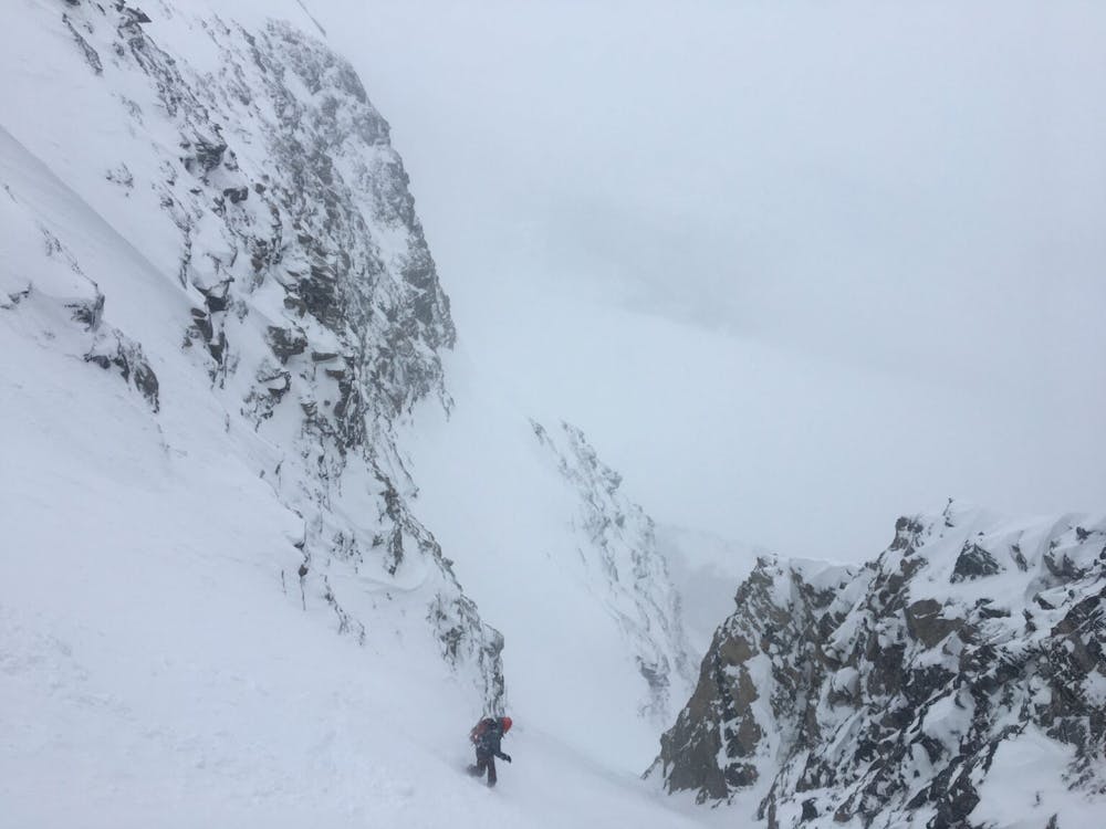
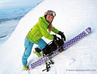
Once in the chute it comes up to a Y where you need to make your way up the lookers right side. From here on out proceed with caution going from protected spot to the next. When we climbed it one would hide in a safe spot while the other person made it to the next spot before the second person followed their tracks. The line is long and seems like it will never end but before long you are up at the col and excited about what you are about to ride.
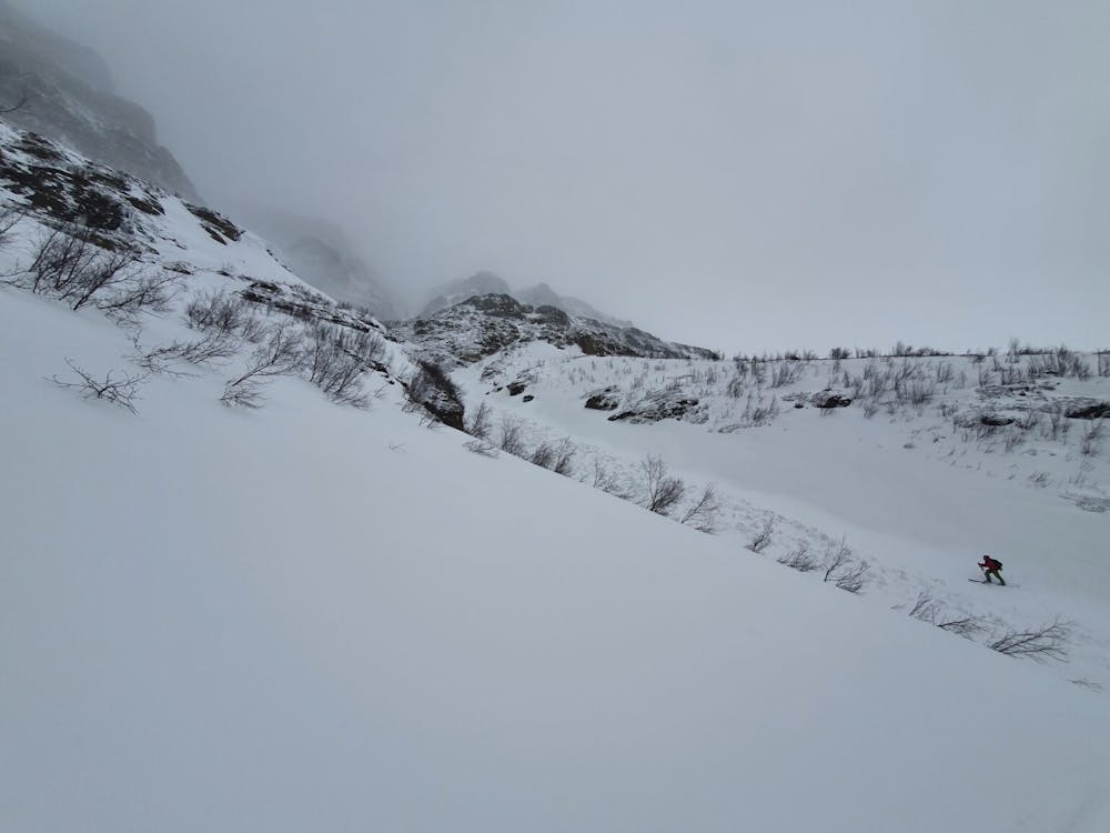
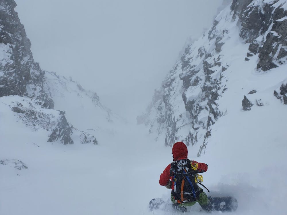
Dropping in make sure to space out and ride from safe spot to safe spot. Unlike our ascent route we decided to ride the gully all the way to just above the waterfall. Once on the flats just above we went skiers left and found a route to ride down through the dense trees before heading back into the gully. Near the bottom there is an open spot where we decided to traverse a bit skiers right and ride on the edge of a farm all the way to the car.
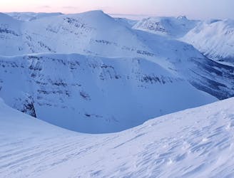
This is a great line but should only be done if the snowpack is stable and you are confident in your climbing abilities.
For more photos and information on the route check out this link https://www.whereiskylemiller.com/tamokdalen/rostafjellet-west/
Severe
Steep skiing at 38-45 degrees. This requires very good technique and the risk of falling has serious consequences.

As well as the slope itself, there are some obstacles (such as rock outcrops) which could aggravate injury.

Little chance of being seen or helped in case of an accident.
1 km away
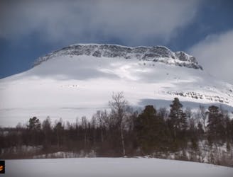
A Stunning Couloir just West of Tamokdalen
Difficult Ski Touring
1.3 km away
Looking for potential areas to tour while it's a high avalanche day
Moderate Ski Touring
5.8 km away
Possibly the best sunset run within all of the Tamokdalen Backcountry
Difficult Ski Touring
5.9 km away
Linking up two of the better North facing slopes in the Tamokdalen Backcountry
Difficult Ski Touring
6 km away
A great line to ride if conditions are stable but just eye candy otherwise
Difficult Ski Touring
6.1 km away
An interesting mountain with big open spaces for freeriding, and a summit guarded by a rock band. Can you overcome it?
Difficult Ski Touring
6.1 km away
Skiing spring corn snow under Hattavarre is a fun ski experience and the climbing up in the S couloir adds a touch of alpine climbing to the tour.
Severe Ski Touring
7.4 km away
Setting up a route to make the most out of the West facing chutes
Difficult Ski Touring
7.4 km away
Ski the fantastic classic normal route or drop big on the front face when conditions align
Moderate Ski Touring
7.4 km away
A great tour to get the views and enjoy your time in the alpine.
Moderate Ski Touring
5 routes · Ski Touring
8 routes · Ski Touring