41 m away
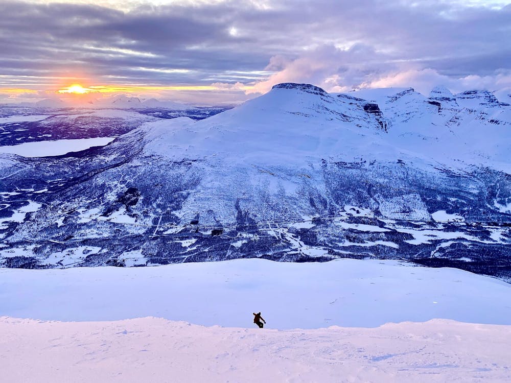
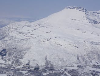
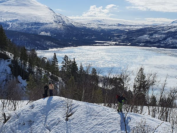
Rostakulen
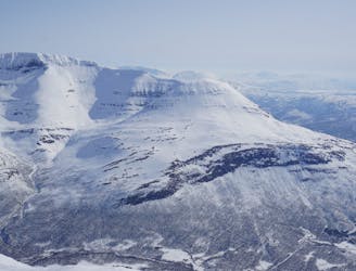
Possibly the best sunset run within all of the Tamokdalen Backcountry
Difficult Ski Touring
- Distance
- 7.1 km
- Ascent
- 1.1 km
- Descent
- 1.1 km
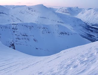
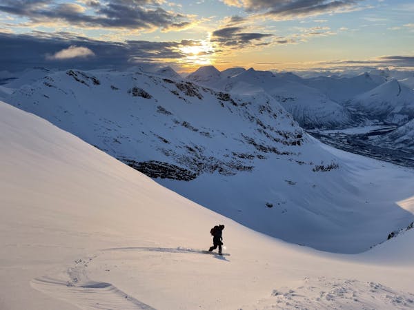
Linking up two of the better North facing slopes in the Tamokdalen Backcountry
Ski Touring Difficult

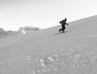
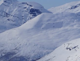
The north ridge of Midteraksia is one of my favourite lines to go for if you are a bit concerned about avalanche conditions but still want to get into the alpine. Being a ridge you can safely climb the upper slopes with minimal exposure to potential avalanches but also find some of the best snow in the area. That being said it is still not 100% safe as getting up to the ridge does force you to climb within an avalanche prone area but once past that then you will be well rewarded.
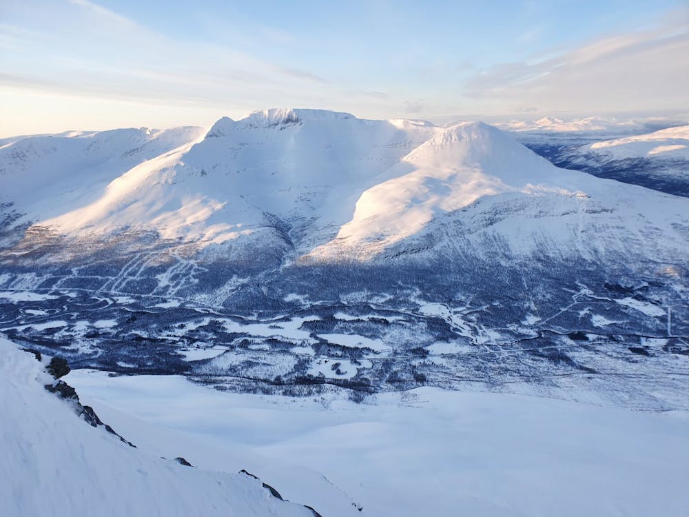
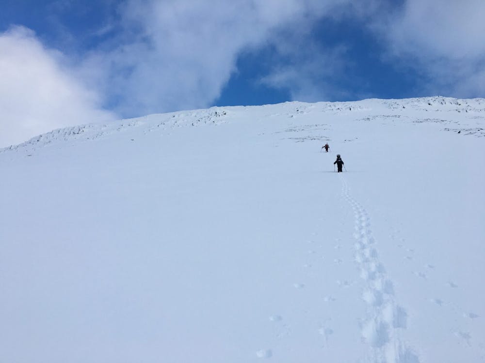
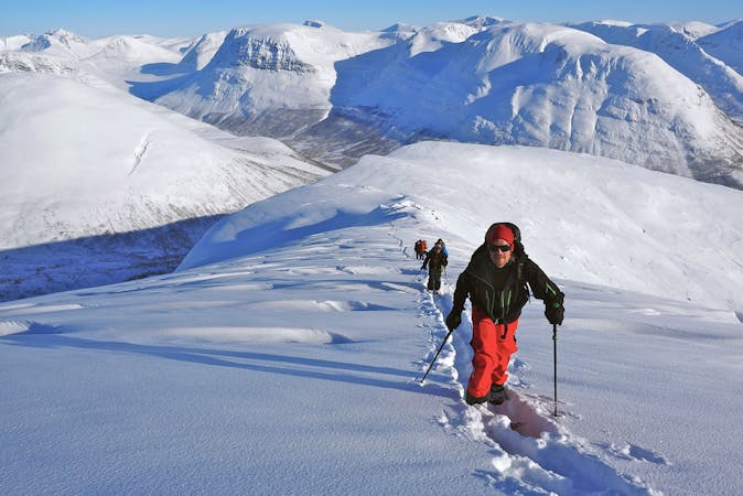
This tour starts almost identically to Rostakulen starting off parking at the Y just over the bridge of an area referred to as Engvoll on the maps. Once you get your gear in order start following the Cross Country skiing trail for a while before reaching the Skjellelva Creek. make sure to stay on the lookers right side of the creek as you make your way up gentle forests before reaching the base of the upper slopes.
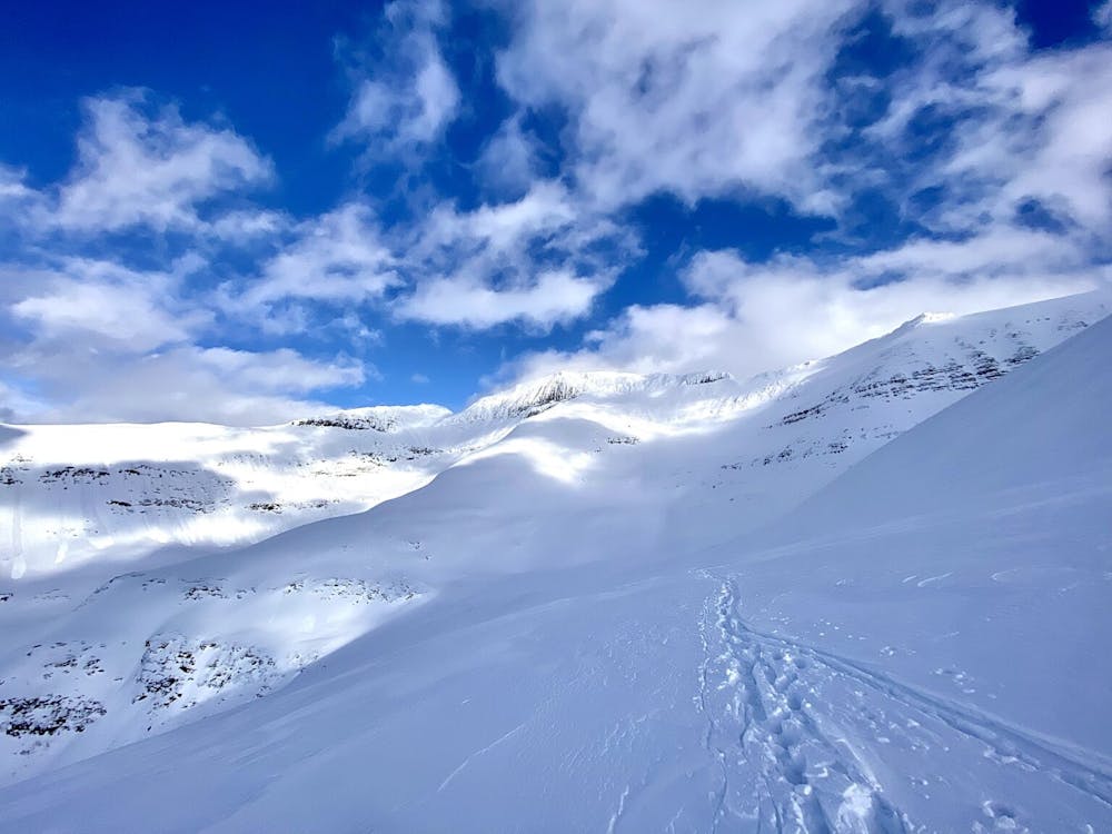
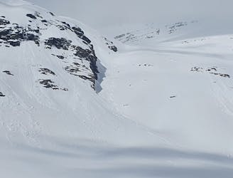
The crux of the route is getting into the upper bowl as there is a wide open gully that should be avoided at all costs and instead you should gain elevation on the lookers right side before traversing left and gaining access to the upper bowl. Being that this is exposed make sure to space your group out and never have everyone on the slope at the same time. If there are 3 people have someone wait at the bottom and only start climbing when the others are safely on the upper slopes.
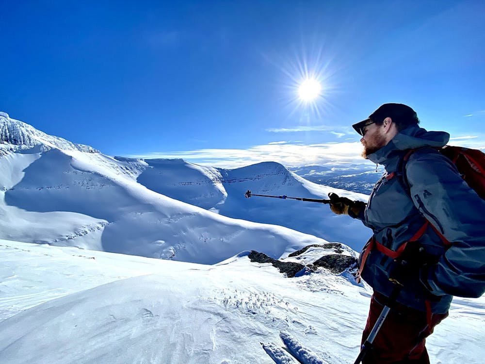
Once the group is back together it is time to start climbing a beautiful ramp to just below the true summit. While climbing make sure to stay on the high point not going to far to the lookers left which has cornices or to the right which just rolls off. Once satisfied with your starting point you can either follow your tracks back down or make your way a bit skiers left into the open bowl before arriving back onto the upper bench.
Exiting wise there are two routes to head back to the car. If you just want to get out you can follow your skin track back but it is low angled and you will most liking be skinning the entire way back.
The other option is to do a low angle traverse towards the lower slopes of Rostakulen (snow conditions must be stable) and if done right you are just below the main headwall of Rostakulen. If you still have a bit of gas in your tank then switch over to crampons and make the final climb up to the summit before descending. If you choose the second route make sure to remember that there is a huge cliff band 2/3 the way down the slope and the moment you start hitting tree line to cut a hard skiers right to make your way around it. Once in the lower trees there is no stress but try to find a bit more open gully as the trees are tight which will descend all the way back to the nordic trail.
This is a great tour which usually holds powder snow much longer then other places. Also with it being a ridge it only takes a little bit of wind to clear up old tracks and you will find yourself on a blank snow canvas.
For more photos and information on the route check out this link https://www.whereiskylemiller.com/tamokdalen/rostakulen-and-midteraksia/
Difficult
Serious gradient of 30-38 degrees where a real risk of slipping exists.

As well as the slope itself, there are some obstacles (such as rock outcrops) which could aggravate injury.
Away from help but easily accessed.
41 m away
Possibly the best sunset run within all of the Tamokdalen Backcountry
Difficult Ski Touring
286 m away
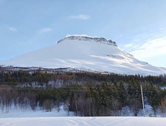
An interesting mountain with big open spaces for freeriding, and a summit guarded by a rock band. Can you overcome it?
Difficult Ski Touring
295 m away
Skiing spring corn snow under Hattavarre is a fun ski experience and the climbing up in the S couloir adds a touch of alpine climbing to the tour.
Severe Ski Touring
866 m away
A great line to ride if conditions are stable but just eye candy otherwise
Difficult Ski Touring
3.4 km away
Setting up a route to make the most out of the West facing chutes
Difficult Ski Touring
3.4 km away
Ski the fantastic classic normal route or drop big on the front face when conditions align
Moderate Ski Touring
3.4 km away
The grand tour of the terrain just north of Tamokhuset
Difficult Ski Touring
3.4 km away
A great tour to get the views and enjoy your time in the alpine.
Moderate Ski Touring
4.5 km away
A long and scenic ski tour from Through Norway, Sweden and Finland
Severe Ski Touring
4.5 km away
Making the most out of a rare sunny night during the midnight sun.
Difficult Ski Touring
5 routes · Ski Touring
8 routes · Ski Touring
3 routes · Ski Touring