41 m away
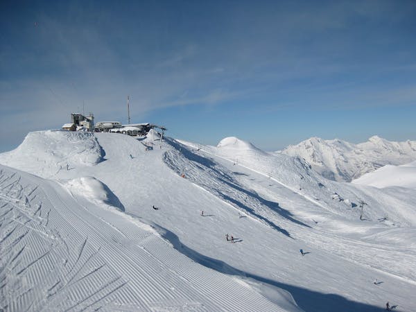
Attelas - Rock and Roll

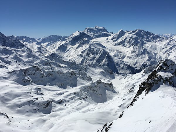
The classic Attelas couloir - experts only
Extreme Freeride Skiing
- Distance
- 562 m
- Ascent
- 0 m
- Descent
- 381 m
The most serious of the Attelas couloirs
Freeride Skiing Extreme

This is the steepest and most serious of the Attelas couloirs. It is extremely steep and very rocky. It should only be undertaken in good conditions - sometimes the entrance is very delicate or altogether impossible. From the Funispace lift station, ski SW along the ridge and identify the entrance to the couloir. You can return to the piste from the top of the ridge if the entrance doesn't go or conditions aren't right. The couloir is around 250m long. Continue down to join the blue Etierces piste.
Extreme
Extreme skiing terrain above 45 degrees. These routes are reserved for experienced experts.

In case of a fall, death is highly likely.

Away from help but easily accessed.
41 m away
The classic Attelas couloir - experts only
Extreme Freeride Skiing
89 m away

An introduction to the classic Attelas couloir skiing
Difficult Freeride Skiing
241 m away

A secret spot that's not so secret anymore but still a classic. One of the Attelas couloirs offering easily accessible adventure and steep skiing but not to be underestimated.
Severe Freeride Skiing
299 m away

The widest and least steep of the Attelas couloirs
Severe Freeride Skiing
381 m away

A short cut through off-piste terrain
Difficult Freeride Skiing
511 m away

Some steeper options from the classic James Blunt
Severe Freeride Skiing
933 m away

Another steep Mont-Gele classic couloir
Severe Freeride Skiing
934 m away

An enjoyable line down the west facing couloir from the top of Mont Gele
Difficult Freeride Skiing
938 m away

The main north facing couloirs from the top of Mont Gele
Severe Freeride Skiing
953 m away

A marked itinerary towards the Cabane de Mont-Fort
Moderate Freeride Skiing
50 routes · Freeride Skiing
7 routes · Freeride Skiing · Ski Touring