19 m away
Les Renne's lower part.

Gentle line, getting much steeper in the middle section.
Severe Freeride Skiing
- Distance
- 689 m
- Ascent
- 1 m
- Descent
- 208 m
Technical line ending up on really steep terrain.
Freeride Skiing Extreme
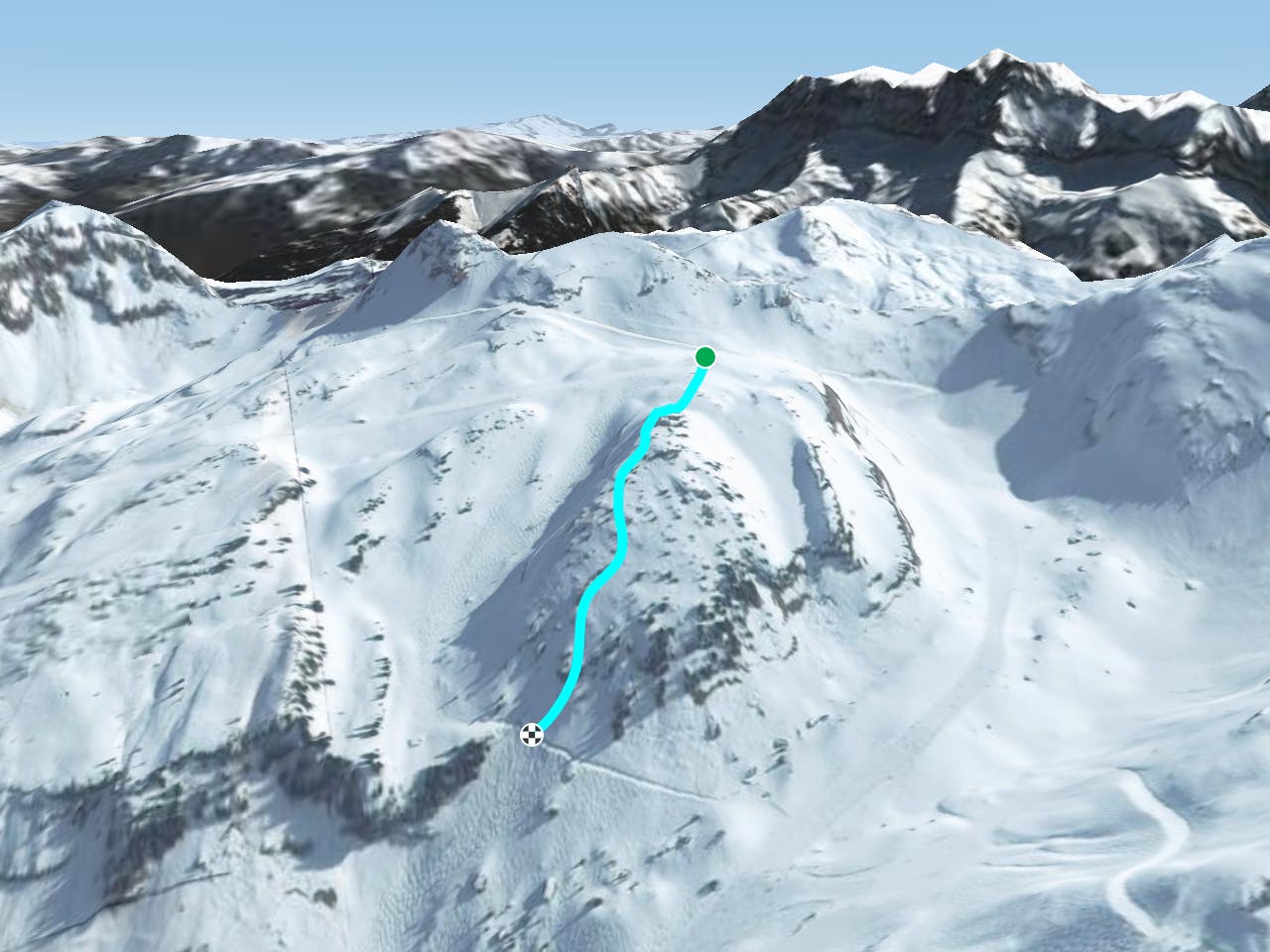
From the top of the Chaux-des-rosées chairlift, go under the same lift on the left side joining back onto the black slope "Les Renards". Check the first section as it is steep and not always easy to see. The middle of the lift is where the steepest part starts. About 100 meters of the section leading back to the "Les Renards" black slope really steep, with rocks to think about too. The northerly aspect of this line will help to keep the snow fresh but it can be harder if icy. The black slope "Les Renards" will bring you back to the same chairlift.
Extreme
Extreme skiing terrain above 45 degrees. These routes are reserved for experienced experts.

In case of a fall, death is highly likely.

Away from help but easily accessed.
19 m away
Gentle line, getting much steeper in the middle section.
Severe Freeride Skiing
24 m away

A long line with a gentle first part and some steepness into the middle part.
Extreme Freeride Skiing
182 m away

A long traverse line close to the red slope "Les Rennes" where the main hazard is avalanches from the Chésery mountain.
Severe Freeride Skiing
485 m away

A famous part of the ski resort for off piste skiing
Difficult Freeride Skiing
494 m away

A famous part of the ski resort for off piste skiing, including a few optional cliffs.
Difficult Freeride Skiing
507 m away

Gentle line feeling like a slope.
Moderate Freeride Skiing
917 m away

Great short day hike and ride for intermediate backcountry skiers.
Difficult Freeride Skiing
920 m away

A really steep line where a mistake can kill you; this is only expert steep skiers.
Extreme Freeride Skiing
927 m away
A nice line starting easy but requiring good skills later on.
Severe Freeride Skiing
935 m away

One of the biggest line of resort into a really high freeride area in autonomous line.
Extreme Freeride Skiing

18 routes · Freeride Skiing