377 m away
Cornebois back side line

One of the biggest line of resort into a really high freeride area in autonomous line.
Extreme Freeride Skiing
- Distance
- 1.7 km
- Ascent
- 160 m
- Descent
- 570 m
A long hike access line until the summit where a really steep hike is present including a steep line.
Freeride Skiing Extreme
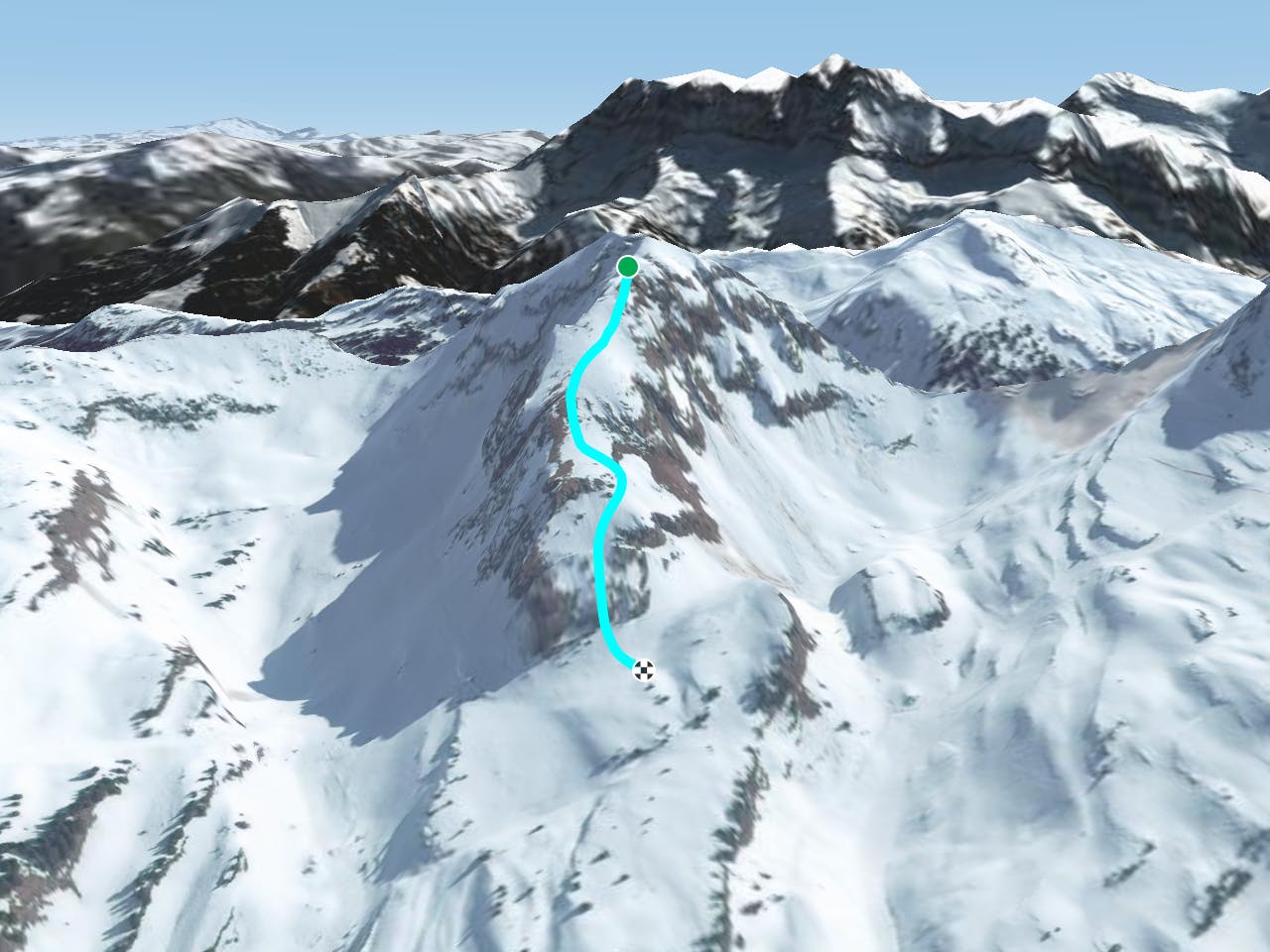
This is a long access line where half day is needed - turn right on top "Les Combes" chairlift and follow "Tête du Géant: North Couloir". The line is really steep to climb where a climbing gear is welcome, to go until the top of the mountain this might take about 1 hour and half or more. The line gets a lot of sun so make sure there's enough snow before heading in as this is on top of a rock area and base of the line is rocks. Avalanche risk is pretty high due to the altitude around here but one unusual hazard to be aware of on this line is the ridge into your right where mistakes can be fatal, snow can be frozen in case of a lack of snow. The line finishes "Happy valleys bis line" which leads back to "Cornebois" chairlift.
Extreme
Extreme skiing terrain above 45 degrees. These routes are reserved for experienced experts.

In case of a fall, death is highly likely.
Little chance of being seen or helped in case of an accident.
377 m away
One of the biggest line of resort into a really high freeride area in autonomous line.
Extreme Freeride Skiing
672 m away

A really nice traverse line that is good in bad visibility and often untracked.
Difficult Freeride Skiing
793 m away

A famous part of the ski resort for off piste skiing, including a few optional cliffs.
Difficult Freeride Skiing
802 m away

A famous part of the ski resort for off piste skiing
Difficult Freeride Skiing
842 m away

Short but steep couloir that often retains brilliant snow conditions.
Extreme Freeride Skiing
843 m away

A really nice line where you will be alone, only for expert skiers.
Extreme Freeride Skiing
848 m away

A steep hike with a short line but really steep.
Extreme Freeride Skiing
879 m away

A long line without many skills required, although the lower part of the line does get slightly steeper.
Severe Freeride Skiing
957 m away

Gentle line feeling like a slope.
Moderate Freeride Skiing
991 m away

Nice shortcut to reach the bottom of the Linga's sector. Very steep
Severe Freeride Skiing

18 routes · Freeride Skiing