1.9 km away
Bisse du Levron
A gentle walk along a mostly flat route with the sound of running water alongside you for the entirety.
Easy Hiking
- Distance
- 18 km
- Ascent
- 457 m
- Descent
- 457 m
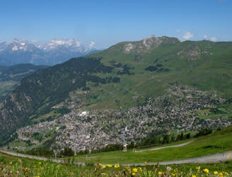
Beautiful path weaving through the forests around Verbier. 7 km 434 m 2-3 hrs approx. 3/5 difficulty.
Hiking Moderate

7 km 434 m 2-3 hrs approx. 3/5 difficulty Climb down from Verbier centre onto the Route de Soleil, following this as it weaves around the mountain side. Easy underfoot as it is a summer road and mostly flat, you can take in the beautiful views as you stroll along. Taking the hiking trail that leads you onto a slightly narrower forest trail, this then turns into a summer road again as you climb up to Chez Dany. Breaking out from the forest you are greeted with impressive views from a height of 1750 m, before your descent back into Verbier down a single track trail, watch out for tree routes here. Walking poles will help with the ascent and descent, but aren’t necessary.
If you would like help with equipment or advice don't hesitate to come in and see us at Mountain Air or shop online: https://mountainairverbier.com/en/
Or if you would like a guide for a hike get in touch with Lottie Pridham who recommends this excellent route: https://www.lottiepridham.comhttps://www.lottiepridham.comhttps://www.lottiepridham
Moderate
Hiking along trails with some uneven terrain and small hills. Small rocks and roots may be present.

The trail contains some obstacles such as outcroppings and rock which could cause injury.
Away from help but easily accessed.
1.9 km away
A gentle walk along a mostly flat route with the sound of running water alongside you for the entirety.
Easy Hiking
1.9 km away
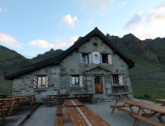
A short walk Around La Chaux including Cabane Mont Fort.
Moderate Hiking
3.1 km away
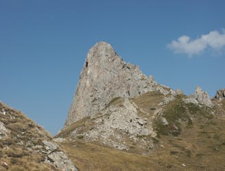
A medium to long walk via Pierre Avoi and Chute des Bisse across a fantastic ridge line that ends at a 360 view of Val de Bagnes and the Rhone Valley.
Difficult Hiking
5 routes · Hiking