7.1 km away
The Coledale Round
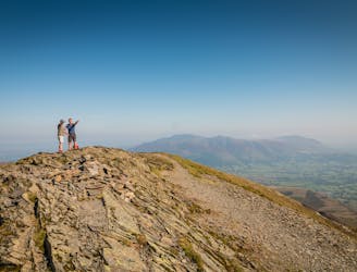
The pleasure found on the hills that cradle Coledale in their lap will satisfy even the greediest of hill gluttons.
Severe Hiking
- Distance
- 17 km
- Ascent
- 1.2 km
- Descent
- 1.2 km
This round which tackles the hills enclosing secretive Gasgale Gill is perfect for a shorter day, and after an inauspicious start rewards baggers with three Wainwrights building to a fine climax with a traverse of one of the best walker’s ridges in the entire national park.
Hiking Difficult
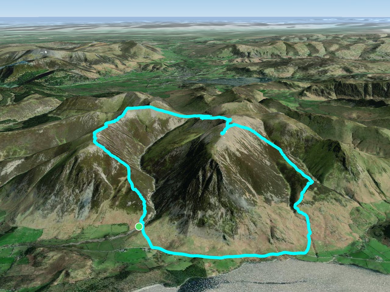
Lakeland is bristling with ‘horseshoe’ walks with many tending towards the rambling all day variety. This unfashionable round which tackles the hills enclosing secretive Gasgale Gill is perfect for a shorter day, and after an inauspicious start rewards baggers with three Wainwrights building to a fine climax with a traverse of one of the best walker’s ridges in the entire national park. If that’s not enough to tempt you then add sumptuous views of lake, valley and mountain to the mix for a walk of rare quality. Go there now!
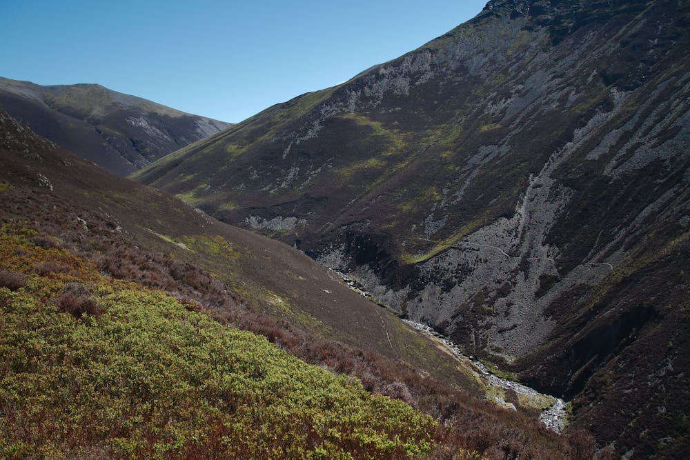
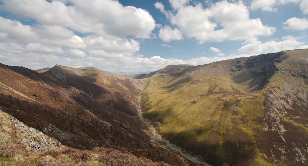
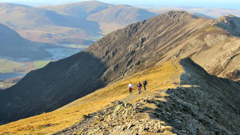
From Lanthwaite Green walk south along the road for 0.8 miles (with Grasmoor towering ‘Eiger-like’ above) until a path on the left leads up to the delightfully named Cinderdale Beck. Ahead is the unassuming hump of Lad Hows and after crossing the beck make your way onto the flat ‘summit’. From there, follow the well defined ridge rising in a relentless sweep all the way to Grasmoor’s stony plateau. It’s a bit of a slog but ever expanding views will be your inspiration until at last you put the first top of the day beneath your boots.
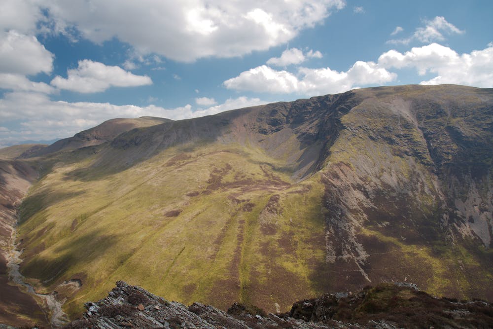
Suitably refreshed you’ll be raring to go as good things await you on the other side of Gasgale Gill, so head off following the many cairns which adorn Grasmoor’s broad top and in due course you’ll be delivered to Coledale Hause, a veritable spaghetti junction! There are a few options here for the incorrigible bagger to up their Wainwright count but resist the urge and get them tomorrow when you do the Coledale Round! For now you’ll have to make do with Hopegill Head and to get to it a trot up Sand Hill will see you within spitting distance and no doubt admiring Gasgale Crags and the ridge to which they cling.
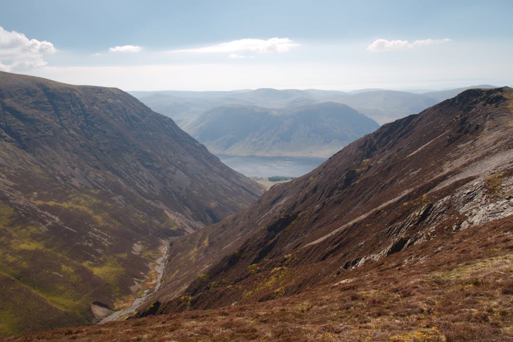
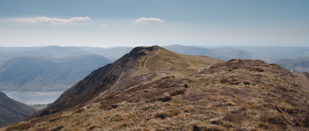
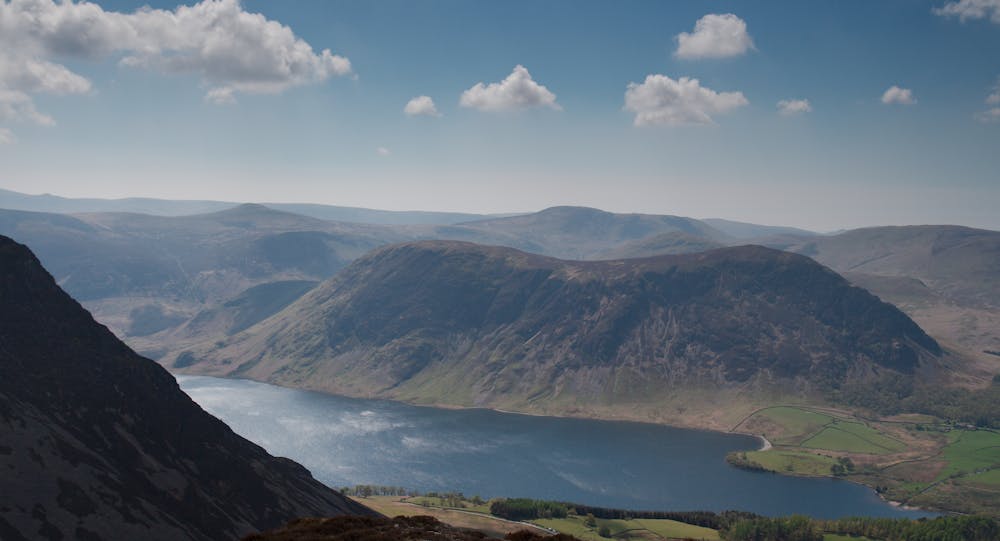
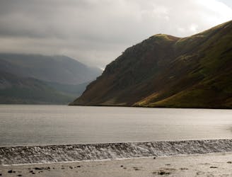
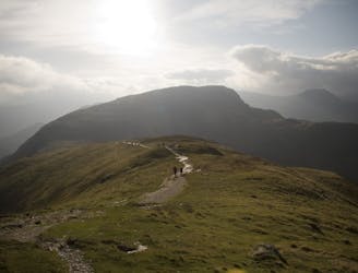
Hopegill Head is a fine, breezy summit composed of (slippery when wet) Skiddaw Slate, plunging away precipitously in the form of the grand and impressively rotten (botanists beware) Hobcarton Crag, the only known English home of ‘Viscaria Alpina’, the Red Alpine Catchfly. The view is intimate rather than extensive, disclosing to great advantage the peaks of the Coledale Round, a fine bird’s eye view of the Vale of Lorton and a tantalising sliver of Crummock Water. Monopolising your gaze however, will be Whiteside, the high point of the ridge you’re about to traverse. If the clag is down leave Hopegill Head in a westerly direction on a shaley path that soon narrows to a fabulous, airy arête. The going is exhilarating but never dangerously exposed though crosses sections of rock where care is needed in wet weather.
The East Top is the true summit of Whiteside and the grassy continuation of the ridge brings you to the West Top, a good vantage point for Mellbreak, the Loweswater Fells and the enclosed environs of Gasgale Gill. With a tinge of sadness it’s time to head down and a steep path leads to a levelling and the minor top of ‘Whin Ben’, the descent of which takes you on a delightful path through the heather until you cross a footbridge and say goodbye to the heights until next you are lucky enough to upon them tread.
© Nocholas Livesey - UKHillwalking.com - Nov 2011
Difficult
Hiking trails where obstacles such as rocks or roots are prevalent. Some obstacles can require care to step over or around. At times, the trail can be worn and eroded. The grade of the trail is generally quite steep, and can often lead to strenuous hiking.
7.1 km away
The pleasure found on the hills that cradle Coledale in their lap will satisfy even the greediest of hill gluttons.
Severe Hiking
7.8 km away
Ennerdale is the 'wildest' major valley in the Lake District, and this horseshoe takes in practically every top on its convoluted skyline to give a long, challenging classic.
Extreme Hiking
8.8 km away
For one of the best short routes in the north Lakes combine the charismatic mini mountain Cat Bells with a ramble along the wooded west side of Derwentwater - perhaps the most picturesque shoreline in England.
Moderate Hiking
9.8 km away
The easiest of the legs of the Bob Graham Round with half the distance being on roads.
Difficult Hiking
6 routes · Hiking

5 routes · Hiking