1.2 km away
Hawes Trail System Primer
A sleeper hit in the Phoenix Metro Area.
Difficult Mountain Biking
- Distance
- 13 km
- Ascent
- 341 m
- Descent
- 341 m
The most technical trail at Hawes, filled with big hucks and massive rock gardens.
Mountain Biking Extreme
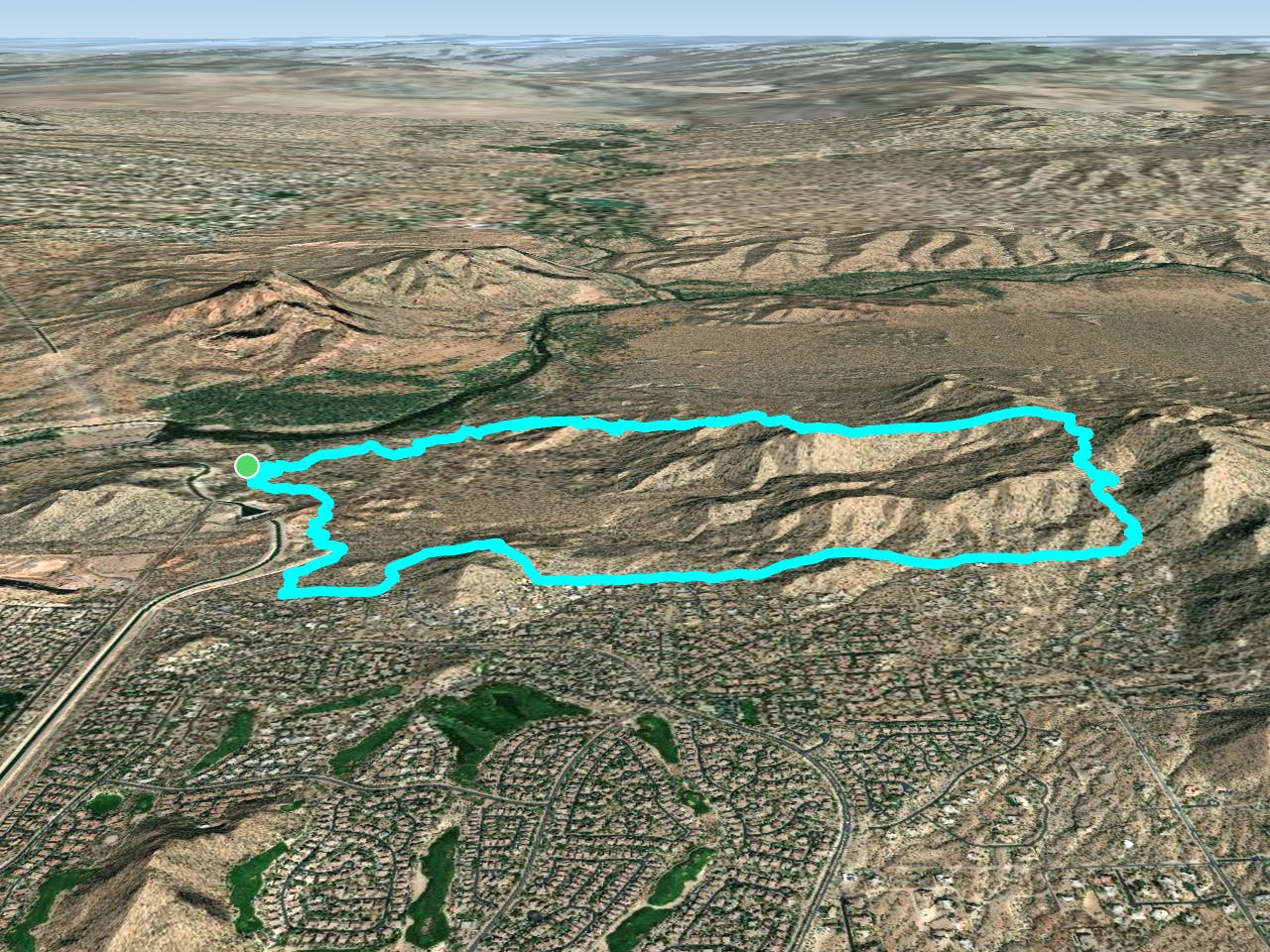
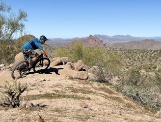
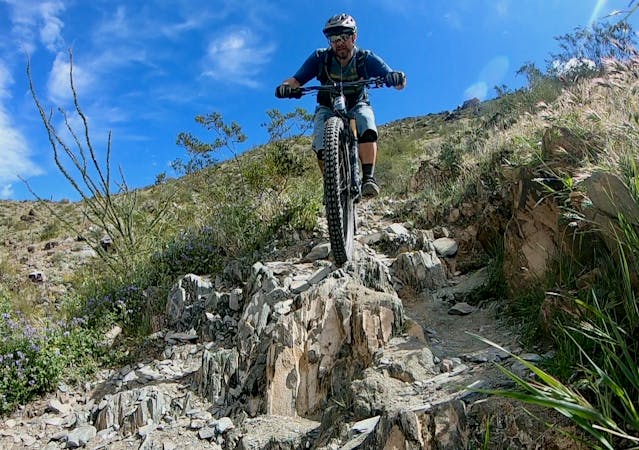
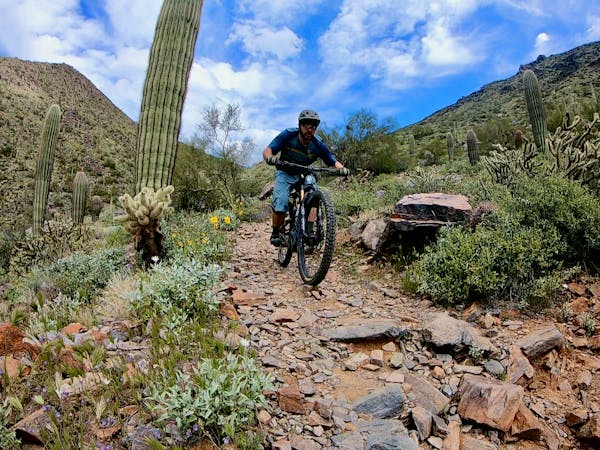
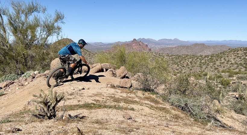
Sunset Ridge has quickly become one of the most famous trails in the Hawes Trail System, in part because it's the most difficult. This double black diamond downhill drops off one of the tallest ridges in the mountain range, following the spine of the ridge straight down the mountainside in a steep, technical, demanding descent.
The trail is filled with massive ledge drops to narrow sniper landings, which are often washed out. In between the hucks, you'll find all manner of technical rock gardens and burl. While some of the hucks have A and B lines, you need to be prepared to send it off of some mandatory airs.
Lower down, the trail descends along the side of the ridge on a narrow bench cut, with some quite substantial fall exposure—especially considering the technicality of the challenging trail tread.
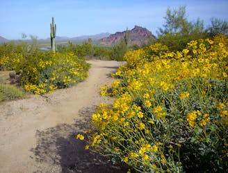
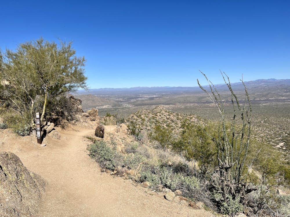
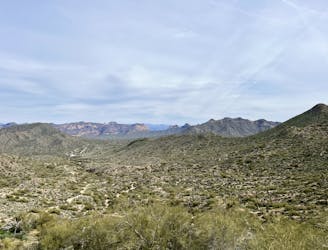
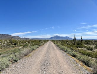
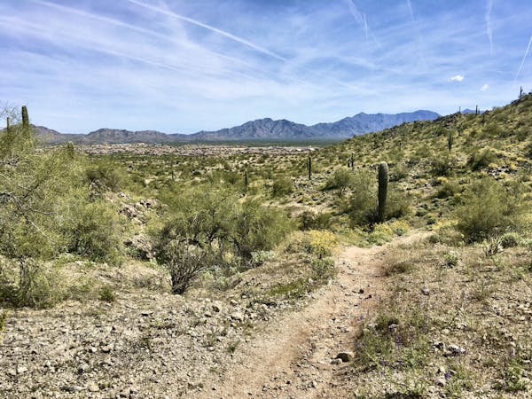
If you can somehow bring yourself to stop and take in the views, you'll be awed at the vistas from this gorgeous trail. The Sonoran Desert spreads out all around you, filled with all manner of cacti, including the towering Saguaros. Small pop-up mountain ranges rise from the desert floor, and to the north, you can see hints of the more majestic ranges rising high above.
Route Options
This route forms a logical loop from the west side of the Hawes Trail System, but do note that the climb on Cactus Garden is quite challenging and will force most riders to hike-a-bike at least a few sections. But if you complete the loop in this direction, you'll have the added reward of climbing back up a low rise and then ripping down the Mine Trail, in itself a fun, loose, technical romp back down toward the highway.
If you're looking for a flowier finish, take a right turn before the Mine Trail to reach Big Sister—the closest thing to a flow trail that you'll find in Arizona.
Sources: https://www.youtube.com/watch?v=dTmzxNyk62w&abchannel=NateHills
Extreme
Very steep, difficult, narrow singletrack with widely variable and unpredictable trail conditions. Unavoidable obstacles could be 15in/38cm tall or greater, and unavoidable obstacles with serious consequences are likely to be present. Obstacles could include big rocks, difficult root sections, drops, jumps, sharp switchbacks, and more. Ideal for expert-level riders.

Some trail sections have exposed ledges or steep ascents/descents where falling could cause serious injury.

Away from help but easily accessed.
1.2 km away
A sleeper hit in the Phoenix Metro Area.
Difficult Mountain Biking
2.8 km away

The closest thing to a flow trail that you'll find in Arizona!
Difficult Mountain Biking
6.3 km away
A true crowd-pleaser loop at Hawes.
Severe Mountain Biking
6.3 km away
Iron Goat and High Ridge provide superb ridgeline ripping on Hawes' east side.
Severe Mountain Biking
6.7 km away
A combination of smooth dirt singletrack and gravel paths creates a fun XC loop through Usery Mountain Park.
Easy Mountain Biking
4 routes · Mountain Biking
10 routes · Mountain Biking
8 routes · Mountain Biking
5 routes · Mountain Biking