2.3 km away
Little Sugar Epic
Make the most of this incredible trail system with this long-distance loop.
Difficult Mountain Biking
- Distance
- 58 km
- Ascent
- 1.3 km
- Descent
- 1.3 km
Sweet flowy singletrack that includes features for all levels of mountain bikers.
Mountain Biking Difficult

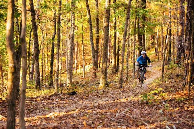
From its outset, the Back 40 was designed for mountain bike use, unlike many trails that began as a hiking trail. With approximately 21 miles included in the outer loop, and over a dozen additional miles of connector trails within, the trail system includes something for all mountain bike skill levels.
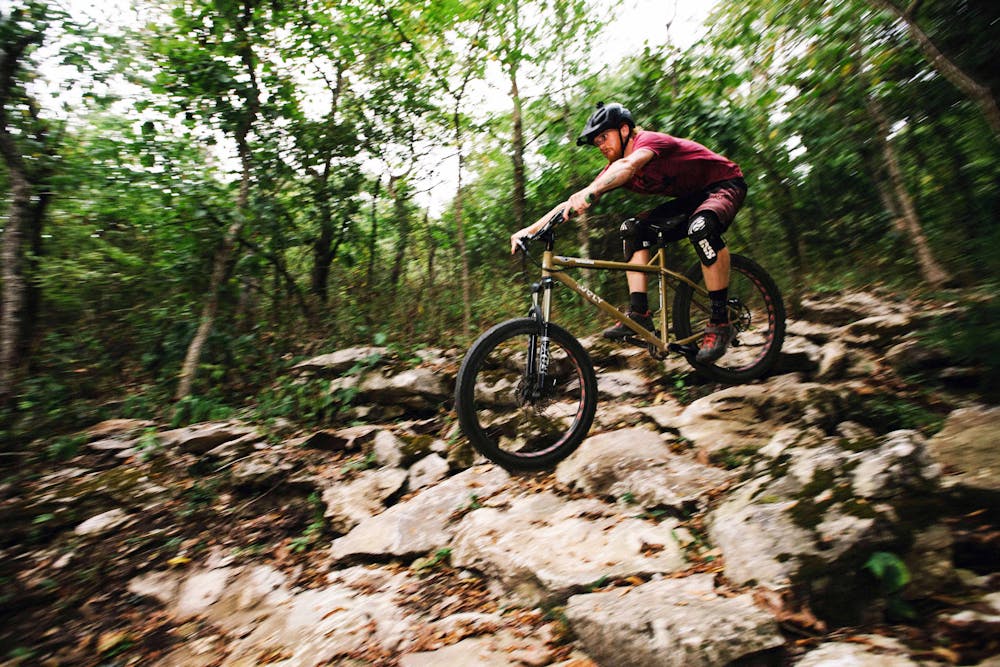
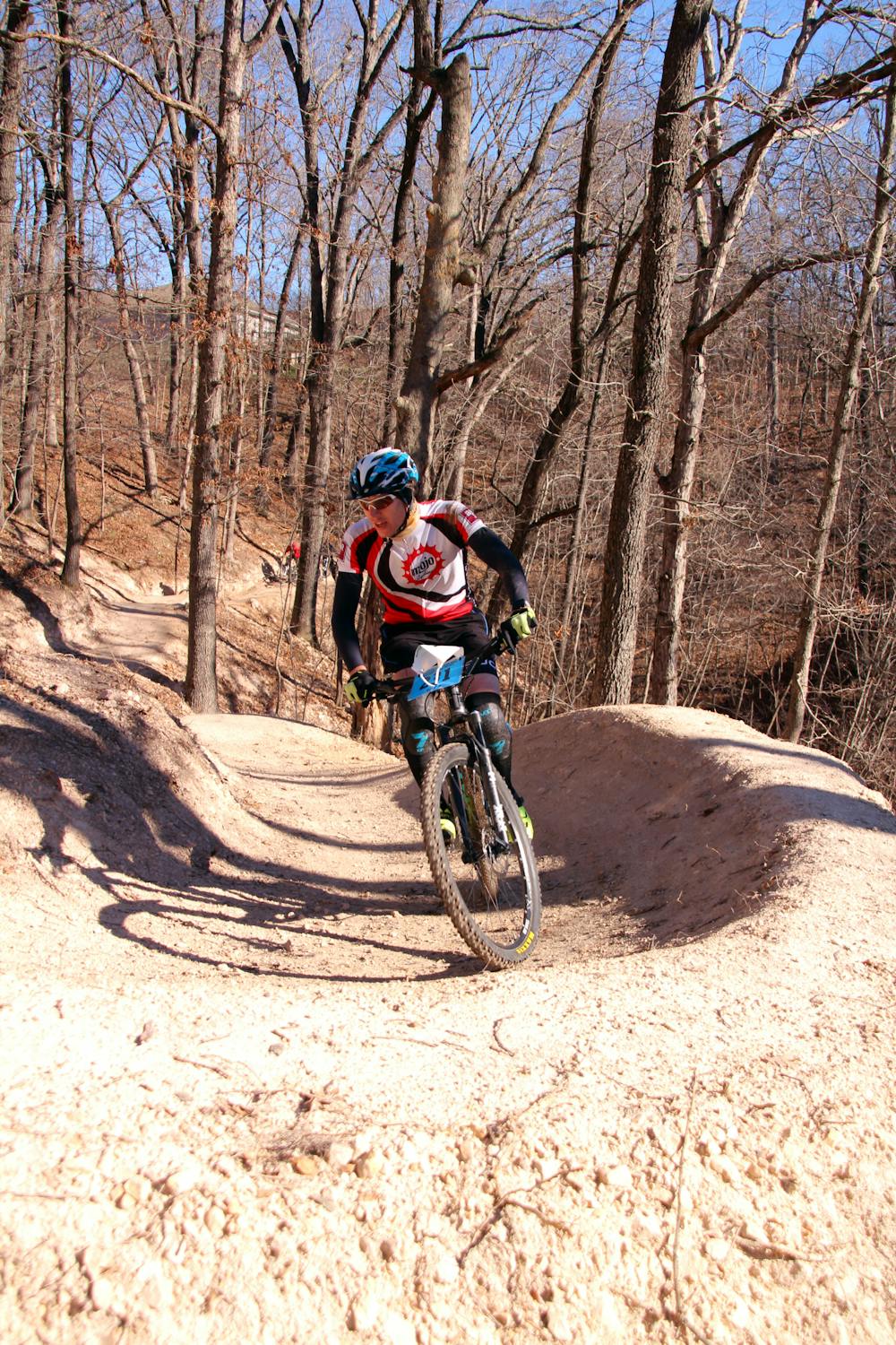
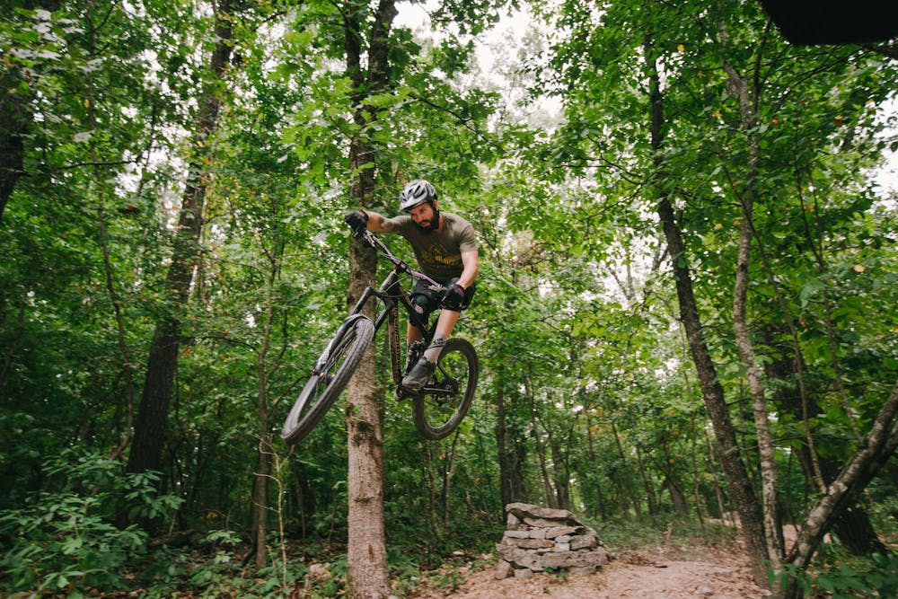
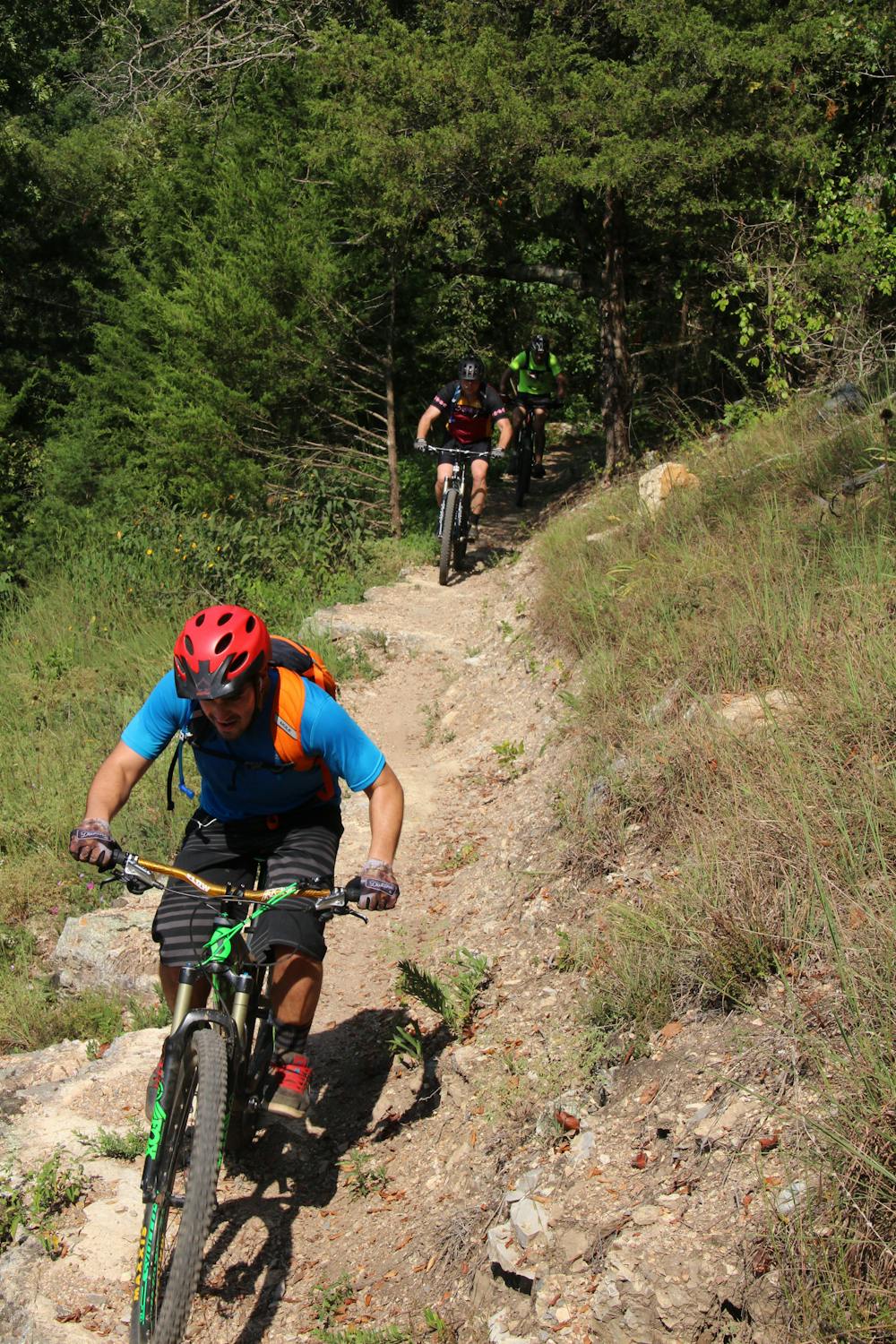
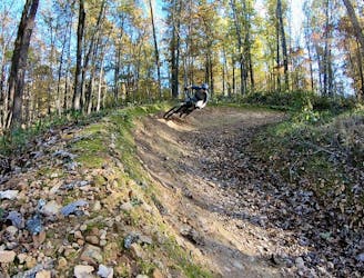
Much of the Back 40 involves routing cyclists up and over countless ridges that connect the densely-wooded Ozark hollows where the trail system is located. With cresting each ridge, a mountain biker is rewarded with gradual descents on high banked switchbacks and long flowing singletrack through the length of the hollow.
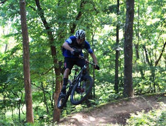
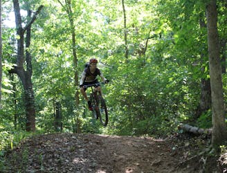
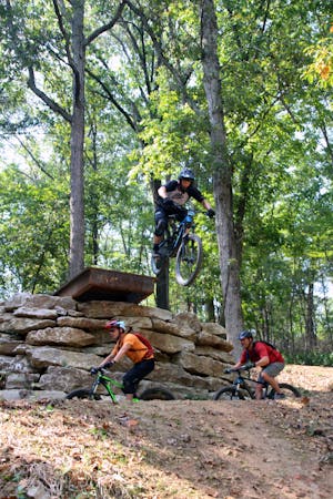
During the winter of 2017 professional trail crews made these flowy descents through the hollows even more enjoyable by routing the constantly-twisting trail higher up the hillside and constructing short rock-kickers—those for riders seeking a little air time.
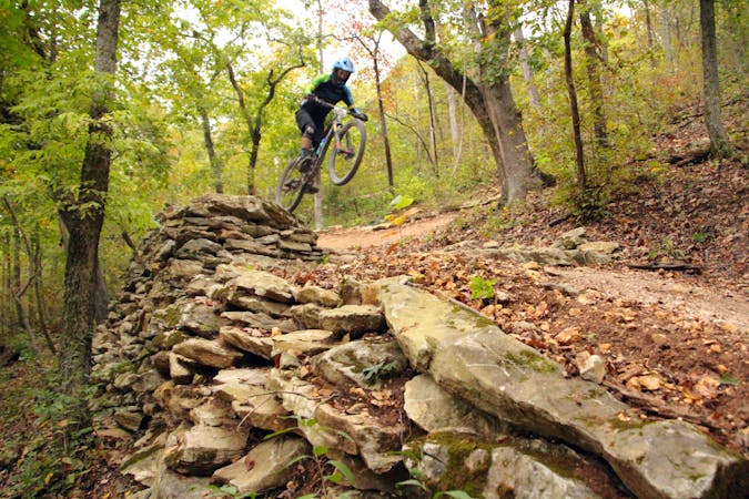
Most average skilled mountain bikers will feel comfortable riding any of the Back 40 trails. Even The Ledges, with warning signs posted at the approach, isn’t something to be avoided; as long as you aren’t intimidated by the potential of riding off a 19-foot hillside that borders the three-foot-wide rock ledge which makes up the trail in this section. However, even The Ledges offers a less intimating bypass route.
There isn’t a recommended direction to ride the Back 40, unless you’re planning to experience The Ledges, which would require riding clockwise. Either direction involves gradual climbs up the ridges to be followed by sweeping descents on the downside.
There are several parking locations distributed throughout the trail system, however, the most convenient place to begin your Back 40 Adventure is at Blowing Springs Park. The Blowing Springs Campground adjoins the park and makes for a great home base for exploring these trails. Although primarily set up for RVs, it does include tent campsites.
With Arkansas’s mild winters, the Natural State is becoming a destination to hold early season training camps for mountain bikers. In April of 2018, while camping at the Blowing Springs Campground, I met fellow campers from Colorado, Nebraska, Minnesota, Michigan, Tennessee, and New York who had traveled to the Back 40 to jump-start their mountain bike training.
The Back 40 also adjoins Blowing Springs trail, for six more miles of singletrack, and by riding a short paved bike trail, connects to the 20+ miles of primo singletrack at the Slaughter Pen MTB Trail.
To sweeten the pot even further, during the winter of 2018 construction will begin adding 40 additional miles of trail to the Back 40 network.
Difficult
Mostly stable trail tread with some variability featuring larger and more unavoidable obstacles that may include, but not be limited to: bigger stones, roots, steps, and narrow curves. Compared to lower intermediate, technical difficulty is more advanced and grades of slopes are steeper. Ideal for upper intermediate riders.

Some trail sections are extremely exposed where falling will almost certainly result in serious injury or death.

Close to help in case of emergency.
2.3 km away
Make the most of this incredible trail system with this long-distance loop.
Difficult Mountain Biking
3.9 km away
Armadillo’s Last Stand and Tatamagouche Trails are both twisting, turning, undulating trails within the Outer Loop trail of Phase I.
Difficult Mountain Biking
4 km away
A high-speed jump line with some large table tops and incredible bridge features.
Difficult Mountain Biking
4 km away

A fast intermediate jump line with surprisingly big hits.
Moderate Mountain Biking
4 km away

The OG jump line at Slaughter Pen
Extreme Mountain Biking
4 km away
More old school single track that flows along the hillside then switches back up the hillside for short climbs and descent.
Difficult Mountain Biking
4 km away

A rock slab-filled black diamond descent.
Severe Mountain Biking
4.3 km away
Slaughter Pen Trails Phase I crisscrosses the hillside with several old-school trails packed with short climbs, wooden bridges, sharp banked turns, and a short downhill run packed with many fun features.
Severe Mountain Biking
4.6 km away
The most efficient way to hit all the runs in the Huntley Gravity Zone.
Difficult Mountain Biking
4.7 km away
Tatamagouche Trails and Armadillo’s Last Stand are both twisting, turning, undulating trails within the Outer Loop trail of Phase I.
Severe Mountain Biking
13 routes · Mountain Biking
10 routes · Mountain Biking
5 routes · Mountain Biking