573 m away
Thunder Mountain Trail
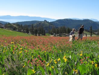
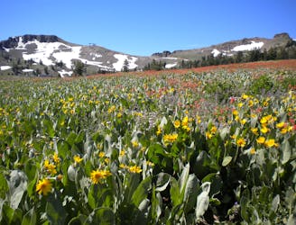
Summer hike from Palisades Tahoe Lodge to High Camp, along a rushing stream and through flower-filled meadows on the mountainside.
Moderate Hiking
- Distance
- 4.7 km
- Ascent
- 571 m
- Descent
- 11 m
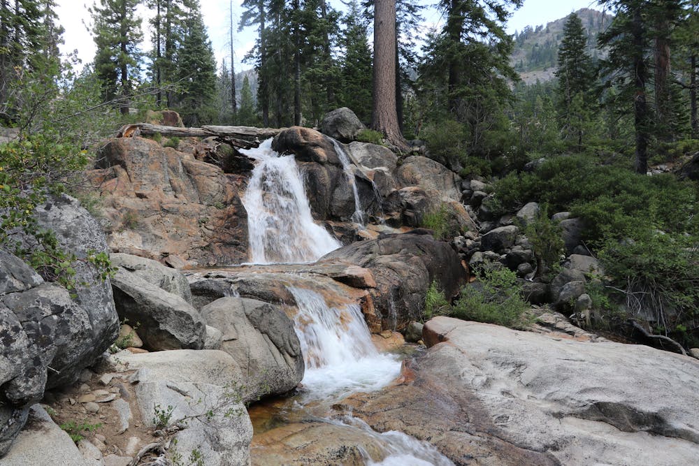
Summer hike in Palisades Tahoe along a cascading creek and steep rock slabs surrounded by granite peaks.
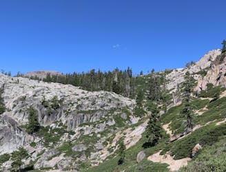
Hiking Difficult

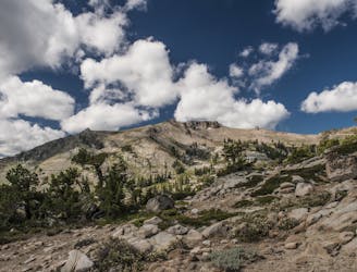
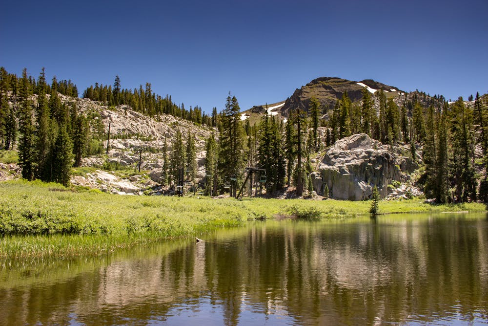
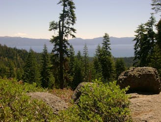
As the ski runs melt away at Palisades Tahoe, the flowers burst to life, and the season is prime for hiking. Patches of snow at the highest elevations melt slowly all through the summer, feeding countless little streams and creeks that cascade over solid granite. One of these is Squaw Creek, which drains down the backside of the mountain into the beautiful little Shirley Lake near the base of Solitude Chair. To see the creek’s waterfalls and Shirley Lake, hike the Shirley Canyon Trail.
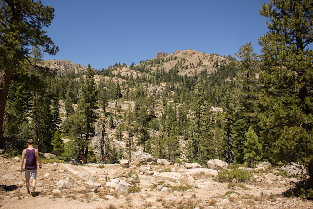
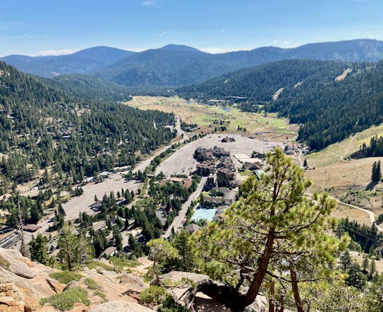
This trail connects Olympic Village at the base with High Camp--the shops, dining, and swimming pool at the top. You can easily skip all the touristy distractions at either end, though, and simply enjoy nature along the trail. The Aerial Tram connects the endpoints as well, so you can ride the tram to hike the trail in only one direction, up or down. If you hike the trail up, the tram ride down is free!
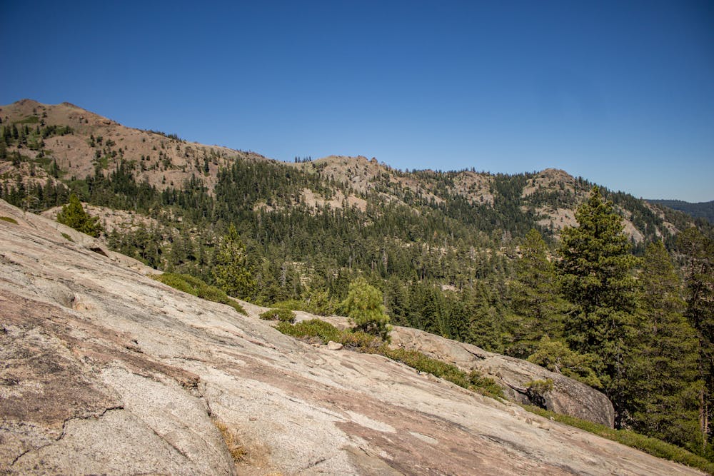
Hiking up is not a gimme, however. The trail is steep and hard to follow in some places, especially with snow on the ground. Nonetheless, it is a popular trail and no problem for those accustomed to hiking on variable terrain.
The trail begins in the shade of tall trees along a babbling brook. As the gradient increases, so does the drama of the scenery. The creek tumbles in multiple waterfalls, wildflowers pop in varieties that shift with the elevation, and views open up of valleys below and peaks above. One especially steep section requires traction on bare rock and possibly using your hands for stability.
Eventually, the gradient lessens, and Shirley Lake appears ahead. Enjoy a cool dip in the water, a picnic on its shore, or simply a quick pause to take it all in. Next comes another steep ascent through bouldery mountain meadows to reach High Camp and the top of the Aerial Tram.
Sources: https://squawalpine.com/events-things-do/walking-hiking-squaw-valley https://squawalpine.com/explore/blog/guide-hiking-shirley-canyon https://tahoerimtrail.org/wp-content/uploads/2017/04/MapBrochBPtoTC.pdf
Difficult
Hiking trails where obstacles such as rocks or roots are prevalent. Some obstacles can require care to step over or around. At times, the trail can be worn and eroded. The grade of the trail is generally quite steep, and can often lead to strenuous hiking.

The trail contains some obstacles such as outcroppings and rock which could cause injury.
Away from help but easily accessed.
573 m away
Summer hike from Palisades Tahoe Lodge to High Camp, along a rushing stream and through flower-filled meadows on the mountainside.
Moderate Hiking
1.8 km away
Easy hike from the top of the tram, through flower-filled meadows with a view of Lake Tahoe.
Easy Hiking
1.8 km away
Hike through meadows and along ridgelines to reach the peaks at the top of Palisades Tahoe.
Moderate Hiking
2.4 km away
A scenic climb up and out of Alpine Meadows Valley, over a high granite ridge that conceals a beautiful lake-filled basin.
Moderate Hiking
8.6 km away
Beginning at the lowest elevation point of the Tahoe Rim Trail, this section is the start of a 165-mile journey through the mountains around Lake Tahoe.
Easy Hiking

8 routes · Hiking

14 routes · Hiking
5 routes · Hiking