PCT: Barker Pass to Donner Summit
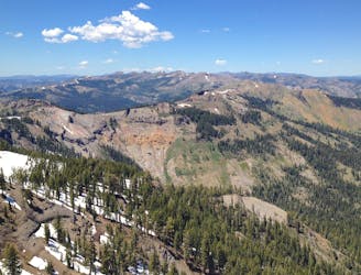
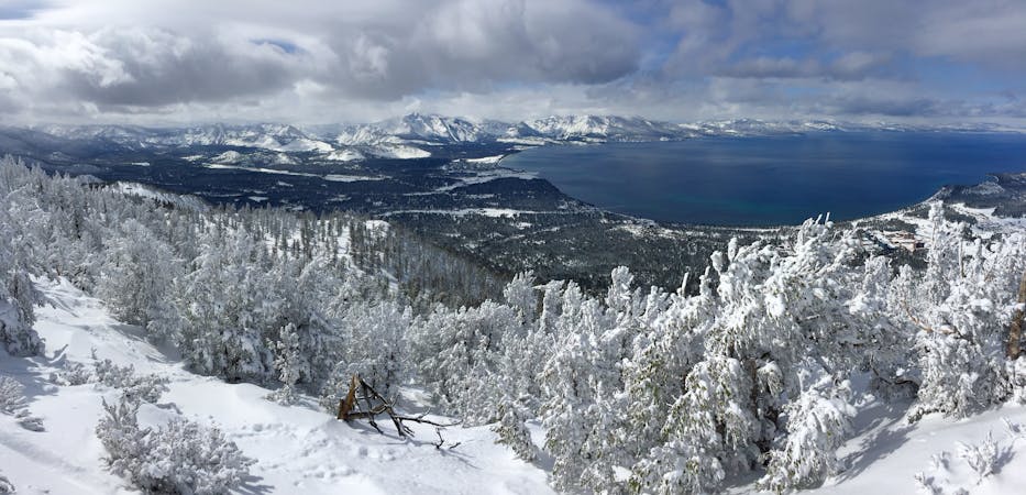
Miles 1124.8-1153.4 of the northbound PCT: Tracing a line across the sky above Lake Tahoe, on a bald crest of craggy peaks.
Difficult Hiking
- Distance
- 44 km
- Ascent
- 1.6 km
- Descent
- 1.8 km
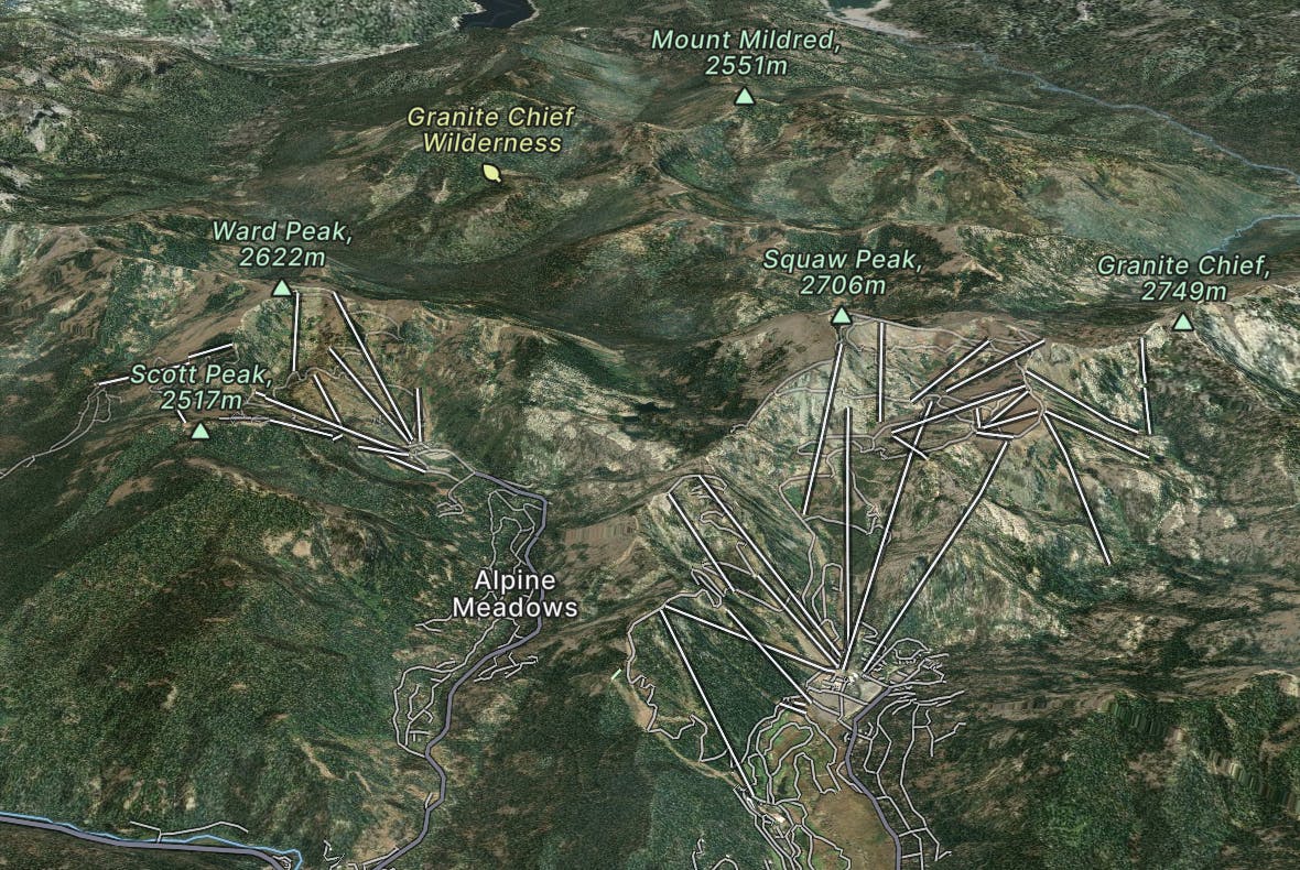
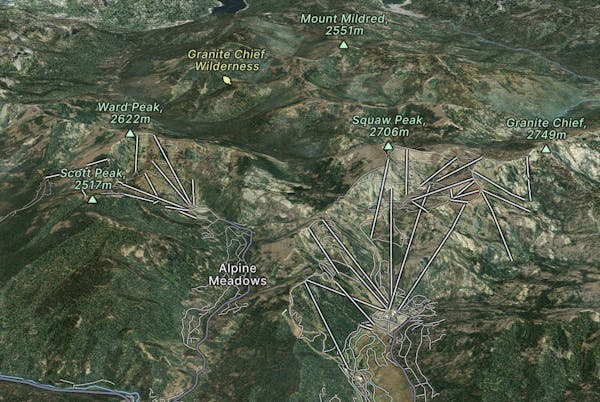
Palisades Tahoe is famous for its steep chutes, big cliffs and deep powder, ideally for thrill seekers. Alpine Meadows has great groomed runs and a perfect family atmosphere.
Explore Palisades Tahoe with curated guides of the best hiking trails, ski routes, and more. With over 51 3D trail maps in FATMAP, you can easily discover and navigate the best trails in Palisades Tahoe.
No matter what your next adventure has in store, you can find a guide on FATMAP to help you plan your next epic trip.
Get a top trail recommendation in Palisades Tahoe from one of our 5 guidebooks, or get inspired by the 51 local adventures uploaded by the FATMAP community. Start exploring now!
Miles 1124.8-1153.4 of the northbound PCT: Tracing a line across the sky above Lake Tahoe, on a bald crest of craggy peaks.
Difficult Hiking
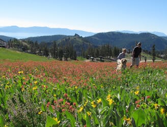
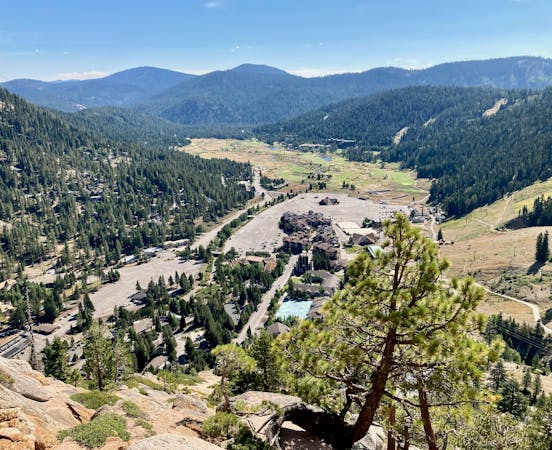
Summer hike from Palisades Tahoe Lodge to High Camp, along a rushing stream and through flower-filled meadows on the mountainside.
Moderate Hiking
Hike through meadows and along ridgelines to reach the peaks at the top of Palisades Tahoe.
Moderate Hiking
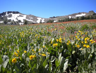
Easy hike from the top of the tram, through flower-filled meadows with a view of Lake Tahoe.
Easy Hiking
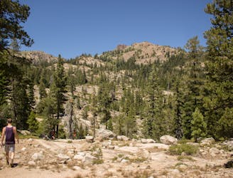
A scenic climb up and out of Alpine Meadows Valley, over a high granite ridge that conceals a beautiful lake-filled basin.
Moderate Hiking
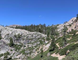
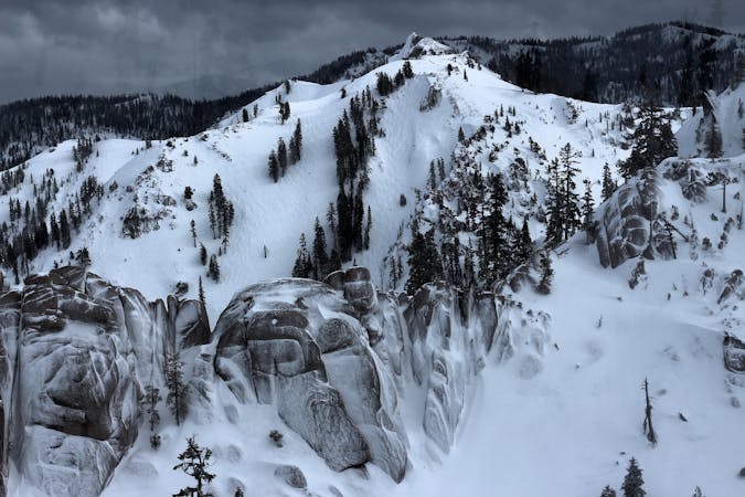
Summer hike in Palisades Tahoe along a cascading creek and steep rock slabs surrounded by granite peaks.
Difficult Hiking

A nice option for Chute 75
Severe Freeride Skiing

A classic chute off of the highest point at Palisades Tahoe
Severe Freeride Skiing
8 routes · Freeride Skiing

14 routes · Hiking
5 routes · Hiking
3 routes · Freeride Skiing

72 routes · Hiking