2 m away
Temescal Canyon Loop
Combination valley and ridge hike, with a waterfall as well as hilltop views.
Moderate Hiking
- Distance
- 5.1 km
- Ascent
- 273 m
- Descent
- 273 m
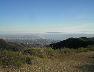
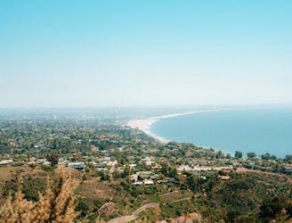
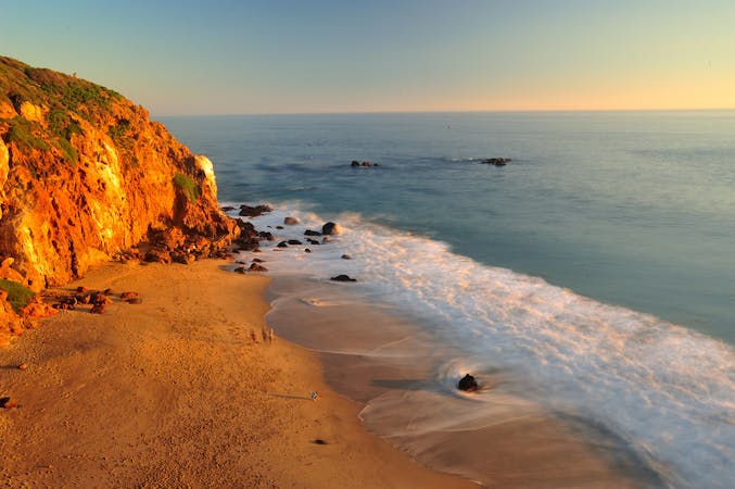
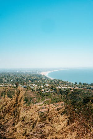
A long, scenic ridgeline overlooking the ocean and downtown LA.
Hiking Difficult

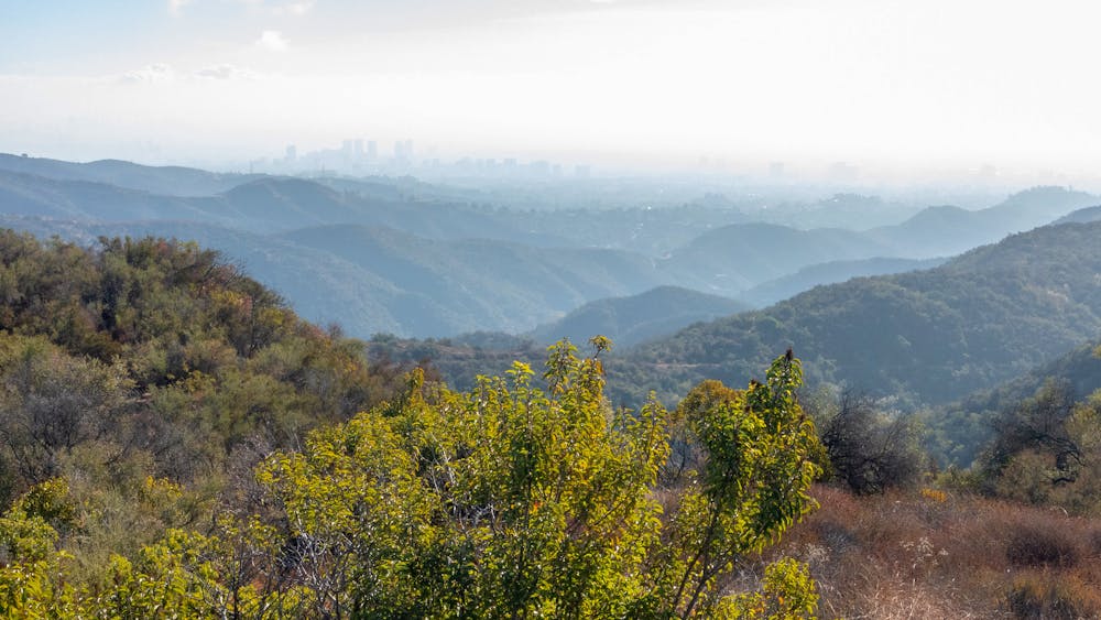
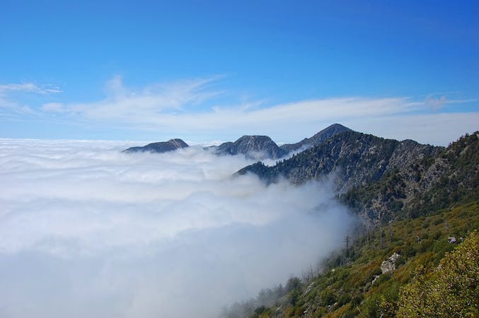
Temescal Ridge rises from the Pacific Palisades, near sea level, to the top of Temescal Peak at 2100 feet. The trail and fire road that traverse the ridge make a somewhat strenuous and very scenic hike from the city into the hills. The main highlights are the elevated views, but you can also enjoy spring wildflowers, interesting rock formations, and some wildlife like deer and birds of prey. The hike mapped here is mostly in Topanga State Park, but begins in Temescal Gateway Park.
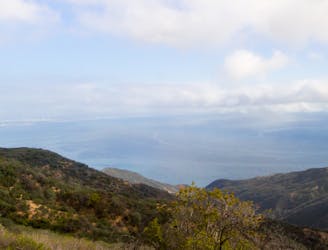
The most direct route is to start on Temescal Ridge Trail. An alternative is to take Temescal Canyon Trail, which is shadier and passes a seasonal waterfall. It meets Temescal Ridge Trail, which then continues upward to Skull Rock. The “skull” is a jumble of large boulders, which you can scramble up for an extra-wide vantage over the foothills and the ocean.
Continuing uphill, the trail eventually joins with Temescal Ridge Fire Road and becomes much wider. A single-track hiking trail parallels the road much of the way, however, so you can stick to the narrow path if you prefer. Keep going until you reach the obvious summit of Temescal Peak. From there, you can see quite far in a 360-degree panorama. It’s a view well earned by such a long ascent. Return downhill the way you came or make a longer loop with Backbone Trail (not mapped).
This hike to Temescal Peak is best on cool days because there is very little shade and nowhere to refill water, except near the trailhead in Temescal Gateway Park. The park has other amenities like restrooms, trail maps, and picnic areas. A fee is charged for parking, but you can alternatively park on the street outside the boundary and walk in.
Sources: https://trails.lacounty.gov/Trail/285/temescal-canyon-trail https://mrca.ca.gov/parks/park-listing/temescal-gateway-park/ https://www.summitpost.org/temescal-peak/682175
Difficult
Hiking trails where obstacles such as rocks or roots are prevalent. Some obstacles can require care to step over or around. At times, the trail can be worn and eroded. The grade of the trail is generally quite steep, and can often lead to strenuous hiking.

The trail contains some obstacles such as outcroppings and rock which could cause injury.
Away from help but easily accessed.
2 m away
Combination valley and ridge hike, with a waterfall as well as hilltop views.
Moderate Hiking
3 km away
Reach one of the finest viewpoints in Greater LA
Moderate Hiking
8.1 km away
Ridgeline walk with ocean views above the Pacific Coast Highway
Easy Hiking

17 routes · Hiking
10 routes · Hiking
6 routes · Hiking
5 routes · Hiking