.jpg?sfvrsn=124bfa04<em>0)
539 m away
Shotgun

A chunky black-diamond finish to many top-to-bottom runs.
Severe Mountain Biking
- Distance
- 1.8 km
- Ascent
- 10 m
- Descent
- 148 m
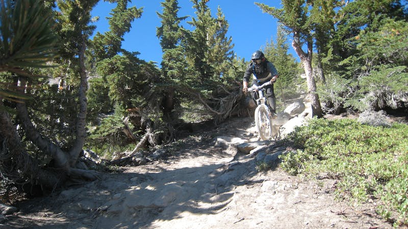
An intermediate two-way singletrack trail on Mammoth Mountain.
Mountain Biking Moderate

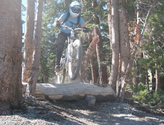
While Big Ring is most often used for cross country or trail riding, since it’s located in the bike park and connects to many of the downhill trails, Big Ring often forms an exit or ending to many downhill or enduro runs. Despite being a two-way trail, well-built berms and rolling grade reversals help riders maintain speed and flow.
The soil is classic Mammoth Mountain, consisting of dry, loose, dirt and sand between rough volcanic rocks. Despite the intermediate rating, rocks still appear in the trail tread and remind you that yes, you’re still riding a mountain bike!
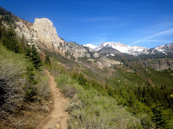
Most of the trail rolls along beneath towering pine trees, but beautiful views of the valley open up where the singletrack crosses the exposed ski runs.
Sources: https://d1pdyfnmzhu191.cloudfront.net/images/default-source/master/maps/2019bikeparktrailmapfront2000x1171-(2).jpg?sfvrsn=124bfa040 https://www.youtube.com/watch?v=EIPZpcFqg
Moderate
Mostly stable trail tread with some variability, with unavoidable obstacles 8in/20cm tall or less. Other obstacles such as rock gullies and steep sections may exist. Ideal for lower intermediate riders.

The path is on completely flat land and potential injury is limited to falling over.
Close to help in case of emergency.
539 m away
A chunky black-diamond finish to many top-to-bottom runs.
Severe Mountain Biking
661 m away

Flow trail to the max!
Difficult Mountain Biking
766 m away

One of the best-developed jump lines on Mammoth Mountain.
Extreme Mountain Biking
767 m away

A hidden gem in the Mammoth Bike Park.
Severe Mountain Biking
1 km away

One of the gnarliest pro lines on Mammoth Mountain.
Extreme Mountain Biking
1.1 km away

Chunky black diamond tech trail.
Severe Mountain Biking
1.4 km away

A downhill-only intermediate trail anchoring Mammoth Mountain's easy side.
Moderate Mountain Biking
1.4 km away

A flowy intermediate ride with amazing views.
Moderate Mountain Biking
1.5 km away

A surprisingly flowy double black diamond descent.
Extreme Mountain Biking
1.5 km away
An extremely varied double black diamond pro-line.
Extreme Mountain Biking
5 routes · Mountain Biking
34 routes · Mountain Biking
8 routes · Mountain Biking
5 routes · Mountain Biking