2 m away
Juniper

A downhill-only intermediate trail anchoring Mammoth Mountain's easy side.
Moderate Mountain Biking
- Distance
- 5 km
- Ascent
- 9 m
- Descent
- 305 m
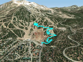
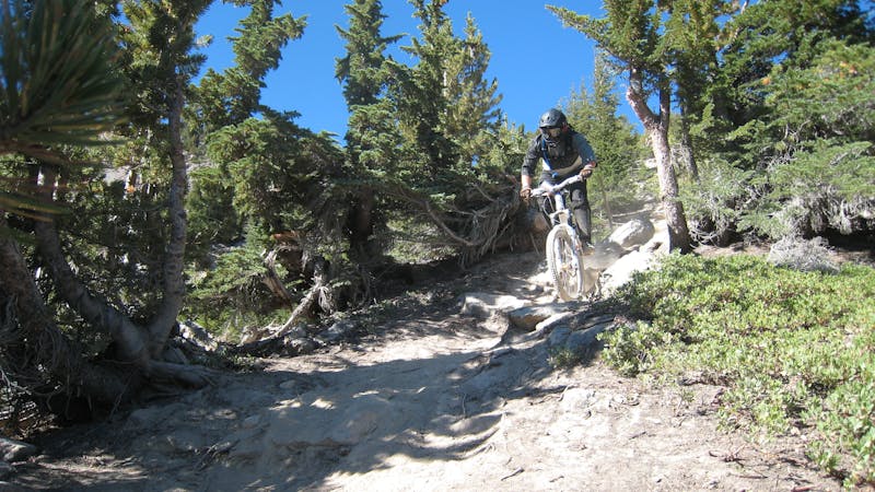
A flowy two-way singletrack trail.
Mountain Biking Difficult

While Manzanita is most often ridden during a cross country ride utilizing Paper Route or other nearby trails, since it’s located in the bike park and connects to many of the downhill trails, Manzanita often forms an exit or ending to many downhill or enduro runs.
This flowy two-way singletrack is an intermediate crowd pleaser, with delightful grade reversals, undulations, and general swoop-and-flow.
Sources: https://www.mammothmountain.com/summer/bike-park-overview/mammoth-bike-park/mammoth-bike-park
Difficult
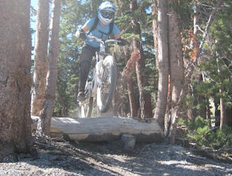
Mostly stable trail tread with some variability featuring larger and more unavoidable obstacles that may include, but not be limited to: bigger stones, roots, steps, and narrow curves. Compared to lower intermediate, technical difficulty is more advanced and grades of slopes are steeper. Ideal for upper intermediate riders.

The path is on completely flat land and potential injury is limited to falling over.
Close to help in case of emergency.
2 m away
A downhill-only intermediate trail anchoring Mammoth Mountain's easy side.
Moderate Mountain Biking
431 m away

The main two-way singletrack trail traversing the flanks of Mammoth Mountain.
Moderate Mountain Biking
1.2 km away

One of the gnarliest pro lines on Mammoth Mountain.
Extreme Mountain Biking
1.4 km away
An intermediate two-way singletrack trail on Mammoth Mountain.
Moderate Mountain Biking
1.5 km away

Flow trail to the max!
Difficult Mountain Biking
1.6 km away
An extremely varied double black diamond pro-line.
Extreme Mountain Biking
1.7 km away

A surprisingly flowy double black diamond descent.
Extreme Mountain Biking
1.7 km away

One of the best-developed jump lines on Mammoth Mountain.
Extreme Mountain Biking
1.7 km away

A hidden gem in the Mammoth Bike Park.
Severe Mountain Biking
1.9 km away

A chunky black-diamond finish to many top-to-bottom runs.
Severe Mountain Biking
34 routes · Mountain Biking
8 routes · Mountain Biking
5 routes · Mountain Biking