28 m away
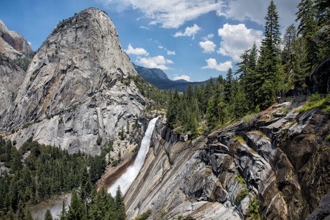
Mist Trail to Vernal and Nevada Falls
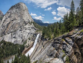
A stunning trail run up steep climbs, passing close to Vernal and Nevada Falls.
Difficult Trail Running
- Distance
- 11 km
- Ascent
- 753 m
- Descent
- 752 m
A long day out to the summit of one of the most iconic mountains in the world.
Trail Running Severe

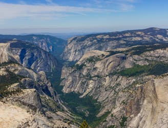
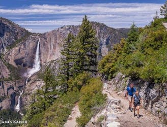
The Half Dome Trail is challenging and provides a decently long trail run. It courses nearly 1500m above the Yosemite Valley. It offers runners spectacular vantage of many of the valley’s iconic monuments: Vernal and Nevada Falls, Liberty Cap, Half Dome itself, and views across the Yosemite Valley and the High Sierra mountains.

If you run a single route in Yosemite, this should be high on the list!
The trail climbs over 1600m over 20km, and runners should, therefore, be prepared for a rather big day out. Luckily, the route is quite well marked along the way. The trail begins with a stiff climb up to Vernal Falls followed by a second steep climb up to Nevada Falls. From Nevada, the trail continues through the forest past Little Yosemite Campground on steep switchbacks.
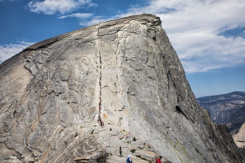
This route is famous for the cable section, which climbs the final 120m on Half Dome. This portion of the route is quite steep, strenuous, and exposed. This is a section to take particular care not to fall. From the summit, the trail returns on the same path.
Of particular importance: a permit is required for this trail. Therefore, it is important to plan ahead when wanting to have a day out on the trail rather than showing up, hoping to run on it on a whim.
Severe

Some trail sections are extremely exposed where falling will almost certainly result in serious injury or death.

Away from help but easily accessed.
28 m away
A stunning trail run up steep climbs, passing close to Vernal and Nevada Falls.
Difficult Trail Running
48 m away
A great full-day trail-run along a premier route high above the Yosemite Valley.
Severe Trail Running
3.1 km away
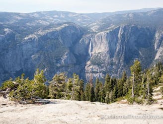
A great out-and-back offering views across Yosemite Valley.
Difficult Trail Running
3.1 km away
An out-and-back from Glacier Point Road to the summit of Sentinel Dome.
Moderate Trail Running
3.2 km away
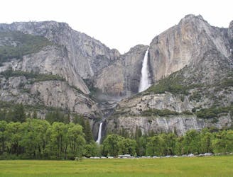
Out-and-back route to reach Yosemite Falls (the lower, middle, and upper falls).
Difficult Trail Running
6 routes · Trail Running