172 m away
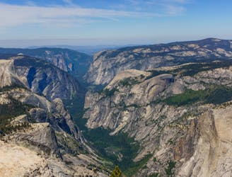
Four Mile Trail
A great out-and-back offering views across Yosemite Valley.
Difficult Trail Running
- Distance
- 17 km
- Ascent
- 1.1 km
- Descent
- 1.1 km
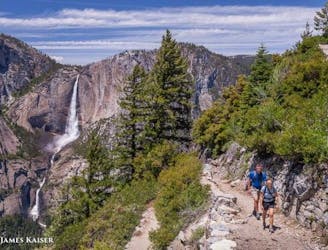
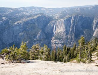
Out-and-back route to reach Yosemite Falls (the lower, middle, and upper falls).
Trail Running Difficult

This trial run makes its way to the stunning Yosemite Falls. The falls themselves are comprised of three sections: upper falls, middle cascade, and lower falls. The majority of trail users stop and turn around at the lower falls. However, continuing on to the upper falls makes for a great trail run and offers an eyes-wide-open experience.
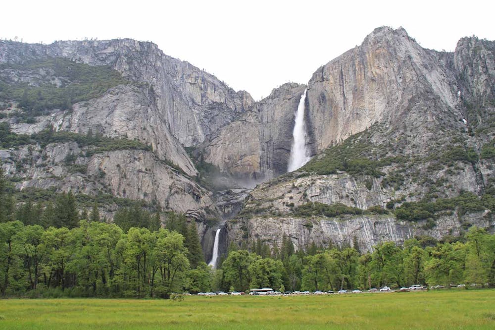
The trail begins at Camp 4 – the Sunnyside campground. From there, the trail climbs steeply over numerous switchbacks to an initial traverse around towards the lower falls. Following the first traverse, runners will again steeply gain elevation over short switchbacks to reach the middle and upper falls. At the top is the Yosemite Fall Overlook, a platform that offers viewers an opportunity to check out the stunning views down to the Yosemite Valley.
The trail is open year-round and is most popular during spring and summer months. However, for those not worried by some snow, winter provides an absolutely inspiring setting to behold the Yosemite Falls.
As is the case with the Mist Trail to Vernal and Nevada Falls, the Yosemite Falls Trail is a great option for a 1.5-2 hour trail-run on a great trail with a spectacular setting.
Difficult

The trail contains some obstacles such as outcroppings and rock which could cause injury.
Away from help but easily accessed.
172 m away
A great out-and-back offering views across Yosemite Valley.
Difficult Trail Running
3.2 km away
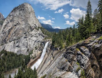
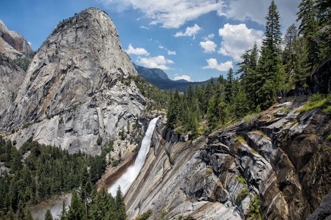
A stunning trail run up steep climbs, passing close to Vernal and Nevada Falls.
Difficult Trail Running
3.2 km away
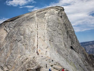
A long day out to the summit of one of the most iconic mountains in the world.
Severe Trail Running
3.2 km away
A great full-day trail-run along a premier route high above the Yosemite Valley.
Severe Trail Running
3.6 km away
An out-and-back from Glacier Point Road to the summit of Sentinel Dome.
Moderate Trail Running
6 routes · Trail Running