359 m away
East Wall Traverse

Access to hikeable and out of bounds terrain
Moderate Freeride Skiing
- Distance
- 1.5 km
- Ascent
- 22 m
- Descent
- 191 m
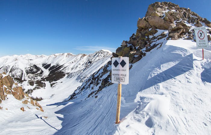
Access to the north pole chute and other drop points along the ridge of Lenawee mountain.
Freeride Skiing Moderate

This is a popular freeride skiing route which is generally considered to be moderate. It's remote, it features unknown exposure and is typically done in an unknown time of year. From a low point of 3.8 km to the maximum altitude of 3.9 km, the route covers 695 m, 117 vertical metres of ascent and 28 vertical metres of descent.
Hike up to extreme terrain.
Moderate
Slopes become slightly steeper at around 25-30 degrees.

Away from help but easily accessed.
359 m away
Access to hikeable and out of bounds terrain
Moderate Freeride Skiing
468 m away

Fun low angled rocky terrain
Moderate Freeride Skiing
475 m away

Mellow bowl skiing into mellow tree skiing
Moderate Freeride Skiing
563 m away

Bowl skiing into a tree run
Difficult Freeride Skiing
579 m away

Fun and challenging line down to the east wall
Difficult Freeride Skiing
594 m away

Bowl skiing tree run
Difficult Freeride Skiing
594 m away

Flat bowl to steep tree skiing
Difficult Freeride Skiing
741 m away

Open bowl skiing to tight tree skiing
Moderate Freeride Skiing
839 m away

Steep bootpack up from inbounds
Difficult Freeride Skiing
905 m away

Nice steep less skied option on East Wall
Severe Freeride Skiing
8 routes · Freeride Skiing