1 m away
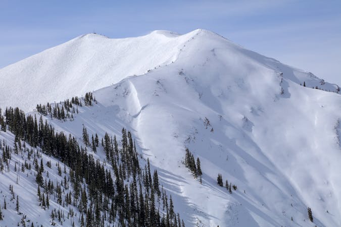
Pali Uphill

Uphill access to the steepest stuff on A-Basin’s frontside.
Difficult Resort Ski Touring
- Distance
- 1.8 km
- Ascent
- 391 m
- Descent
- 1 m
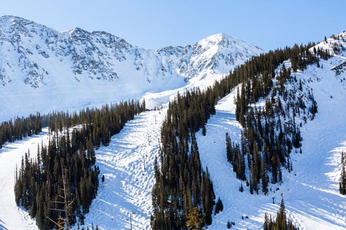
One possible route for skinning to the top of Arapahoe Basin resort.
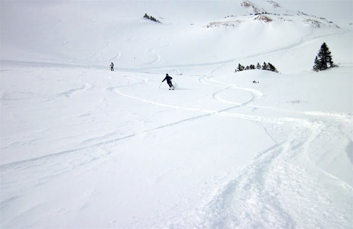
Resort Ski Touring Moderate

A-Basin is pretty generous with the uphill access that’s allowed outside of operating hours. Before 8:30am and after 4:30pm you can skin up any frontside green or blue runs, and continue to the top if you like. The East Wall zone is completely off-limits after hours, but you can still take your pick of any lift-served runs on the front side to ski down.
The route mapped here is just one of many options for skinning from bottom to top. It takes Ramrod > Dercum’s Gulch > Lenawee Face. You could start on High Noon instead, but Ramrod is slightly more direct. Note that any of these runs can be closed to uphill at any time, so you’ll want to check the uphill status online ahead of time, then pay attention to signs on the mountain.
You can find the status on A-Basin’s Uphill Access page, along with more info about routes and policies. Note that the resort does require a pass for uphill access, which costs money unless you already have a season pass.
Moderate

Close to help in case of emergency.
1 m away
Uphill access to the steepest stuff on A-Basin’s frontside.
Difficult Resort Ski Touring
58 m away

The route for skinning uphill during open hours at Arapahoe Basin.
Moderate Resort Ski Touring
4.9 km away

Uphill access at Loveland, for skinning in the morning and evening.
Easy Resort Ski Touring
7.3 km away

Morning and evening uphill access to the top of Keystone resort.
Moderate Resort Ski Touring
8.1 km away

Uphill access at Keystone that stays mostly on green runs.
Easy Resort Ski Touring

17 routes · Resort Ski Touring
40 routes · Resort Ski Touring
1 routes · Resort Ski Touring
4 routes · Freeride Skiing · Resort Ski Touring