2 m away
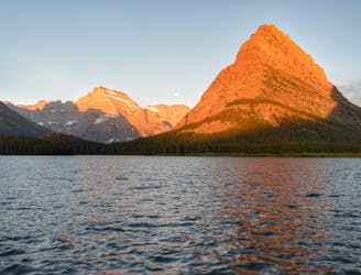
Grinnell Lake

Easygoing hike to a beautiful alpine lake.
Easy Hiking
- Distance
- 11 km
- Ascent
- 156 m
- Descent
- 156 m
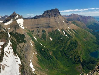
Day hike to the impressive Grinnell Glacier.
Hiking Difficult

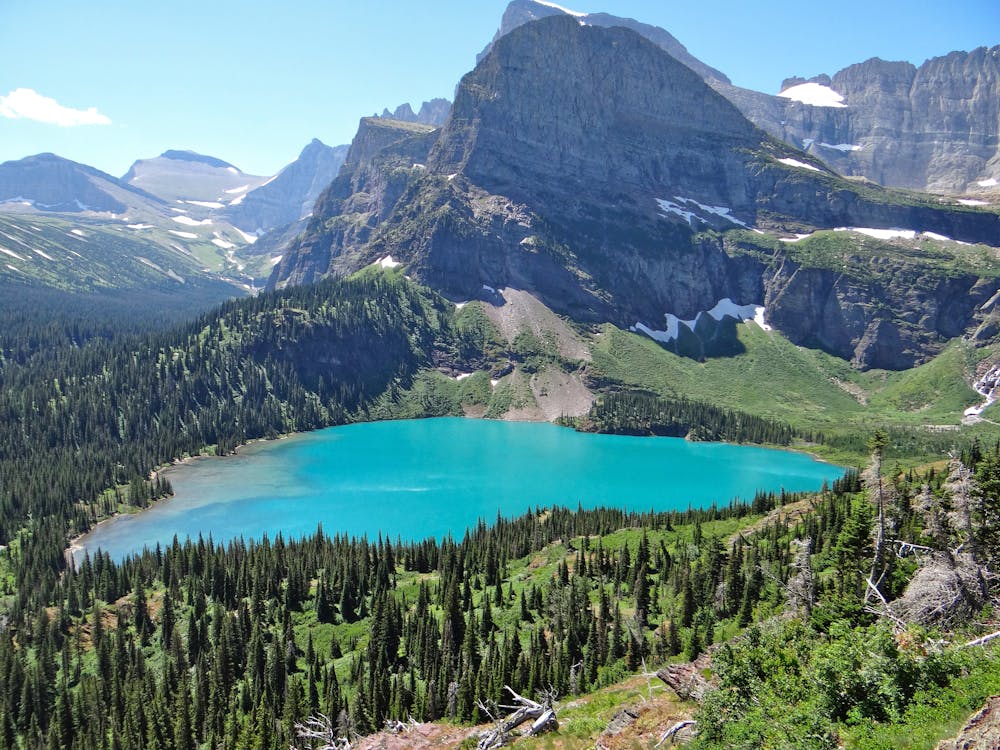
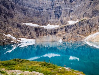
The trip to the Grinnell Glacier viewpoint is one of the best day trips in Glacier National Park. This route features everything: wildflowers, alpine lakes, wildlife, vistas, and much more! It is one of the best trips in the park for someone looking to get close up to a glacier, too. The terminus at Upper Grinnell Lake features outstanding views of Grinnell Glacier.
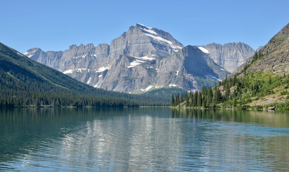
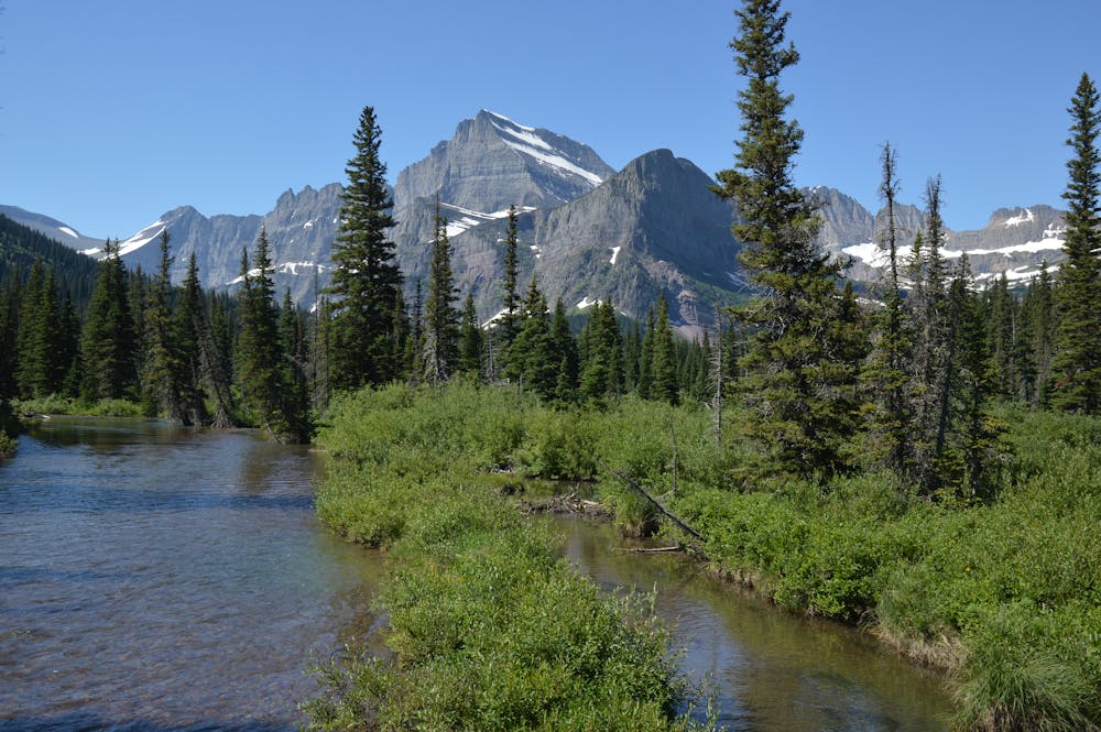
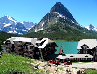
The route begins in a forested area. You can shave off a few miles by taking the boat ride across Swiftcurrent Lake and Lake Josephine. Taking the boat is a fun experience, although hiking around the lakes provides excellent views too.
Be bear aware on this journey as the route traverses through prime grizzly habitat. Moose, bighorn sheep, and mountain goats are sometimes spotted in the area, too. It is a treat when you get the chance to see these incredible animals!
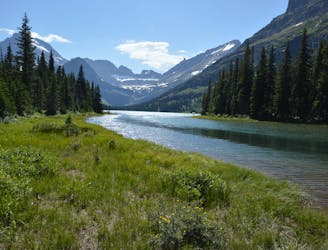
The forest slowly transitions to an alpine environment where wildflowers dot the landscape. Magnificent Grinnell Falls will come into view shortly thereafter. You eventually reach the viewpoint of Lower Grinnell Lake, which is one of the best views on the hike. Standing high above the lake, you get fabulous views of the surrounding peaks. The sparkling turquoise water of Lower Grinnell Lake is a sight to behold.
The route features more climbing from here, but the destination is not far off. Arriving at the viewpoint is a surreal feeling. You have now arrived at one of the most precious spots in the entire park, and the hike to get there wasn't even too strenuous!
Take some valuable time to rest here, as you will not want to leave the peaceful setting. The views of the Garden Wall from this spot are spectacular. If you dare, jumping into freezing Upper Grinnell Lake will surely chill the bones! The proximity to the glacier from here is impressive.
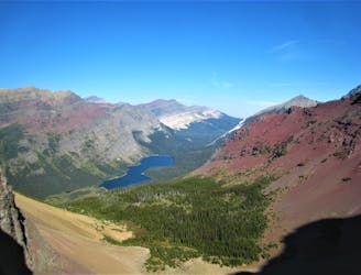
On a separate note, hiking to the Grinnell Glacier Overlook on the Highline Trail will provide an epic bird's eye view of this area. Being able to access both viewpoints in the park is incredible. It's highly recommended to visit the overlook in addition to this route.
Once ready, retrace your steps back to the trailhead. The descent is nice and gradual.
Difficult
Hiking trails where obstacles such as rocks or roots are prevalent. Some obstacles can require care to step over or around. At times, the trail can be worn and eroded. The grade of the trail is generally quite steep, and can often lead to strenuous hiking.

The trail contains some obstacles such as outcroppings and rock which could cause injury.
Away from help but easily accessed.
2 m away
Easygoing hike to a beautiful alpine lake.
Easy Hiking
155 m away
An alternate way to complete the CDT when snow or logistics into Canada are problematic.
Moderate Hiking
162 m away
The classic finish to the CDT at the Border Monument on Waterton Lake.
Difficult Hiking
514 m away
Gentle walk around two beautiful lakes.
Moderate Hiking
1.5 km away
Hike to a quintessential glacial lake!
Moderate Hiking
1.5 km away
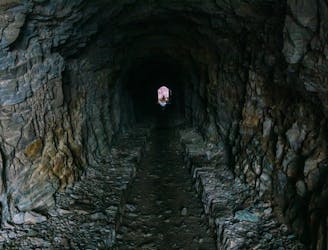
Hike through a historic tunnel at the top of the Ptarmigan Wall.
Difficult Hiking
1.6 km away
A gorgeous day hike through the Swiftcurrent Valley.
Difficult Hiking
8.9 km away
Epic side trip to one of the best views in the park.
Difficult Hiking

11 routes · Hiking
6 routes · Hiking

25 routes · Alpine Climbing · Hiking

40 routes · Hiking
13 routes · Hiking