63 m away
Ptarmigan Tunnel
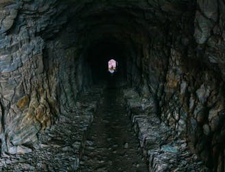
Hike through a historic tunnel at the top of the Ptarmigan Wall.
Difficult Hiking
- Distance
- 18 km
- Ascent
- 756 m
- Descent
- 756 m
A gorgeous day hike through the Swiftcurrent Valley.
Hiking Difficult

For a fantastic day hike in Glacier National Park, be sure to check out Swiftcurrent Pass. If you are looking for a good physical challenge with panoramic views, this route is a great option. It isn't the most difficult hike in the park, but it definitely packs a punch.

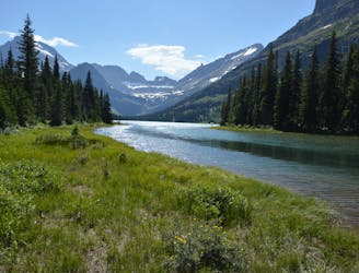
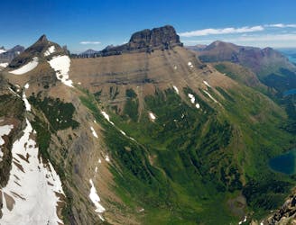
The allure of this hike is the beautiful Swiftcurrent Valley. The entire hike ascends through the valley and culminates with spectacular views at Swiftcurrent Pass. Passing through the valley provides an excellent opportunity to view wildlife, as well as the chance to see the many lakes and streams throughout.
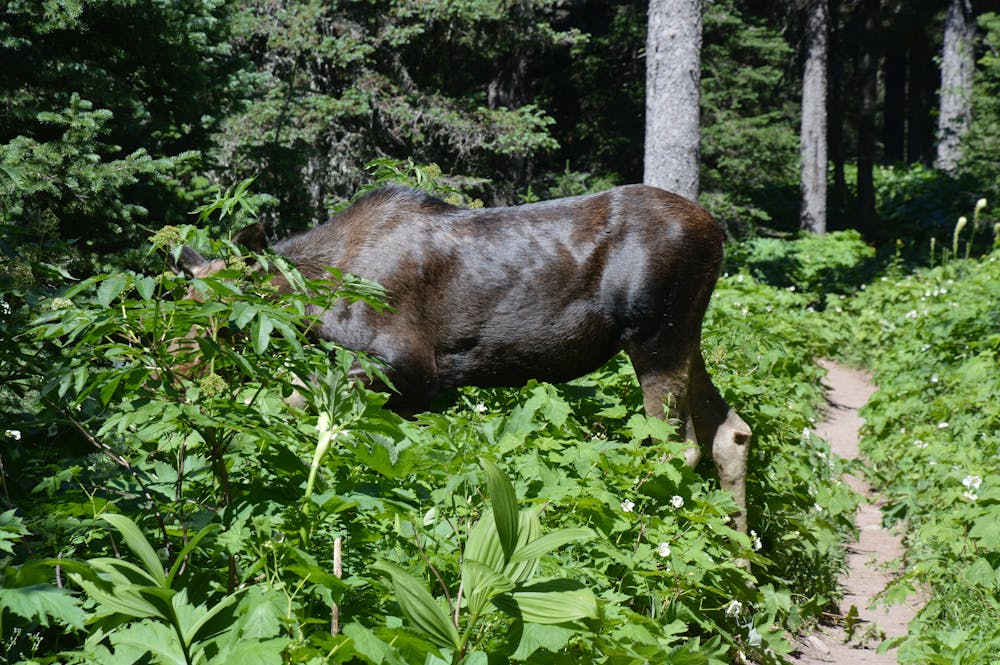
Be very alert along the first stretch of this hike, as this is bear territory. It's highly recommended to hike in a group and having bear spray readily accessible. Moose are often seen along this route too, which is a treat! Given that you are in Glacier, be prepared to see any species of wildlife!
The first lake you'll reach is Fishercap. The crowds will likely thin following Fishercap. Bullhead and Redrock lakes are next in line. Redrock Falls is also a sight to be had. Don't rush through this section, as the views are well-worth savoring.
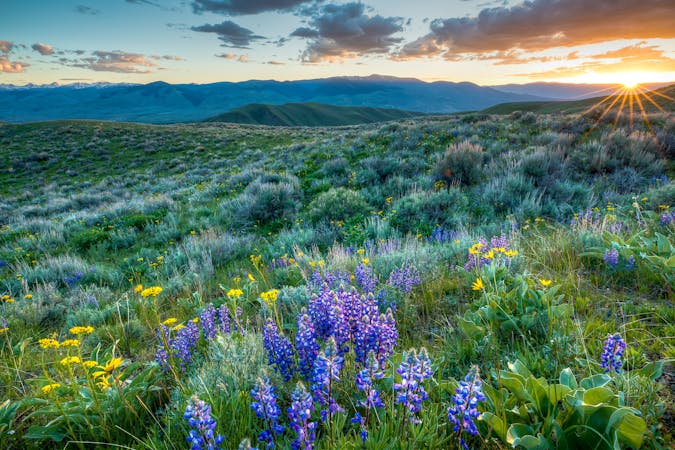
Another plus of traversing through the valley is the abundance of wildflowers. Depending on the time of year, this area has some of the best wildflower displays to be found!
The uphill continues as you near the pass. The views open up with each step. Once at the pass, either stay here or make the worthy side trip up to the Swiftcurrent Lookout. Note, this will add another 1,000+ feet of elevation gain.
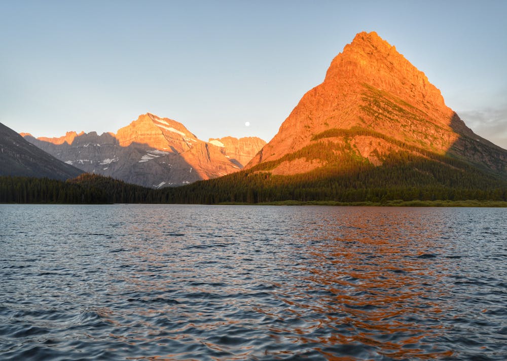
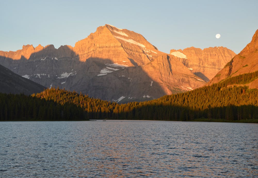
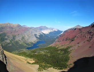
Swiftcurrent pass brings spectacular views of the valley below. The chain of lakes, along with Swiftcurrent Lake, appears in the distance. This is definitely one of the finest views Glacier Park has to offer. Take your time, have some lunch, and then retrace your steps back down to the Many Glacier area once you're ready.
You will not be disappointed you took the trip through the Swiftcurrent Valley!
Difficult
Hiking trails where obstacles such as rocks or roots are prevalent. Some obstacles can require care to step over or around. At times, the trail can be worn and eroded. The grade of the trail is generally quite steep, and can often lead to strenuous hiking.

The trail contains some obstacles such as outcroppings and rock which could cause injury.
Away from help but easily accessed.
63 m away
Hike through a historic tunnel at the top of the Ptarmigan Wall.
Difficult Hiking
65 m away
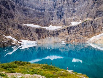
Hike to a quintessential glacial lake!
Moderate Hiking
1.5 km away
An alternate way to complete the CDT when snow or logistics into Canada are problematic.
Moderate Hiking
1.5 km away
The classic finish to the CDT at the Border Monument on Waterton Lake.
Difficult Hiking
1.6 km away

Easygoing hike to a beautiful alpine lake.
Easy Hiking
1.6 km away
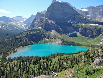
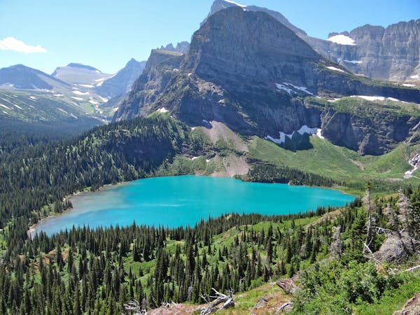
Day hike to the impressive Grinnell Glacier.
Difficult Hiking
1.6 km away
Gentle walk around two beautiful lakes.
Moderate Hiking
7.5 km away
Epic side trip to one of the best views in the park.
Difficult Hiking
11 routes · Hiking
6 routes · Hiking

25 routes · Alpine Climbing · Hiking

40 routes · Hiking
13 routes · Hiking