1.7 km away
Fryingpan Mountain
A short hike to a historic fire tower with breathtaking panoramic views.
Easy Hiking
- Distance
- 2.5 km
- Ascent
- 110 m
- Descent
- 110 m
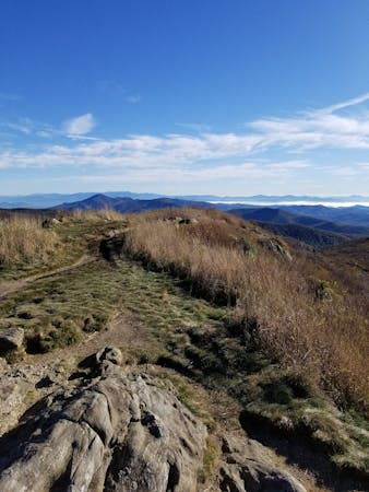
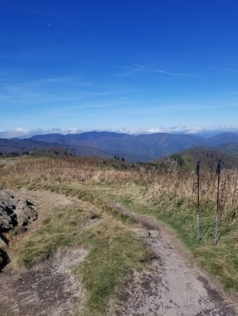
A historic and iconic route connecting Mount Pisgah to Mount Mitchell.
Hiking Difficult

This segment of the Mountains to Sea Trail (MST) traverses from the Iconic Pisgah Inn to Mt. Mitchell State Park.
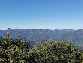
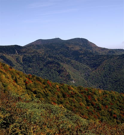
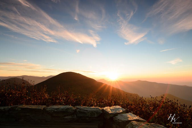
A 3-mile round trip detour to Mt. Pisgah will reward you with stunning views of the Blue Ridge Mountains from a developed observation deck. Similar to Mt. Pisgah, a spur to the summit of Mt. Mitchell will take you to the highest point east of the Mississippi River, just shy of 6,700'.
For an experienced trail runner looking for a challenge, this stretch has been known by many as one of the most adventurous and rewarding routes in the southeast.
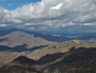
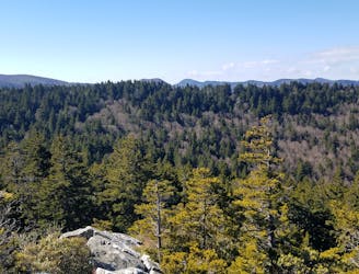
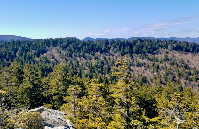
Countless overlooks line the trail and the traverse from high elevation spruce-fir forests, to temperate rainforests, offers unique and ever-changing foliage.
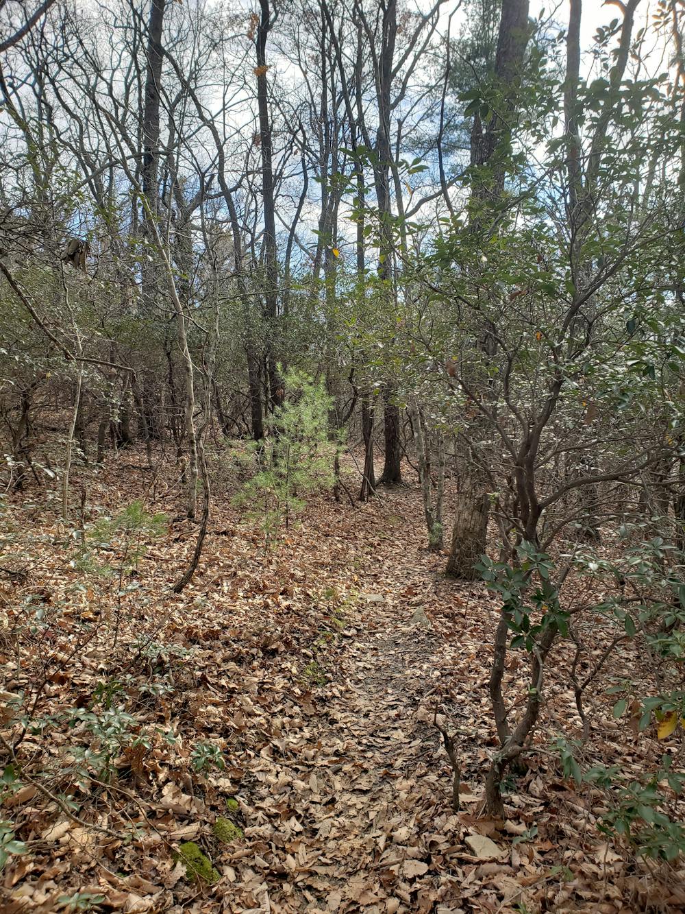
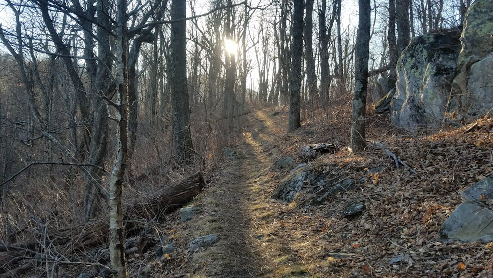
Beginning at the Pisgah Inn, look for the white dot blaze heading toward Little Pisgah Mountain. After a series of several smaller mountains and knobs, you'll reach Bent Creek Experimental Forest, a popular destination for runners and mountain bikers alike.
This portion of the trail is also referred to as the Shut-In Trail, the original corridor used by George Vanderbilt to get from the Biltmore Estate to his hunting lodge adjacent to Mt. Pisgah. Nearing the end of Bent Creek, the trail merges onto the Blue Ridge Parkway (BRP) as it crosses Brevard Road, and eventually several others through the outskirts of Asheville.
This portion is the most easily traversed and offers countless opportunities for shorter, family-friendly day hikes. For a thru-hiker or trail runner attempting this entire segment, this is where you can catch your breath as you skirt along Biltmore Forest and onto the Folk Art Center.
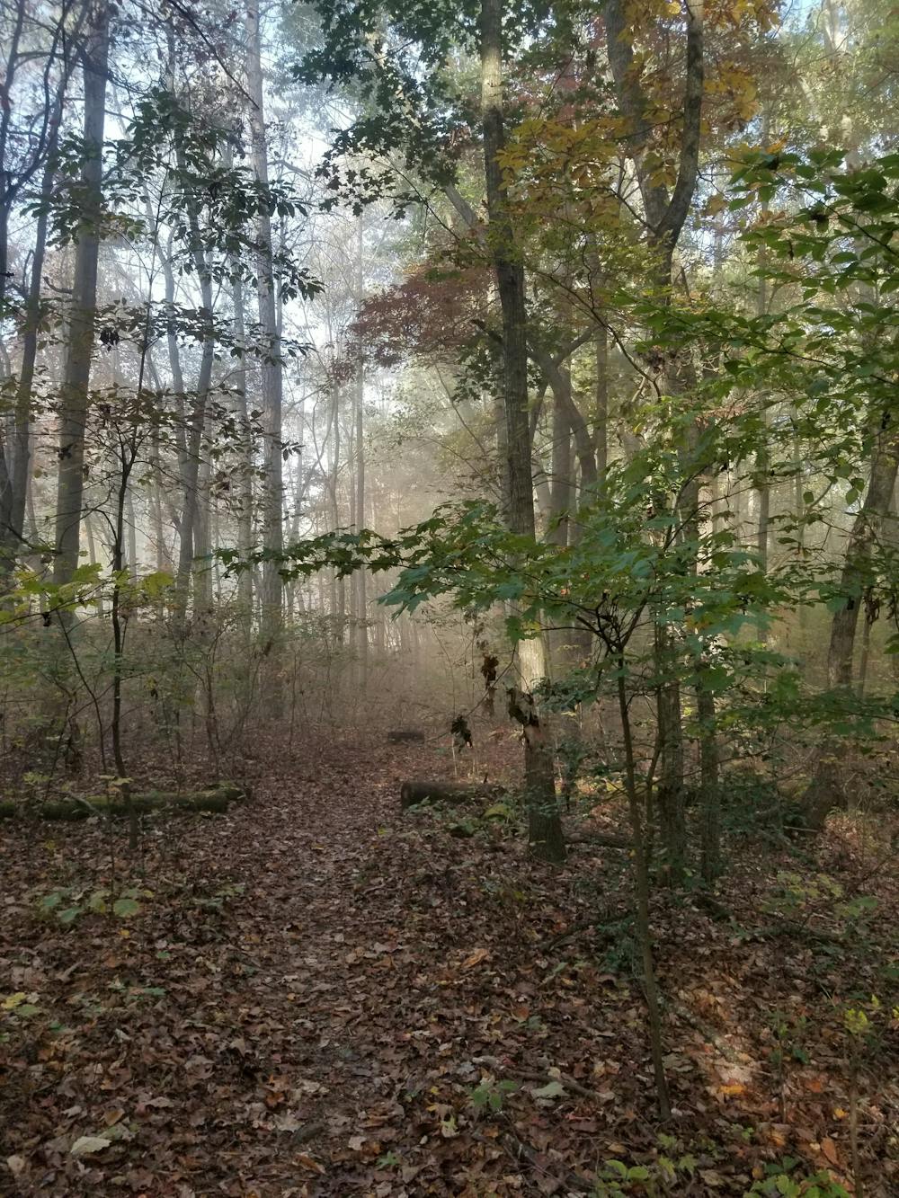
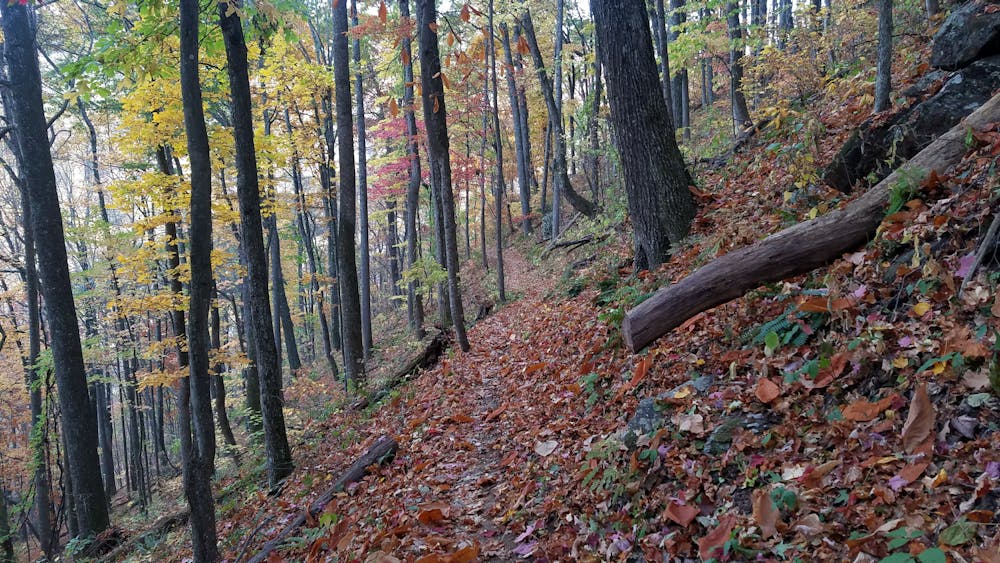
The temperate rain forest ecology in this region will be a nice change of scenery before ascending back toward the alpine terrain. Take the opportunity to enjoy the various rhododendron tunnels and vibrant colors this portion has to offer.
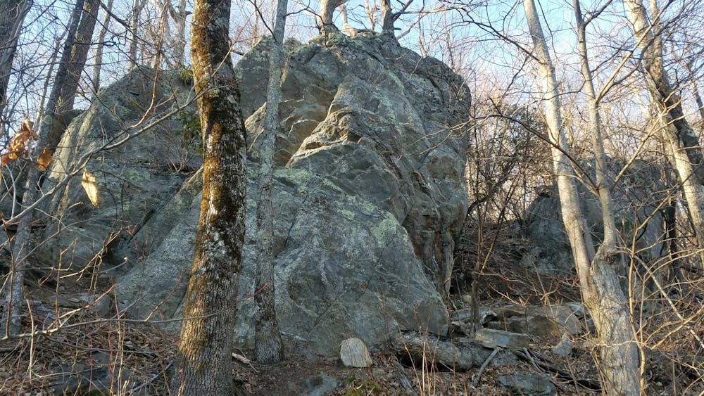
Climbing toward Craven Gap, the trail traverses along several narrow benches lined with unique rocky formations before climbing toward Rattlesnake Lodge and Craggy Gardens Visitor Center, popular destinations for locals and travelers alike. According to the NPS, "For generations, visitors have headed for the Craggies in June, typically the prime time for viewing the pink and purple blooms of Catawba rhododendrons that blanket the area."
As you near Mount Mitchell State Park, the trail turns north and parallels NC-128 before eventually summiting the highest point east of the Mississippi River.
For even more spectacular views, traverse this segment in the fall, as the changing colors are renowned for their beauty.
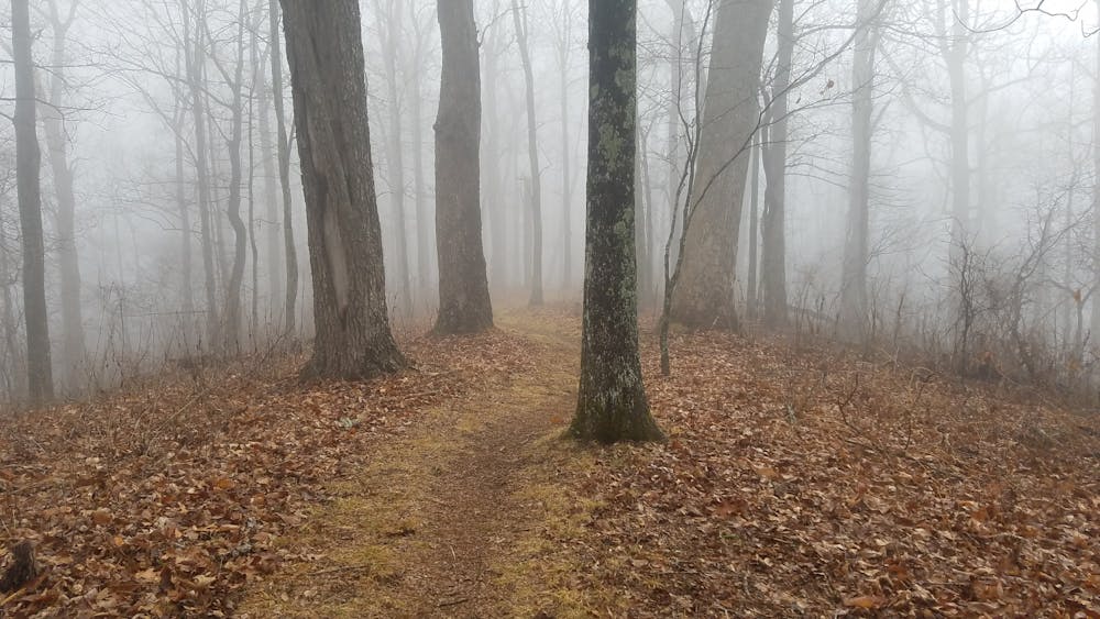
Though much of this portion can be traversed year-round, the higher elevations may be harder to access and navigate during the winter months.
This route parallels the Blue Ridge Parkway and crosses it at many times. These crossings often have small parking lots where one could rendezvous with a supply vehicle or even refill on water in a couple of places. Be aware that the Blue Ridge Parkway frequently closes in winter months. Check here for the latest road conditions and closures:
https://www.nps.gov/maps/full.html?mapId=e212fcb5-4ff9-4787-bbe4-3d40cc0d0daa#11/35.3854/-82.5430
Sources: https://www.hikewnc.info/trailheads/pisgah-national-forest/long-distance/shut-in-trail/ https://www.blueridgeparkway.org/poi/craggy-gardens/
Difficult
Hiking trails where obstacles such as rocks or roots are prevalent. Some obstacles can require care to step over or around. At times, the trail can be worn and eroded. The grade of the trail is generally quite steep, and can often lead to strenuous hiking.

The trail contains some obstacles such as outcroppings and rock which could cause injury.
Away from help but easily accessed.
1.7 km away
A short hike to a historic fire tower with breathtaking panoramic views.
Easy Hiking
1.7 km away
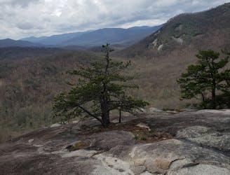
A popular hike providing spectacular views from the summit of Mount Pisgah.
Difficult Hiking
5.9 km away
A gem of a hike showcasing some of the best features in Pisgah National Forest.
Difficult Hiking
6 km away
A beautiful, family-friendly hike through the historic Pink Beds Valley.
Easy Hiking
7.2 km away
A challenging and incredibly-steep approach to Shining Rock.
Severe Hiking
7 routes · Hiking

7 routes · Hiking
16 routes · Hiking
9 routes · Hiking

10 routes · Hiking

16 routes · Hiking
3 routes · Hiking
8 routes · Hiking