5.6 km away
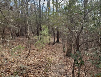
Poundingmill / Mullinax Loop
A quiet hike along historic logging paths in Turkey Pen.
Moderate Hiking
- Distance
- 10 km
- Ascent
- 391 m
- Descent
- 391 m
A gem of a hike showcasing some of the best features in Pisgah National Forest.
Hiking Difficult

With over 500,000 acres in Pisgah National Forest, its often hard to figure out where to head for a day hike. Waterfalls, rhododendron tunnels, and exposed overlooks are only a few parts of what makes Pisgah great. With this hike, you can have it all.
This route begins on seasonal Yellow Gap Road, typically open April to October. When closed, a longer day hike or overnight trip can be planned from the Blue Ridge Parkway, but the weather frequently causes road closures during winter months.
Begin at the bottom of the Pilot Cove-Slate Rock Trail. The trail begins and ends along Yellow Gap Road, and will require a 1.5-mile walk along the road unless you have two vehicles.
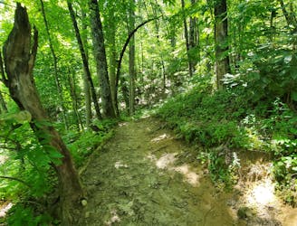
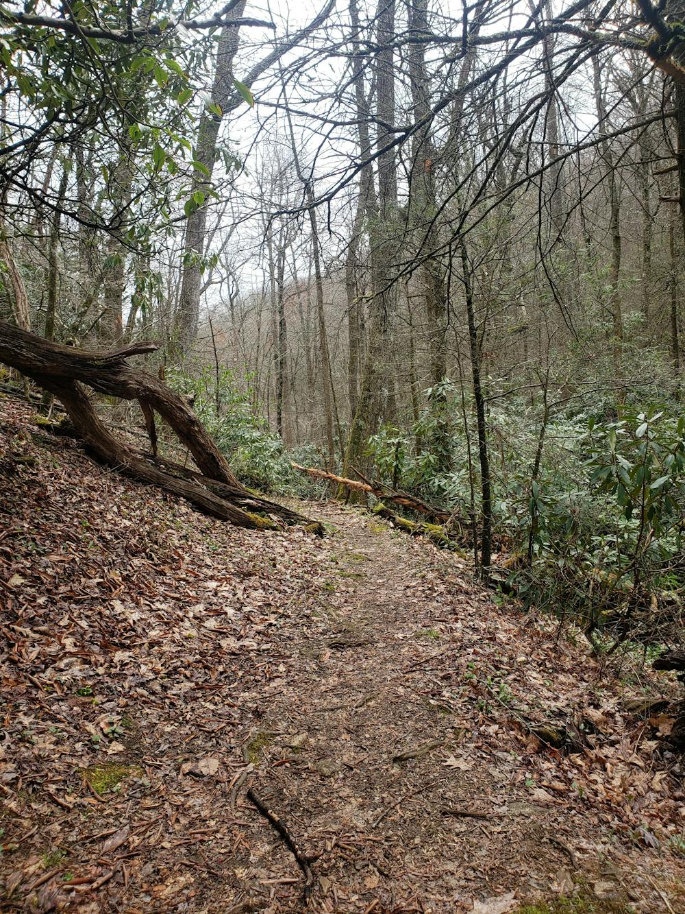
Completed counter-clockwise, the hike begins by following Slate Rock Creek upstream. In the spring and summer months, enjoy the wide array of wildflowers blanketing the trail. The mountain stream provides some cascading waterfalls, most of which can be accessed by side trails. Expect that after a recent rain, you may get your feet wet where fresh springs flow across the trail and into the stream.
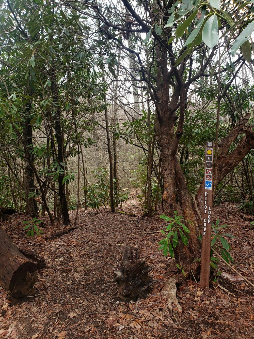
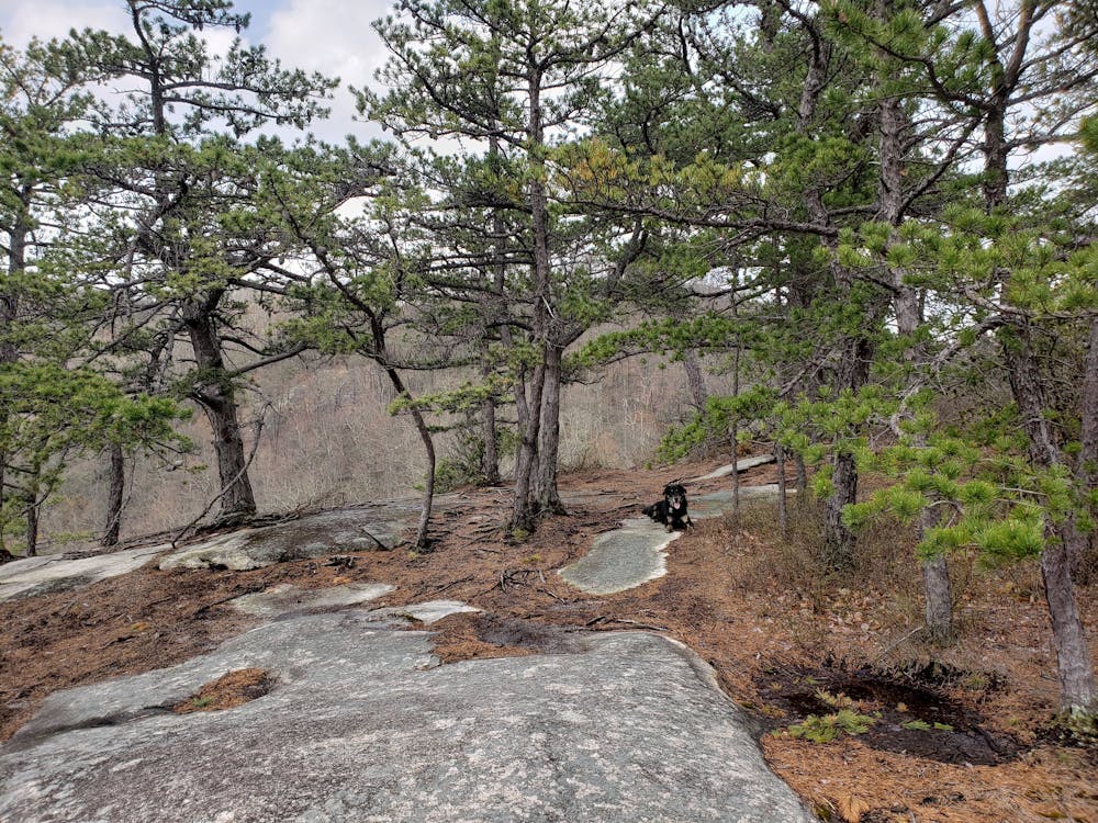
Around 3 miles in, the trail spurs to the left across the creek. An unofficial trail to the right leads to Laurel Mountain. A quick, yet steep, climb leads to a junction with Pilot Cove Loop Trail. Head left and follow the narrow path as it undulates across Slate Rock Ridge.
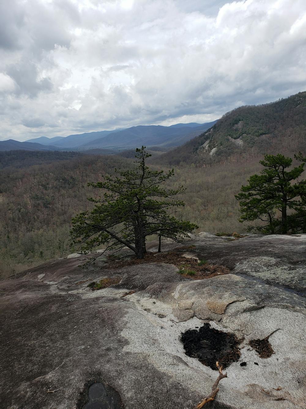
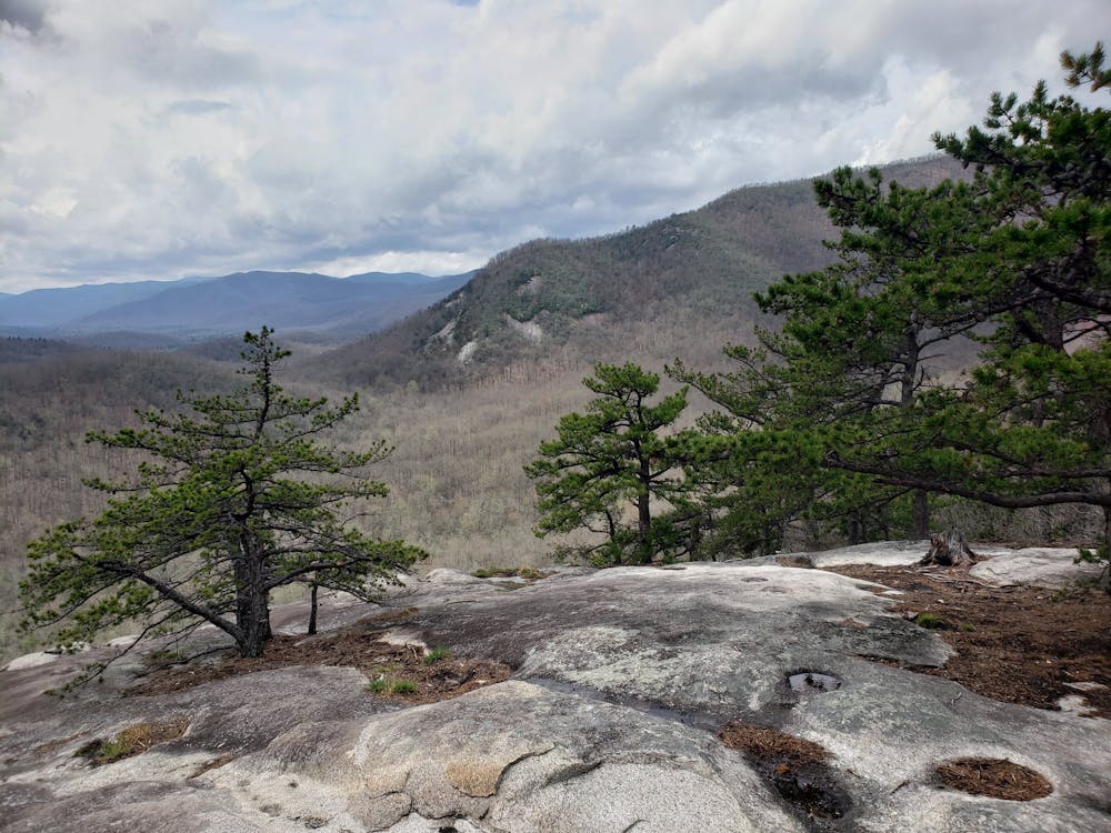
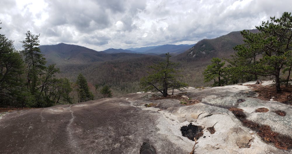
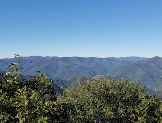
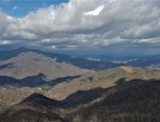
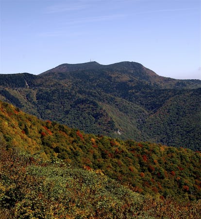
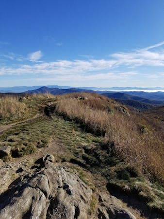
Near the crest of the ridge, the trail leads onto an exposed slickrock face, with expansive views to the west and southwest. Nearby Pilot Rock can be seen to the right, Pink Beds Valley to the left, and the distant high peaks of the Balsam Range can be seen in the distance. To many, this is one of the most memorable views in the forest.
Leaving the ridge, the trail spirals its way around a contour via a steep descent before merging onto the Pilot Cove-Slate Rock Trail. The old two-track trail leads back to Yellow Gap Road after just a few minutes of hiking. Should you have multiple vehicles, this is where you would stage one for the end of the hike. Should you only have one, follow the road to the left (east) about 1.5 miles as it parallels Bradley Creek back to where you began.
Sources: https://www.hikewnc.info/trails/mills-river/pilot-cove-slate-rock
Difficult
Hiking trails where obstacles such as rocks or roots are prevalent. Some obstacles can require care to step over or around. At times, the trail can be worn and eroded. The grade of the trail is generally quite steep, and can often lead to strenuous hiking.

Some trail sections have exposed ledges or steep ascents/descents where falling could cause serious injury.
Little chance of being seen or helped in case of an accident.
5.6 km away
A quiet hike along historic logging paths in Turkey Pen.
Moderate Hiking
5.6 km away
An hike in Turkey Pen pairing an old roadbed to a technical ridgetop traverse.
Difficult Hiking
5.9 km away
A historic and iconic route connecting Mount Pisgah to Mount Mitchell.
Difficult Hiking
6.3 km away
A popular hike providing spectacular views from the summit of Mount Pisgah.
Difficult Hiking
7 km away
A short hike to a historic fire tower with breathtaking panoramic views.
Easy Hiking
8.6 km away
A beautiful, family-friendly hike through the historic Pink Beds Valley.
Easy Hiking
7 routes · Hiking

7 routes · Hiking
16 routes · Hiking

10 routes · Hiking

16 routes · Hiking
8 routes · Hiking