2.9 km away
Wizard Island Summit
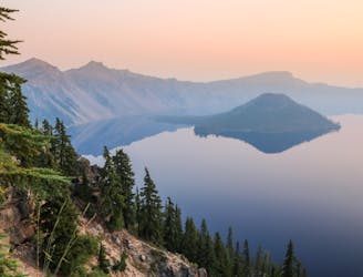
One of the most beautiful but logistically difficult to reach points in Crater Lake National Park.
Severe Hiking
- Distance
- 3.9 km
- Ascent
- 232 m
- Descent
- 232 m
Climb to a stunning overlook of Crater Lake.
Hiking Difficult

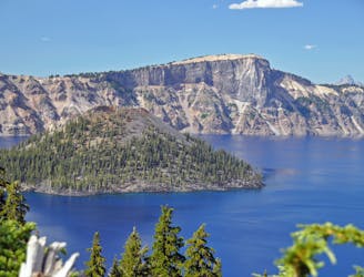
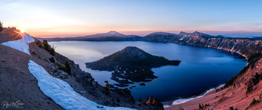
Garfield Peak holds the title of "most popular hike in Crater Lake National Park," so if you don't enjoy trail traffic, it's best to head further off the beaten path. That said, Crater Lake as a whole isn't nearly as trafficked as some of the big-name national parks, so the number of people vying for the summit of Garfield Peak is generally quite reasonable.
And once you get there... Oh. My. Gosh. The view!
The hike begins from the lodge and main parking area on the southern end of Crater Lake National Park. The trail is straightforward with no turns, so this out-and-back hike requires no navigation whatsoever.
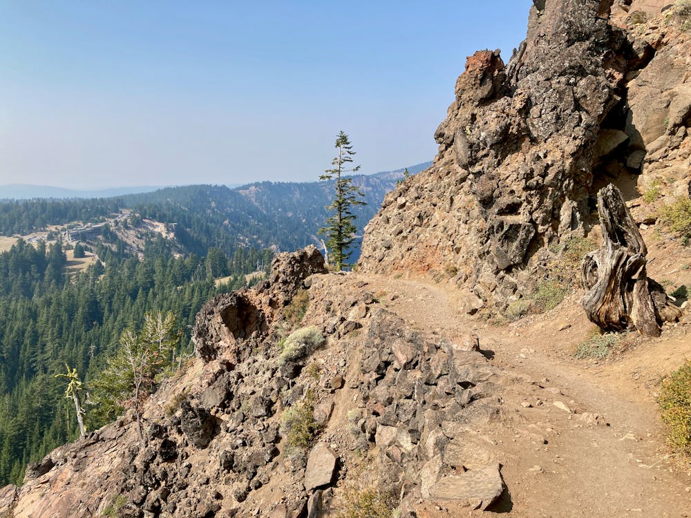
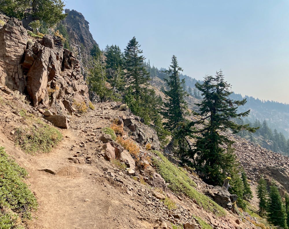
The trail tread is quite wide and well-trod, but in places, it is quite steep and reasonably rocky. The steepness of the trail combined with some big rocks and boulders earn it a "difficult" FATMAP rating, although the 3.4-mile round-trip hike will feel easy to many. Do also note that while the trail tread is relatively wide, the bench is cut into the side of a steep mountain, and at times the exposure is substantial.
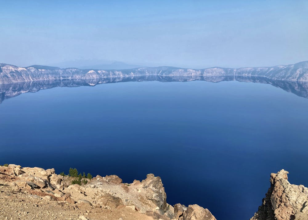
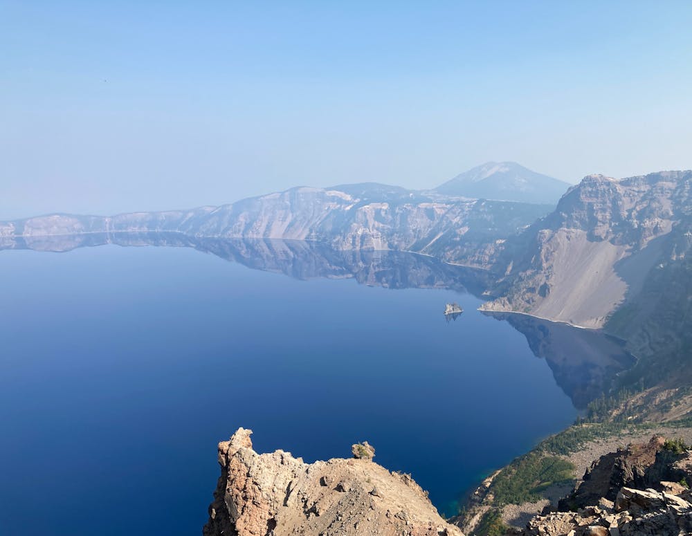
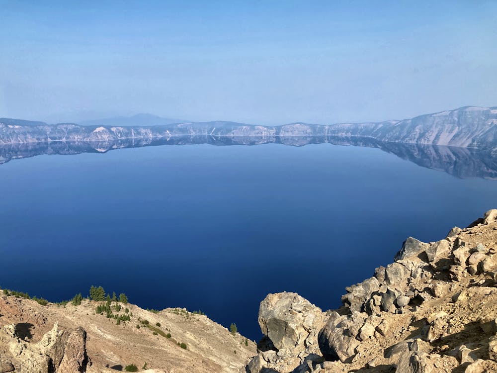
Unlike some hikes where you're only greeted with a view once you reach the end (and sometimes not even then), you'll enjoy expansive views the entire time while hiking to the top of Garfield Peak! The vistas continue to change as you round various switchbacks and move from one side of the ridge to the rim, and back again. Keep your phone at the ready to snap dozens of photos!
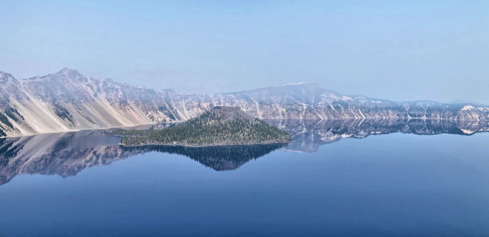
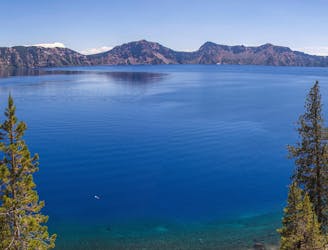
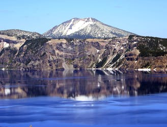
Once on top, enjoy the panoramic 360-degree views, with the entirety of Crater Lake, the deepest lake in the USA, spread out below you. It's truly an incredible sight to behold!
Difficult
Hiking trails where obstacles such as rocks or roots are prevalent. Some obstacles can require care to step over or around. At times, the trail can be worn and eroded. The grade of the trail is generally quite steep, and can often lead to strenuous hiking.

Some trail sections have exposed ledges or steep ascents/descents where falling could cause serious injury.

Away from help but easily accessed.
2.9 km away
One of the most beautiful but logistically difficult to reach points in Crater Lake National Park.
Severe Hiking
3.1 km away
A popular detour from the PCT in Crater Lake National Park, tracing the edge of the caldera for astounding views over the lake.
Moderate Hiking
5.3 km away
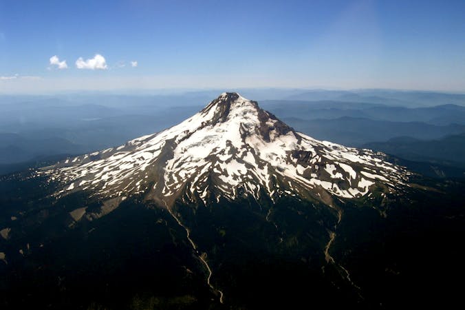
Miles 1820.9-1847.8 of the northbound PCT: Weaving through the volcanic landscape of Crater Lake National Park, but bypassing the namesake attraction itself.
Moderate Hiking
5.4 km away
Escape the crowds on this remote summit hike.
Severe Hiking
9.1 km away
The only way to reach the waters of Crater Lake.
Moderate Hiking
9.3 km away
Panoramic hike to the highest point in the national park, and a phenomenal view over Crater Lake.
Difficult Hiking
10 routes · Alpine Climbing · Hiking
6 routes · Hiking

52 routes · Mountain Biking · Freeride Skiing · Gravel Biking · Hiking · Road Biking

72 routes · Hiking

63 routes · Alpine Climbing · Hiking