2.9 km away
Garfield Peak
Climb to a stunning overlook of Crater Lake.
Difficult Hiking
- Distance
- 5.5 km
- Ascent
- 337 m
- Descent
- 337 m
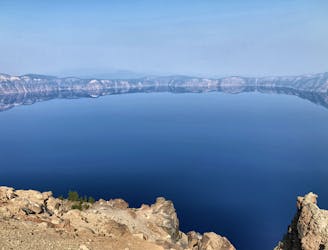
One of the most beautiful but logistically difficult to reach points in Crater Lake National Park.
Hiking Severe

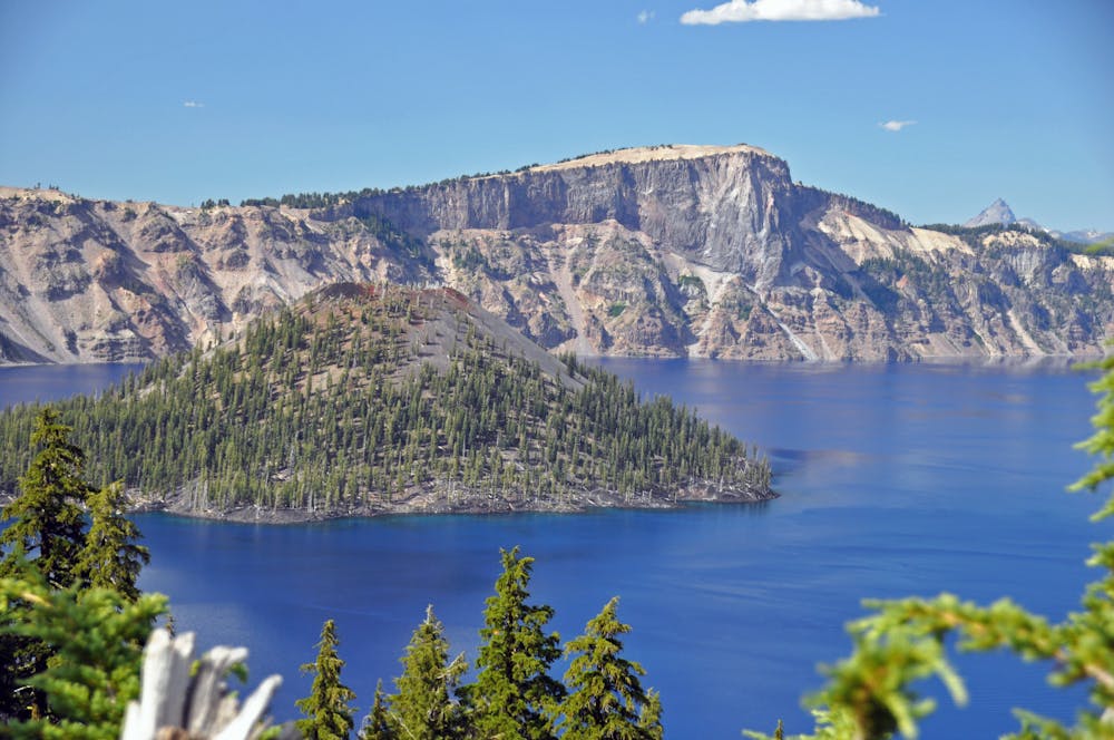
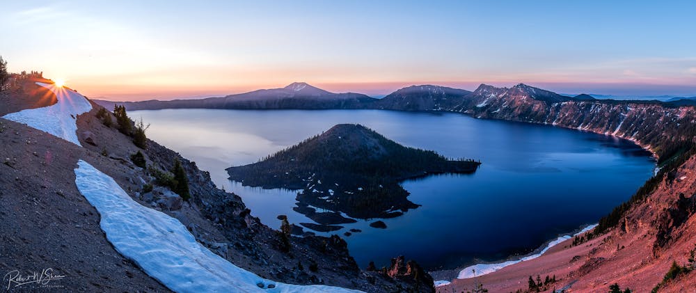
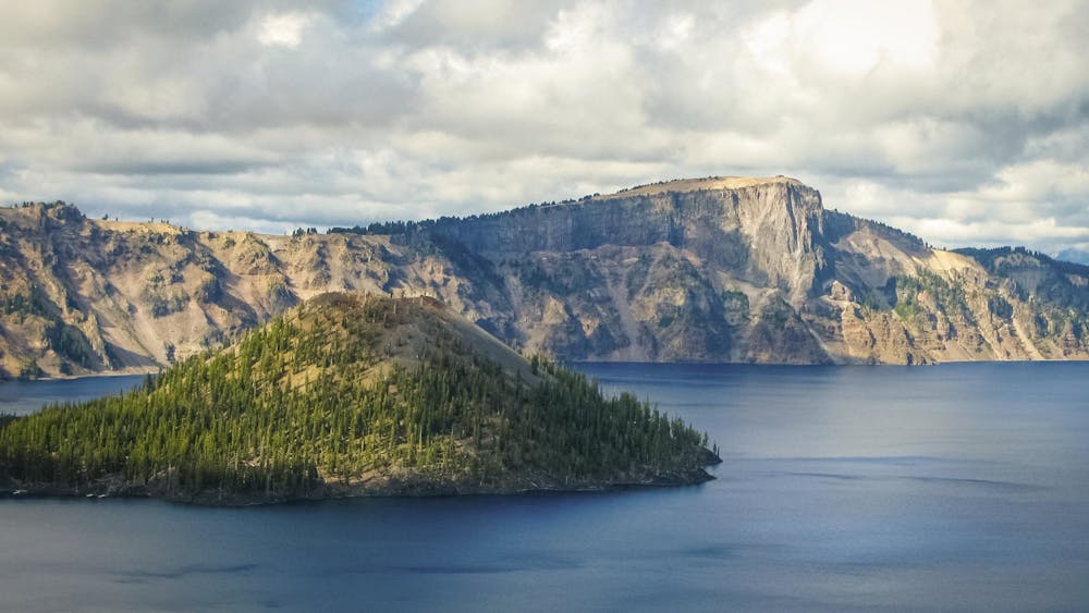
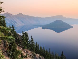
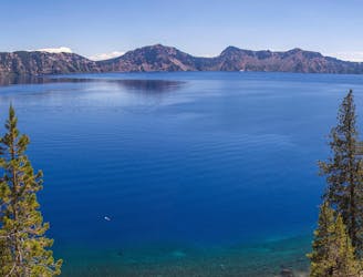
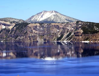
"Wizard Island" is the name of the iconic volcanic cone jutting out of the brilliant blue waters of Crater Lake. While visible from anywhere on the crater's rim, the top of Wizard Island's Summit actually takes quite a bit of logistical work to reach.
To begin, you'll have to hike down the Cleetwood Cove trail to reach the water's edge and a shuttle boat that will transport you to Wizard Island. Be sure to book your passage in advance. "You have the option of a three-hour, half-day drop-off or a full-day, six-hour stay," according to Chris Young on OutdoorProject.com.
After a beautiful boat ride across the lake, you'll finally have reached Wizard Island itself. But in front of you is a steep mile and a quarter of hiking to climb over 760 vertical feet to reach the conical summit of Wizard Island.
The trail itself requires scrambling over "large, treacherous lava rocks" and hiking uphill on loose, sliding gravel, according to Young. While the hike isn't long, it can feel quite demanding, especially in the harsh, direct sunlight of mid-summer at these high elevations. Once at the top of Wizard Island, be sure to hike around the entire mini caldera to soak in the views from every angle. You can also follow a social trail dropping 90 feet back down into Wizard Island's caldera, if you so desire. Be sure to savor these views from the top of the island, as it's one of the most beautiful and logistically difficult-to-reach points in all of Crater Lake National Park.
After hiking back down the mountain, take a dip in the lake to wash off the dust while you wait for your boat ride back to Cleetwood Cove. But be sure to save some energy, because when you get back to Cleetwood, you'll still be faced with an almost 700 vertical foot climb back to the crater's rim.
Severe
Hiking challenging trails where simple scrambling, with the occasional use of the hands, is a distinct possibility. The trails are often filled with all manner of obstacles both small and large, and the hills are very steep. Obstacles and challenges are often unexpected and can be unpredictable.

The trail contains some obstacles such as outcroppings and rock which could cause injury.

Little chance of being seen or helped in case of an accident.
2.9 km away
Climb to a stunning overlook of Crater Lake.
Difficult Hiking
5 km away
A popular detour from the PCT in Crater Lake National Park, tracing the edge of the caldera for astounding views over the lake.
Moderate Hiking
7.4 km away
Miles 1820.9-1847.8 of the northbound PCT: Weaving through the volcanic landscape of Crater Lake National Park, but bypassing the namesake attraction itself.
Moderate Hiking
7.4 km away
The only way to reach the waters of Crater Lake.
Moderate Hiking
7.5 km away
Escape the crowds on this remote summit hike.
Severe Hiking
9.8 km away
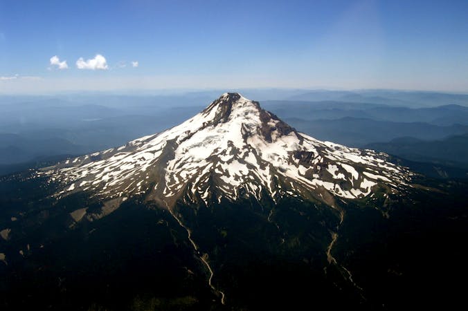
Panoramic hike to the highest point in the national park, and a phenomenal view over Crater Lake.
Difficult Hiking
10 routes · Alpine Climbing · Hiking

6 routes · Hiking

52 routes · Mountain Biking · Freeride Skiing · Gravel Biking · Hiking · Road Biking

72 routes · Hiking

63 routes · Alpine Climbing · Hiking