2.8 km away
Tyler's Traverse Shuttle
A fast, flowy shuttle run on the southern end of the Bend trail system.
Moderate Mountain Biking
- Distance
- 24 km
- Ascent
- 262 m
- Descent
- 666 m
One of the most rewarding mountain bike rides in Bend!
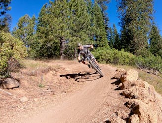
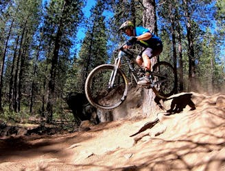
Mountain Biking Difficult

The Swampy to Mrazek shuttle may just be one of the most beautiful and most rewarding mountain bike rides in Bend, Oregon!
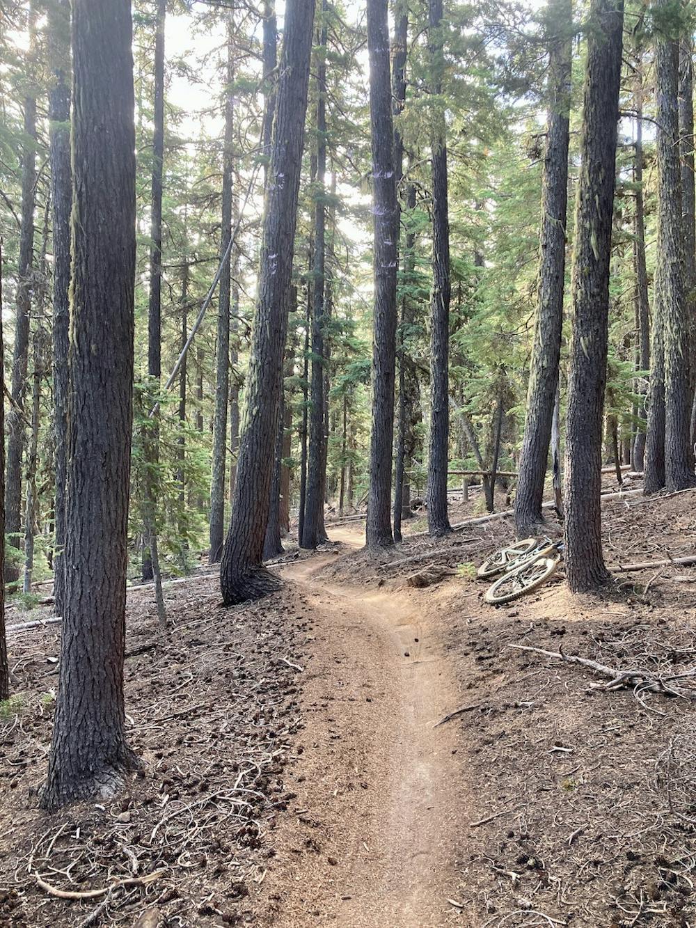
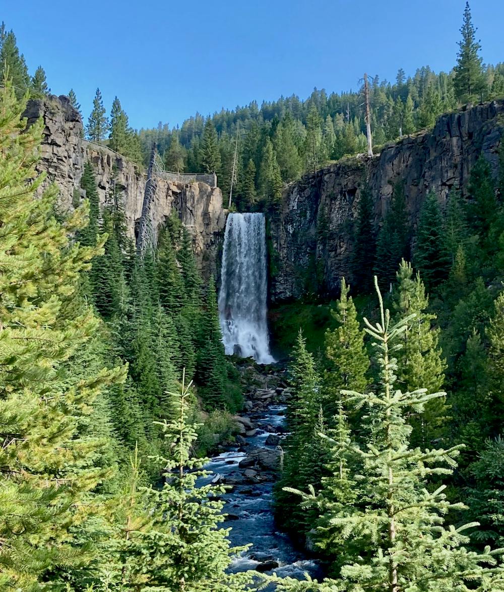
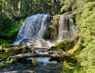
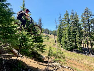
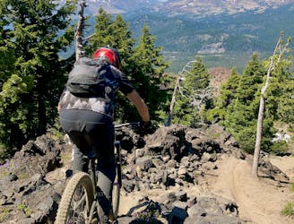
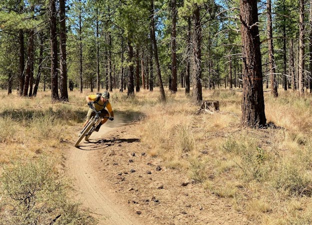
This epic point-to-point route begins on the Swampy Trail, which is rated easy. It’s quite sandy, but at the time of this writing is undergoing maintenance from the Central Oregon Trail Alliance (COTA). Swampy then drops into South Fork, which is rated black on some platforms, blue on others. I’d give it a dark blue. It’s a high-speed downhill with a couple of rocky sections, some roots, and some air opportunities, but overall it’s just a fast, ripping downhill, all the way to the Tumalo Falls Trailhead.
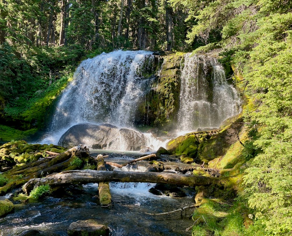
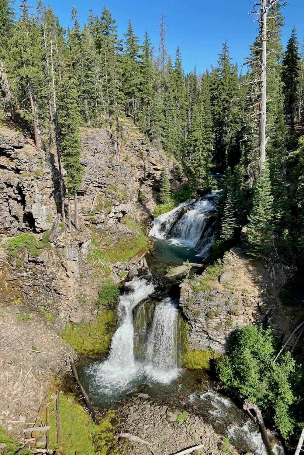
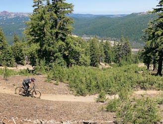
From Tumalo Falls, you’ll tackle the main climb of the route up North Fork. While you’ll begin by passing the astounding vista of Tumalo Falls, North Fork continues to reward with stunning views of thundering cascades in a narrow gorge, views of the rushing stream, and an endless parade of waterfalls as you continue climbing up the trail. While it’s a steep grunt, this is potentially the most scenic climbing trail you’ll ever pedal! The stunning views definitely help the time to pass more quickly.
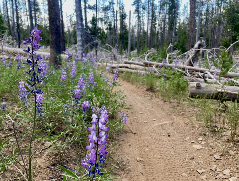
Once at the top of North Fork, take a right on Mrazek and pedal through lush meadows as you finish out the climb.
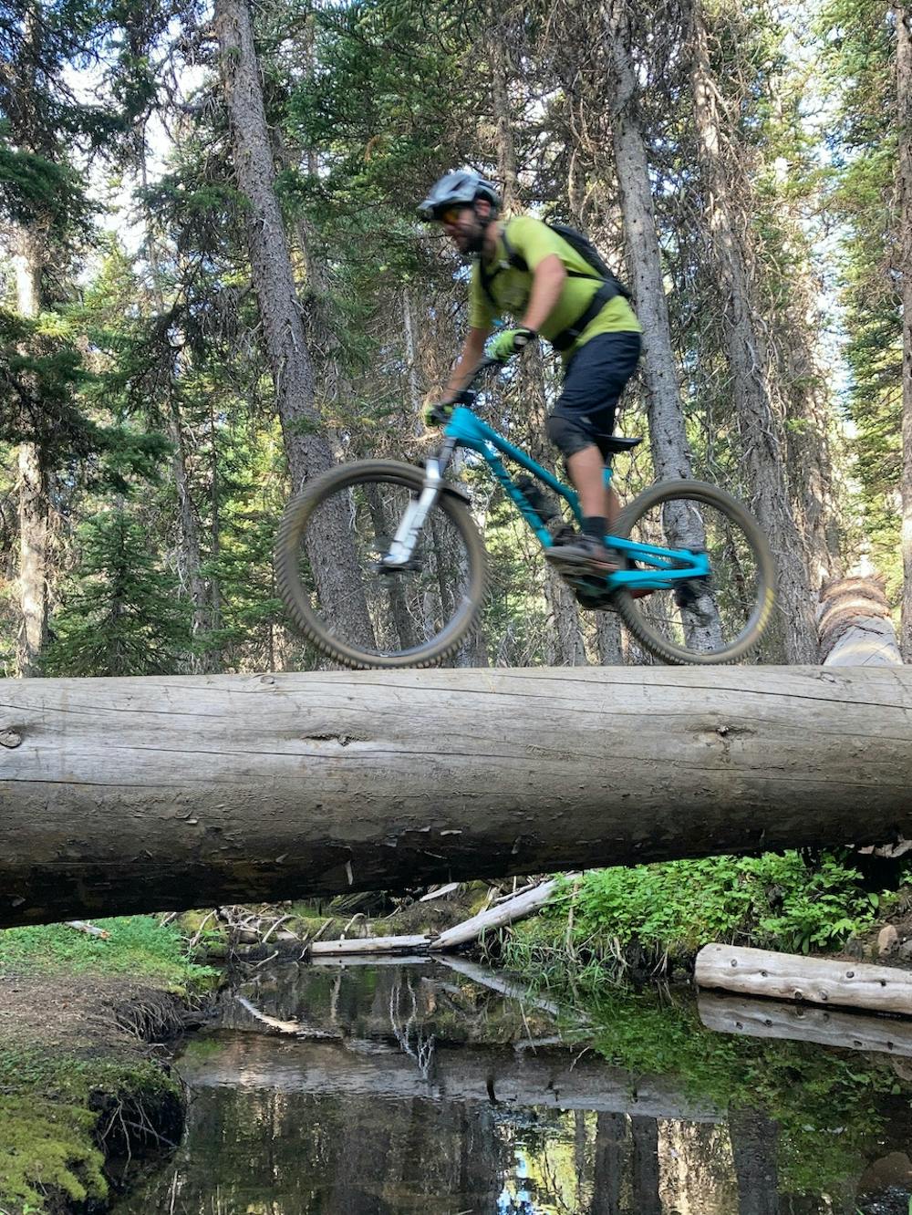
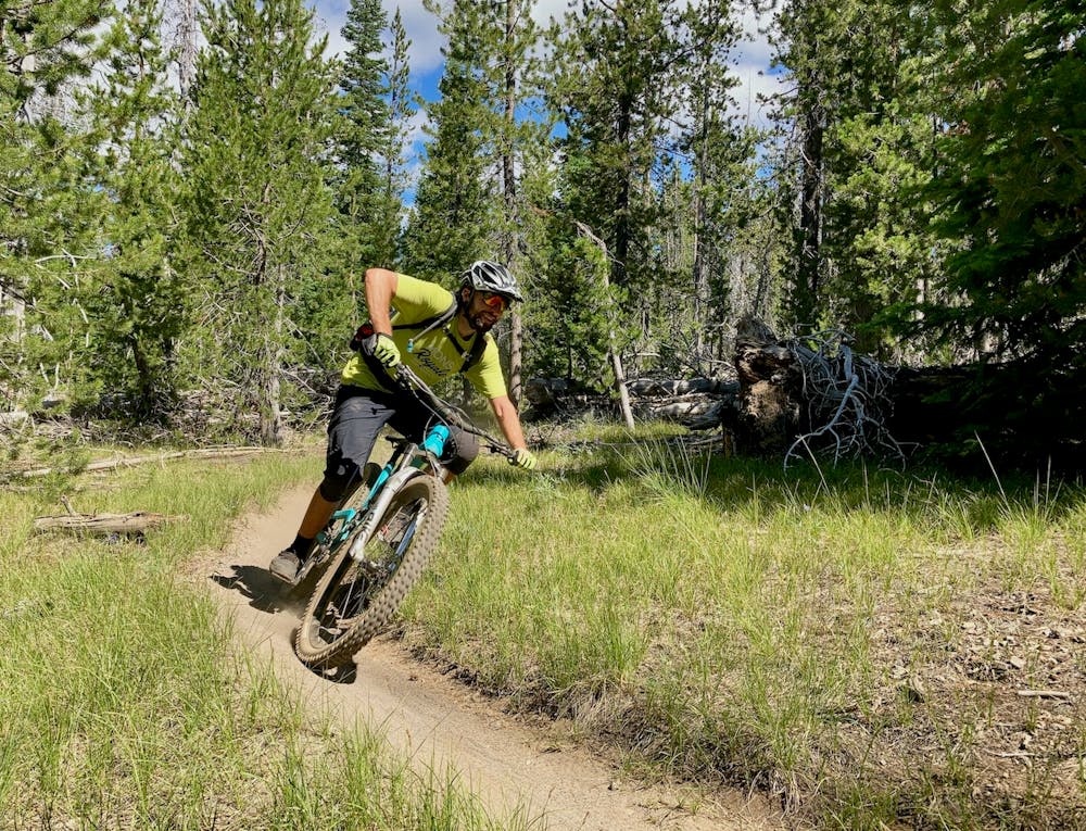
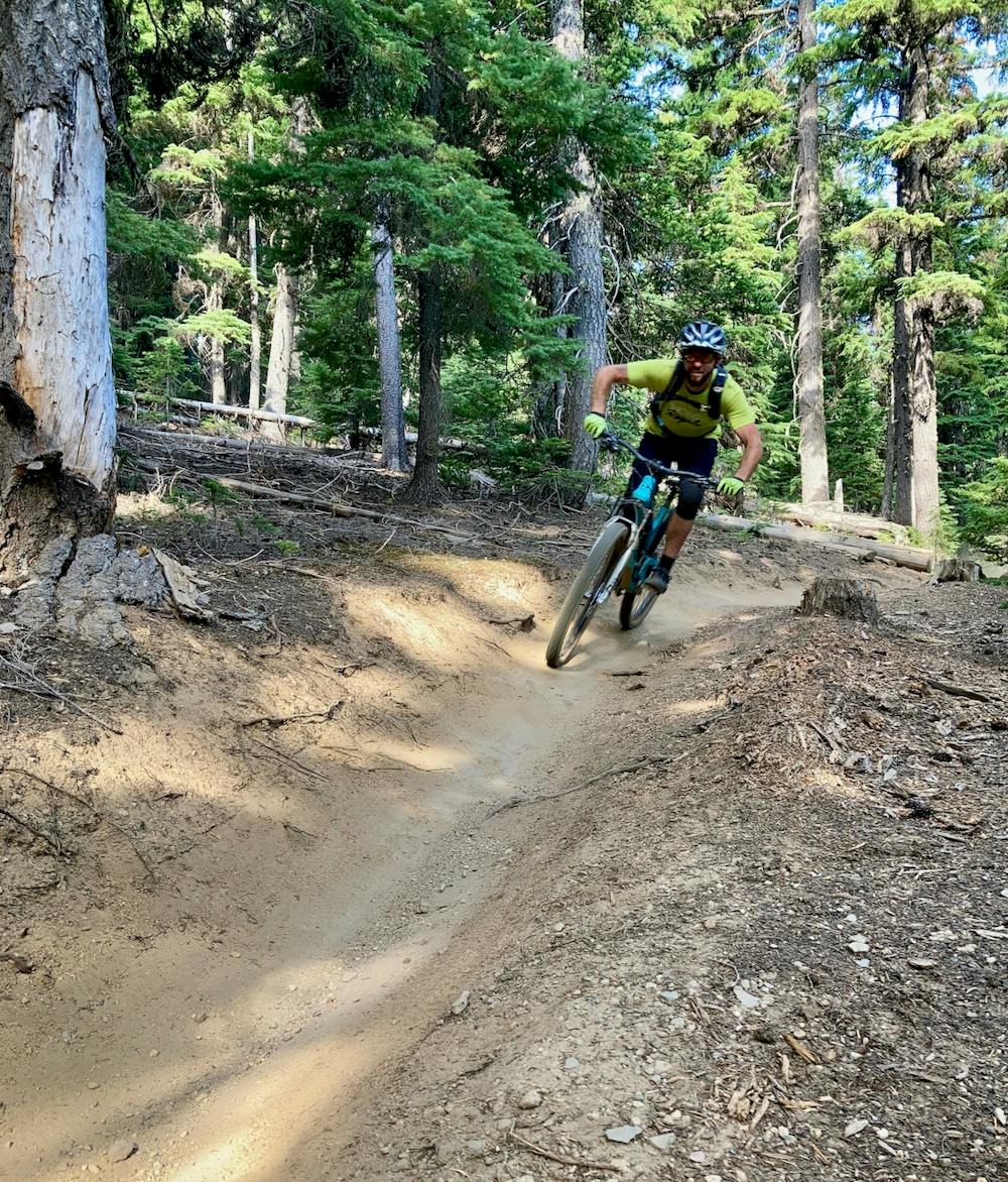
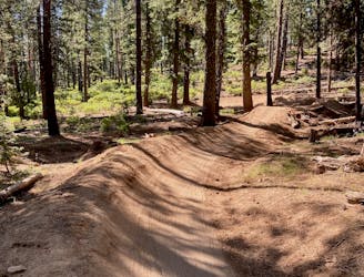
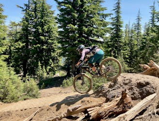
The upper section of Mrazek is fast and wide open, with some good views from the top of the ridge of the valley below. If you can tear yourself away from this rad 13-mile downhill, take some time to enjoy the viewpoints higher up.
Tight and twisty is the name of the game on the lower section of Mrazek, as the climate dries out and the singletrack twists and turns through tight scrub oak. This section of singletrack rewards the competent bike handle and corner, with the ability to still make time in spite of the back-to-back swoops and turns.
You can finish your ride by either connecting to the Phil’s trailhead, or by finishing at the Shevlin Park Trailhead, as mapped.
Difficult
Mostly stable trail tread with some variability featuring larger and more unavoidable obstacles that may include, but not be limited to: bigger stones, roots, steps, and narrow curves. Compared to lower intermediate, technical difficulty is more advanced and grades of slopes are steeper. Ideal for upper intermediate riders.

The trail contains some obstacles such as outcroppings and rock which could cause injury.
Away from help but easily accessed.
2.8 km away
A fast, flowy shuttle run on the southern end of the Bend trail system.
Moderate Mountain Biking
2.8 km away
Bend's classic enduro stage.
Severe Mountain Biking
6.3 km away
North Fork from Skyliner Trailhead.
Difficult Mountain Biking
8.8 km away
A feature-rich loop ride removed from the business of the Phil's Trailhead.
Difficult Mountain Biking
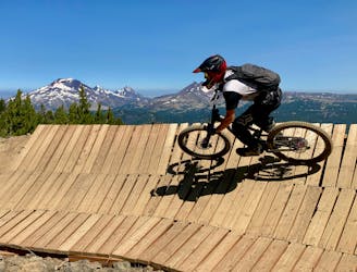
8.9 km away
Bachelor's obligatory wooden feature trail.
Severe Mountain Biking
9.5 km away
Mt. Bachelor's signature double black diamond tech trail.
Extreme Mountain Biking
9.5 km away
Superb black diamond tech trail.
Severe Mountain Biking
9.5 km away
One of the longest top-to-bottom runs in the park.
Moderate Mountain Biking
9.5 km away
A classic intermediate flow trail that ties the Mt. Bachelor bike park together.
Moderate Mountain Biking
7 routes · Mountain Biking

6 routes · Mountain Biking
5 routes · Mountain Biking · Hiking · Stand Up Paddle

20 routes · Mountain Biking

15 routes · Mountain Biking