126 m away
Hanging Bowl

A popular double cliff air
Extreme Freeride Skiing
- Distance
- 203 m
- Ascent
- 0 m
- Descent
- 145 m
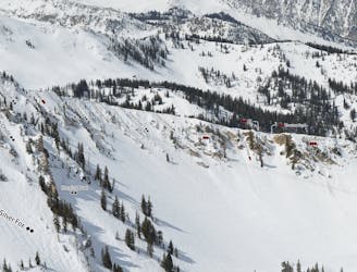
A steep and tight chute with rocks
Freeride Skiing Extreme

A steep and tight chute with rocks poking out everywhere. The top hanging apron is a no fall zone with rocks lurking under the surface at every turn. The terrain will naturally funnel you into the tight choke which may also have a small drop over some rocks, where a straight line will spit you out at high speed into the bottom of Great Scott. This can be a busy intersection depending on who is skiing Great Scott, so a spotter is never a bad idea.
Extreme
Extreme skiing terrain above 45 degrees. These routes are reserved for experienced experts.

As well as the slope itself, there are some obstacles (such as rock outcrops) which could aggravate injury.
Away from help but easily accessed.
126 m away
A popular double cliff air
Extreme Freeride Skiing
164 m away

A very steep and rocky way into Great Scott
Severe Freeride Skiing
222 m away

A short but fun Macaroni shaped chute
Difficult Freeride Skiing
272 m away
A cliff drop to straight line
Extreme Freeride Skiing
307 m away

A short, tight straight line
Extreme Freeride Skiing
349 m away

Steep technical skiing in the Forbidden Zone.
Extreme Freeride Skiing
454 m away

Secret gate that takes you just other side of rope line
Difficult Freeride Skiing
776 m away

Steep chutes that are rarely open
Severe Freeride Skiing
955 m away

Some V shaped airs
Extreme Freeride Skiing
962 m away

A steep, wide open chute
Difficult Freeride Skiing