
0 m away
Apex -> Prospect Ridge Shuttle
A superb shuttle option from the top of Guardsman Pass if you've already ridden the Wasatch Crest Trail one too many times.
Difficult Mountain Biking
- Distance
- 14 km
- Ascent
- 166 m
- Descent
- 1 km
This is a superb shuttle option from the top of Guardsman Pass if you've already ridden the Wasatch Crest Trail one too many times.
Mountain Biking Difficult

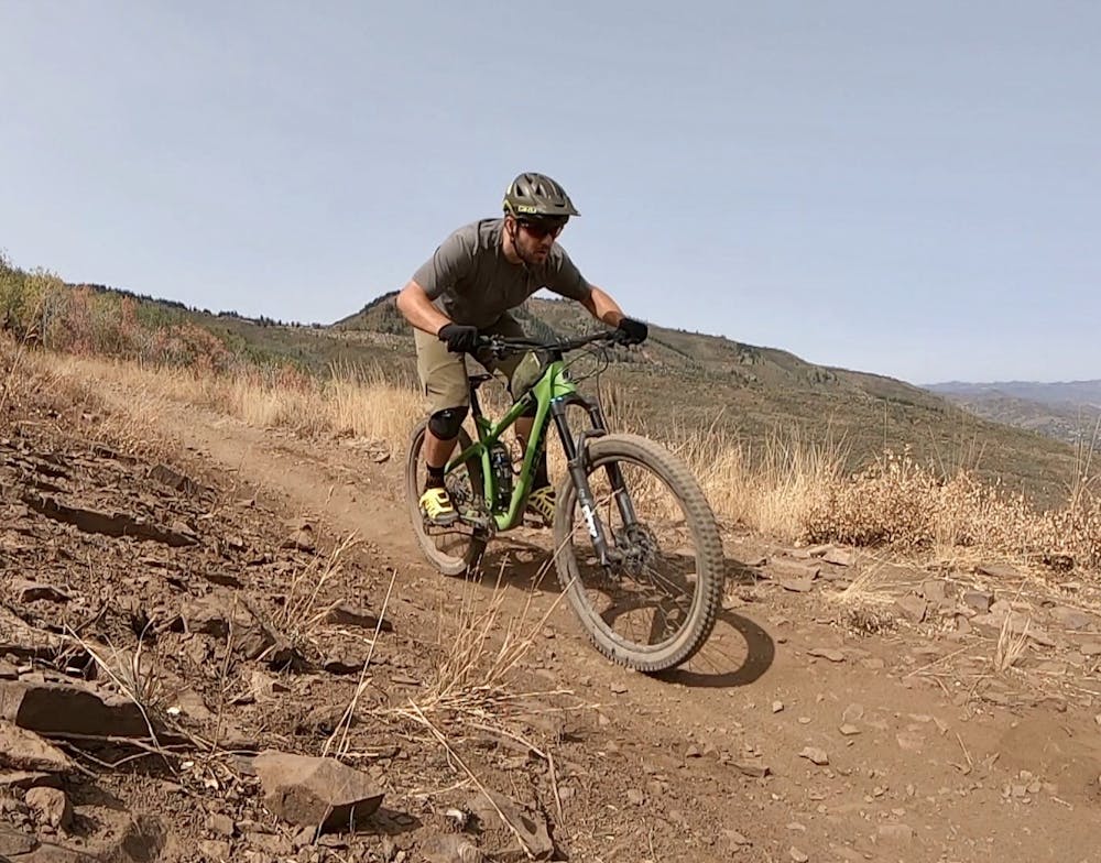
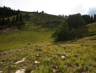
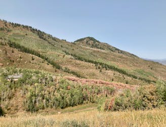
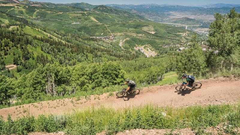
Have you ridden the Wasatch Crest trail so many times that you know it by heart? While that iconic shuttle route is tough to beat, this route, which similarly begins at the top of Guardsman Pass, offers some beautiful alpine views, but focuses more heavily on the descending, dropping quickly back down to the town of Park City.
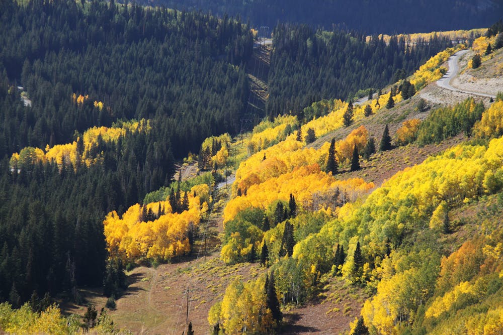
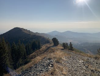
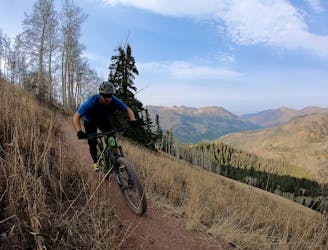
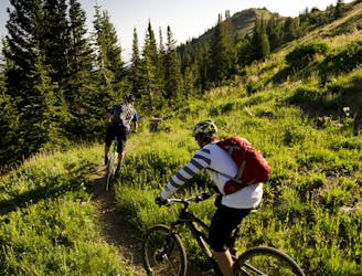
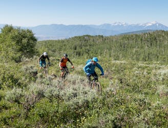
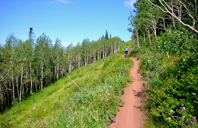
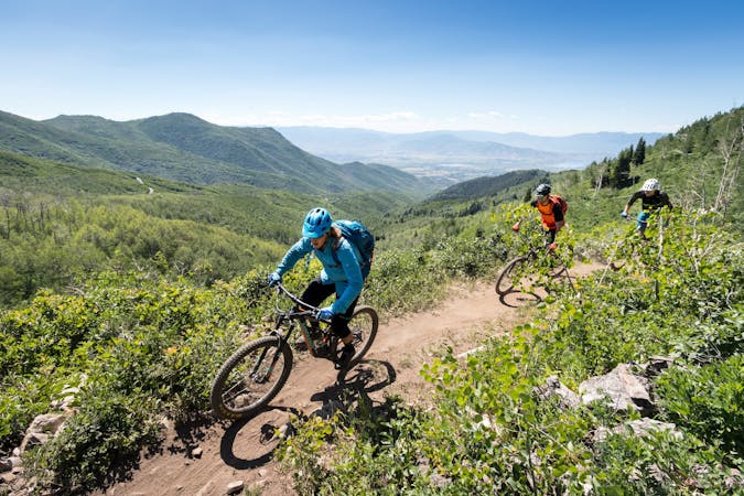
The alpine views up high and the sinewy black strips of singletrack through the aspen trees and wide-open meadows are more than enough reason to tackle this ride. But when the singletrack points downhill, the high-speed descending will demand total focus, putting aspen trees and views of Park City completely out of your mind.
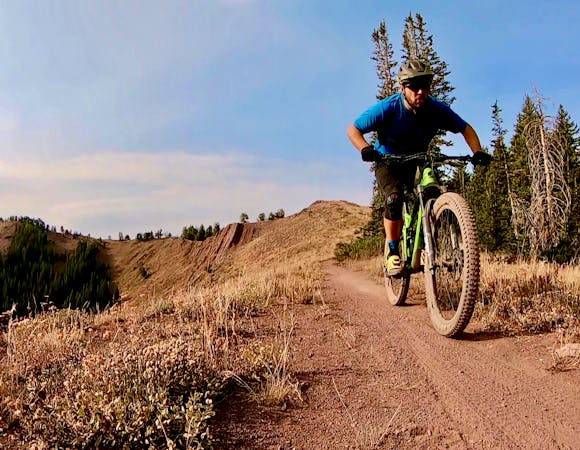
Dark black dirt makes for mad traction all the way down the mountain. While some small rock gardens and root webs punctuate the singletrack, overall the trails are flowy and non-technical, making for a great intermediate-friendly shuttle run.
The trails through Park City Mountain Resort are fast and flowy overall, but the fast straightaways have a tendency to end abruptly in switchbacked corners. Most of the corners are now bermed, helping to conserve some speed.
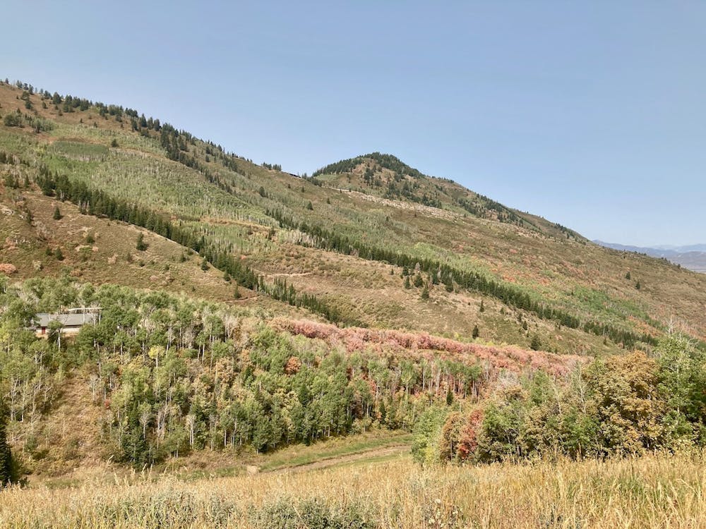
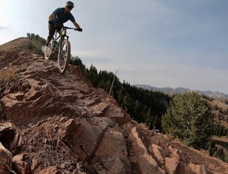
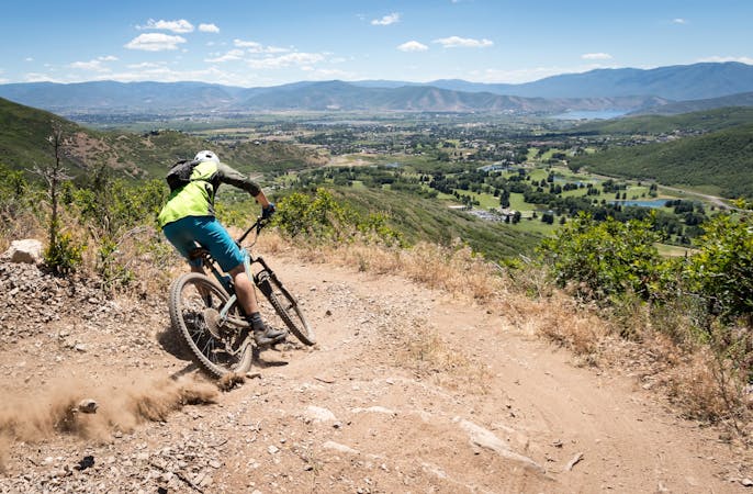
The upper section of CMG is technically a two-way trail, although most people descend it. The upper section is fast and wide-open, with a few rough rock sections to keep things interesting. None of the rock features are large or exceedingly technical, but they do provide a little entertainment and a welcome change from Park City's generally-smooth trail tread. As CMG winds around and down the mountain, beautiful views of Park City will open up below you.
The final section of CMG is downhill-only as it twists and turns through the dense forest near the base of the mountain. After swooping through a series of switchbacks, you’ll suddenly pop back out at the parking lot, asking yourself, “why does it have to be over already?!"
Difficult
Mostly stable trail tread with some variability featuring larger and more unavoidable obstacles that may include, but not be limited to: bigger stones, roots, steps, and narrow curves. Compared to lower intermediate, technical difficulty is more advanced and grades of slopes are steeper. Ideal for upper intermediate riders.

The trail contains some obstacles such as outcroppings and rock which could cause injury.

Little chance of being seen or helped in case of an accident.
0 m away
A superb shuttle option from the top of Guardsman Pass if you've already ridden the Wasatch Crest Trail one too many times.
Difficult Mountain Biking
1 m away
Gorgeous ridge top singletrack riding with long singletrack descent all the way down to Salt Lake City far, far below!
Difficult Mountain Biking
1 m away

Gorgeous ridge top singletrack riding with a ripping descent to finish—the best trail in Park City!
Difficult Mountain Biking
5 m away
Combine the old and the new on this top-to-bottom Park City shuttle.
Difficult Mountain Biking
5 m away
Wasatch Crest shuttle dropping to Mounthaven via the Mill D North Fork Trail.
Difficult Mountain Biking
5 m away
Wasatch Crest to Kimball Junction, via UOP.
Difficult Mountain Biking
5 m away
Descend the delightful Pinecone Trail into the heart of PCMR.
Moderate Mountain Biking
3.9 km away
An easily-accessible shuttle route off of Guardsman Pass Road
Difficult Mountain Biking
4.1 km away
The WOW trail connects Park City with Midway and Heber City, making for both a great shuttle run and a pedal-driven connection.
Moderate Mountain Biking
6.1 km away

A double black diamond old school DH line
Extreme Mountain Biking
10 routes · Mountain Biking

25 routes · Mountain Biking
8 routes · Mountain Biking

10 routes · Mountain Biking
5 routes · Mountain Biking
5 routes · Mountain Biking
8 routes · Mountain Biking

20 routes · Mountain Biking