0 m away
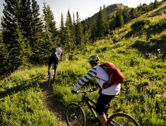
Wasatch Crest -> Park City
Gorgeous ridge top singletrack riding with a ripping descent to finish—the best trail in Park City!
Difficult Mountain Biking
- Distance
- 22 km
- Ascent
- 327 m
- Descent
- 1.2 km
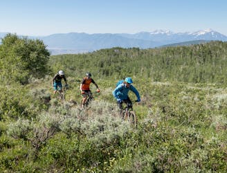
Gorgeous ridge top singletrack riding with long singletrack descent all the way down to Salt Lake City far, far below!
Mountain Biking Difficult

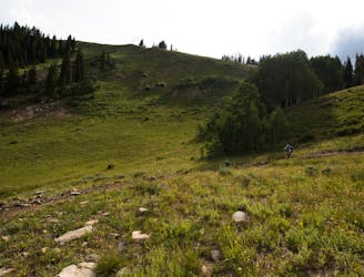
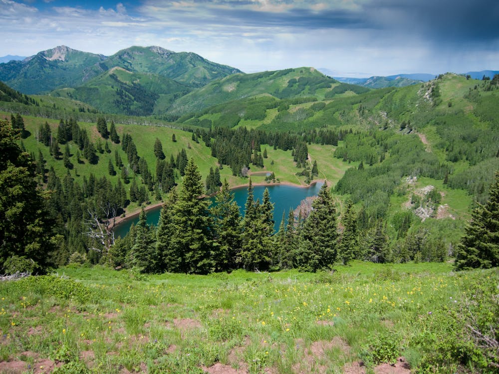
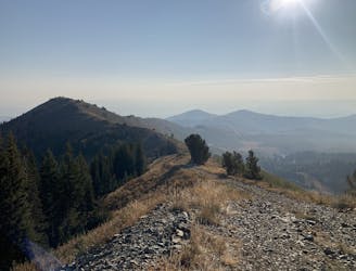
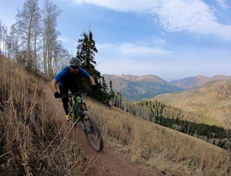
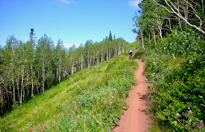
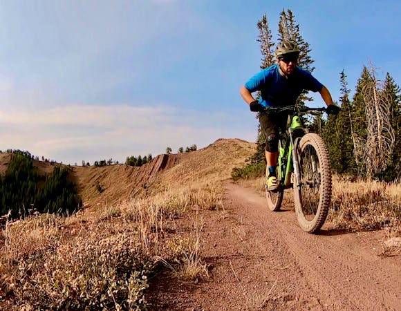
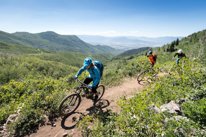
Flowy ridge top singletrack with jaw-dropping views of Big Cottonwood Canyon and the Park City region make the Wasatch Crest trail one of the best trails in Utah—and that’s saying something! After catching a shuttle in Salt Lake city, you’re whisked upward to the top of Guardsman Pass. As you pedal away from the pass, it's hard to wrap your head around how quickly you end up in the middle of absolutely nowhere—but soon you're surrounded by nothing besides jagged mountain peaks.
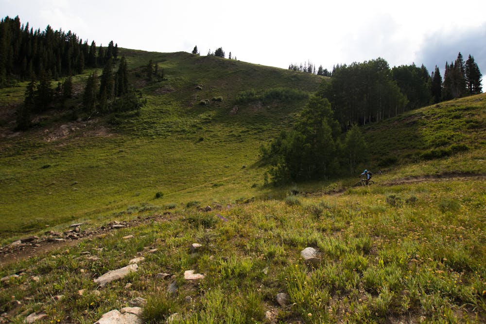
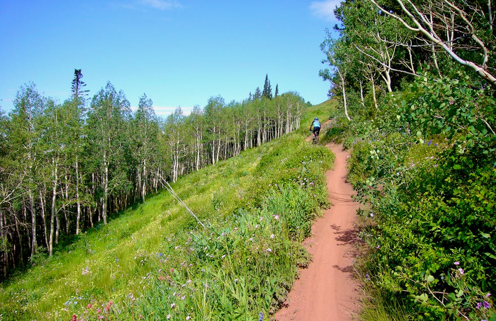
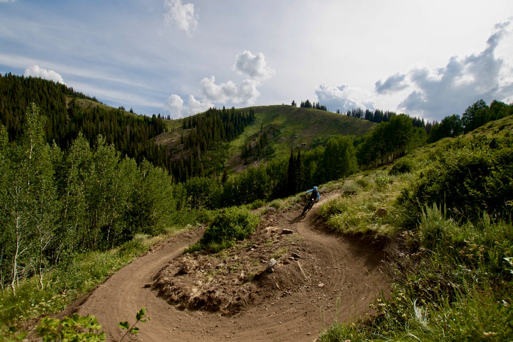
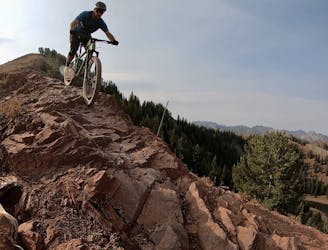
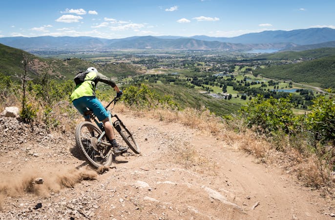
The red dirt and rocks along these mountain tops provide an interesting accent to the high-speed riding, as it's very different than the dark black dirt in Park City proper.
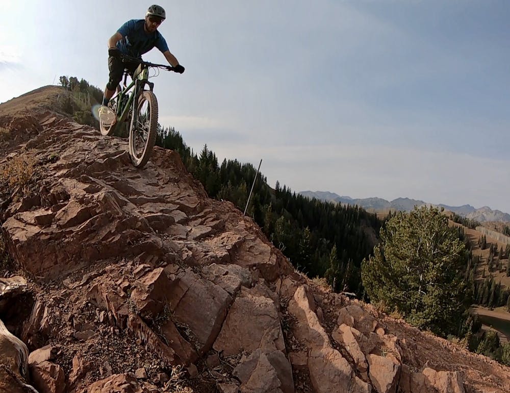
Overall this trail is flowy, but the flow doesn't last—an extremely technical, rocky descent along the ridge known as "The Spine" is absolutely brutal, but can be walked by intermediate riders. Again the singletrack switches back to flow.
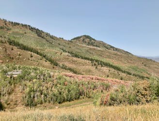
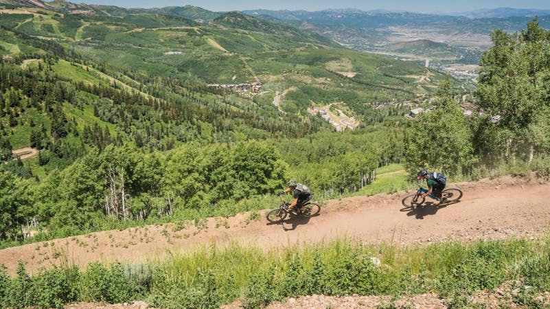
The route shown here finishes by dropping down the Mill Creek trail to Salt Lake City far, far below. Take note of the day of the week: according to Kristen Bonkoski in an article published on Singletracks.com, “upper Mill Creek canyon is closed to mountain bikers on odd days.” So while you can descend down into Park City (mapped separately) any day of the week, you can only do the full run to SLC on even days.
Wherever you park and whatever shuttle you do, make sure that you descend down the correct side of the mountain so you don’t get stranded.
Sources: https://www.singletracks.com/blog/mtb-trails/5-epic-shuttle-rides-near-salt-lake-city/ https://www.skiutah.com/blog/authors/tim/the-wasatch-crest-trail-it-s-got-a-shuttle
Difficult
Mostly stable trail tread with some variability featuring larger and more unavoidable obstacles that may include, but not be limited to: bigger stones, roots, steps, and narrow curves. Compared to lower intermediate, technical difficulty is more advanced and grades of slopes are steeper. Ideal for upper intermediate riders.

Some trail sections are extremely exposed where falling will almost certainly result in serious injury or death.
In the high mountains or remote conditions, all individuals must be completely autonomous in every situation.
0 m away
Gorgeous ridge top singletrack riding with a ripping descent to finish—the best trail in Park City!
Difficult Mountain Biking
1 m away
A superb shuttle option from the top of Guardsman Pass if you've already ridden the Wasatch Crest Trail one too many times.
Difficult Mountain Biking
1 m away
This is a superb shuttle option from the top of Guardsman Pass if you've already ridden the Wasatch Crest Trail one too many times.
Difficult Mountain Biking
4 m away
Combine the old and the new on this top-to-bottom Park City shuttle.
Difficult Mountain Biking
4 m away
Wasatch Crest shuttle dropping to Mounthaven via the Mill D North Fork Trail.
Difficult Mountain Biking
4 m away
Wasatch Crest to Kimball Junction, via UOP.
Difficult Mountain Biking
5 m away
Descend the delightful Pinecone Trail into the heart of PCMR.
Moderate Mountain Biking
3.9 km away
An easily-accessible shuttle route off of Guardsman Pass Road
Difficult Mountain Biking
4.1 km away
The WOW trail connects Park City with Midway and Heber City, making for both a great shuttle run and a pedal-driven connection.
Moderate Mountain Biking
6.1 km away

A double black diamond old school DH line
Extreme Mountain Biking
10 routes · Mountain Biking

25 routes · Mountain Biking
8 routes · Mountain Biking

10 routes · Mountain Biking
5 routes · Mountain Biking
5 routes · Mountain Biking
8 routes · Mountain Biking

20 routes · Mountain Biking