3.2 km away
Old Growth / Benson & Hedges

Old Growth chute is a mini classic that provides great rock wall lined ambience and easy access.
Difficult Ski Touring
- Distance
- 580 m
- Ascent
- 0 m
- Descent
- 364 m
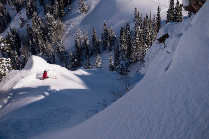
Mount Superior is one of the most classic lines in the range. The S Face is nearly 3,000 feet long and starts in the mid 40 degree range.
Ski Touring Difficult

Park at Our Lady Of The Snow church 7 miles up the canyon. Head up to Cardiff Pass following the power lines. From the pass stay on the ridge and head W. This ridge rises up and then drops down again along some cornices, but stay on the ridge and continue along trending on the S side of the ridge when it's too rocky on the true ridge. You'll climb up again towards Little Superior. The trail usually turns to booting up the ridge at this point, and stays pretty true to the ridge. There may be some mild rock climbing involved.
From the summit there are several entries onto the enormous S Face. Most entries are easily visible from the ridge. The upper slopes are in the lower 40 degree range and mellow out nicely the lower you go until the gentle apron sweeps up to meet you. Please choose your timing to ski this run wisely since it is a huge avalanche path that can cover the road.
Difficult
Serious gradient of 30-38 degrees where a real risk of slipping exists.

As well as the slope itself, there are some obstacles (such as rock outcrops) which could aggravate injury.

Little chance of being seen or helped in case of an accident.
3.2 km away
Old Growth chute is a mini classic that provides great rock wall lined ambience and easy access.
Difficult Ski Touring
3.3 km away

Virginia Slims is the fun dogleg chute next to the more popular Old Growth chute in the lower reaches of Cardiff Fork.
Difficult Ski Touring
3.4 km away

Scotty's is a classic north facing roadside attraction in upper Little Cottonwood Canyon.
Difficult Ski Touring
3.7 km away

A big fun run off of Kessler Peak with some great chute and trees skiing involved.
Difficult Ski Touring
4 km away

This is the huge avalanche path that's visible from the road on the N slope of Kessler Peak.
Difficult Ski Touring
5.3 km away

Stairs Gulch is 4,000 feet long, serious with a combination of a steep, technical chute and a flat, more mellow finish.
Difficult Ski Touring
6.3 km away

Probably the longest, most consistent rock-lined chute in the Wasatch if you're into that sort of thing.
Severe Ski Touring
7.1 km away

Access from Brighton to backcountry zones like Patsy Marley and Wolverine Cirque.
Moderate Ski Touring
7.6 km away

The Dresden is one of the longest and most continually steep faces in the Wasatch.
Severe Ski Touring
9.7 km away

Major Tom is a steep and sporty couloir in a remote corner of the Wasatch that can have a few rappels to navigate!
Extreme Ski Touring

18 routes · Resort Ski Touring · Ski Touring
9 routes · Resort Ski Touring · Ski Touring