4.2 km away
Bucklin Trail
An approach trail up the west side of Killington Mountain.
Difficult Hiking
- Distance
- 12 km
- Ascent
- 754 m
- Descent
- 754 m
A short hike near Rutland known for its panoramic views, summer wildflowers, and birdwatching opportunities.
Hiking Moderate

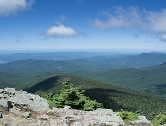
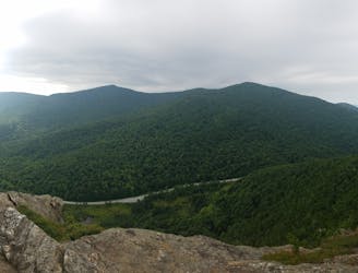
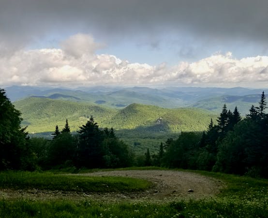
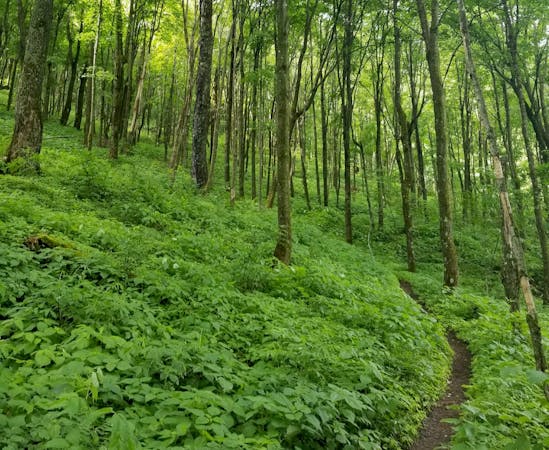
Just over 3 miles long, the Bald Mountain Trail offers the best mountaintop views near Rutland. Per the State Park's trail guide, this hike is "noted for its vistas, birdwatching potential, blueberries, and wildflowers," and "invites the visitor to explore all that Aitken State Forest has to offer." Along the way, you'll explore four prominent vistas, some with 360-degree views! Even better, free camping is available throughout the State Forest as long as you adhere to their series of guidelines found here.
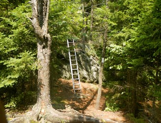
The trailhead for this hike is located near the junction of Notch Rd. and Wheelerville Rd., just minutes from downtown Rutland or less than 30 from Killington Mountain. If you've explored the other classic hikes in the area like Deer Leap Rock or even the Canty Trail, consider this easier hike for a change of pace. Though the trail can be challenging at times, this hike is never too challenging compared to others in the area.
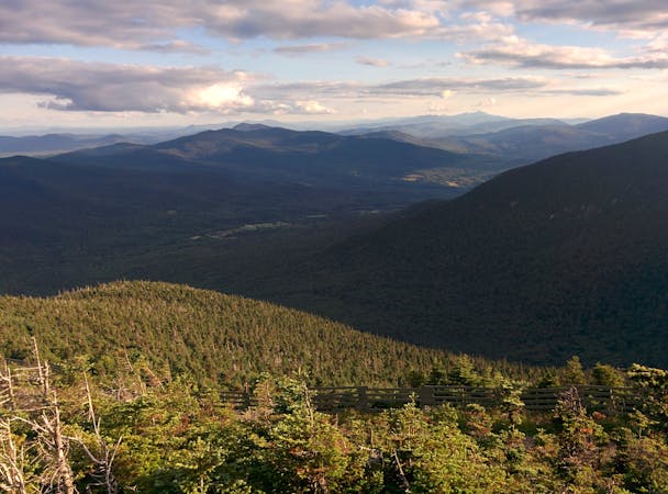
Confined by the Green Mountain National Forest to the east, Aitken State Forest is just over 900 acres in size. It's home to both summer and winter recreation opportunities. This hike is best in the summer and especially known as a birding hotspot in the region. For visitors of Killington, the only other notable birdwatching site is near Kent Pond, accessible via the Appalachian Trail. According to this source, the area is home to 95 unique species of birds and is best visited from May to July.
Sources: https://vtstateparks.com/assets/pdf/coolidgeaitken.pdf http://rutlandcountyaudubon.org/aitkenstateforest/ https://en.wikipedia.org/wiki/AitkenStateForest https://vtstateparks.com/assets/pdf/aitken-primitive.pdf
Moderate
Hiking along trails with some uneven terrain and small hills. Small rocks and roots may be present.

The trail contains some obstacles such as outcroppings and rock which could cause injury.
Away from help but easily accessed.
4.2 km away
An approach trail up the west side of Killington Mountain.
Difficult Hiking
8.9 km away

A classic summer hike between Rutland and Killington with epic views and a waterfall.
Moderate Hiking
9.8 km away
After departing from the AT, the Long Trail begins a grueling traverse across multiple high ridges and through a remote wilderness area.
Difficult Hiking
9.8 km away
A easily shuttled stretch of the AT, connecting Killington Mountain to the Connecticut River.
Difficult Hiking

58 routes · Hiking
9 routes · Hiking
5 routes · Hiking
5 routes · Mountain Biking · Hiking · Trail Running