2 km away
Long Trail: US-4 to VT-125
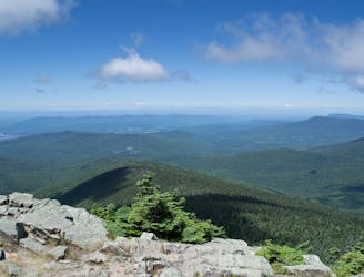
After departing from the AT, the Long Trail begins a grueling traverse across multiple high ridges and through a remote wilderness area.
Difficult Hiking
- Distance
- 46 km
- Ascent
- 2 km
- Descent
- 1.9 km
A classic summer hike between Rutland and Killington with epic views and a waterfall.
Hiking Moderate
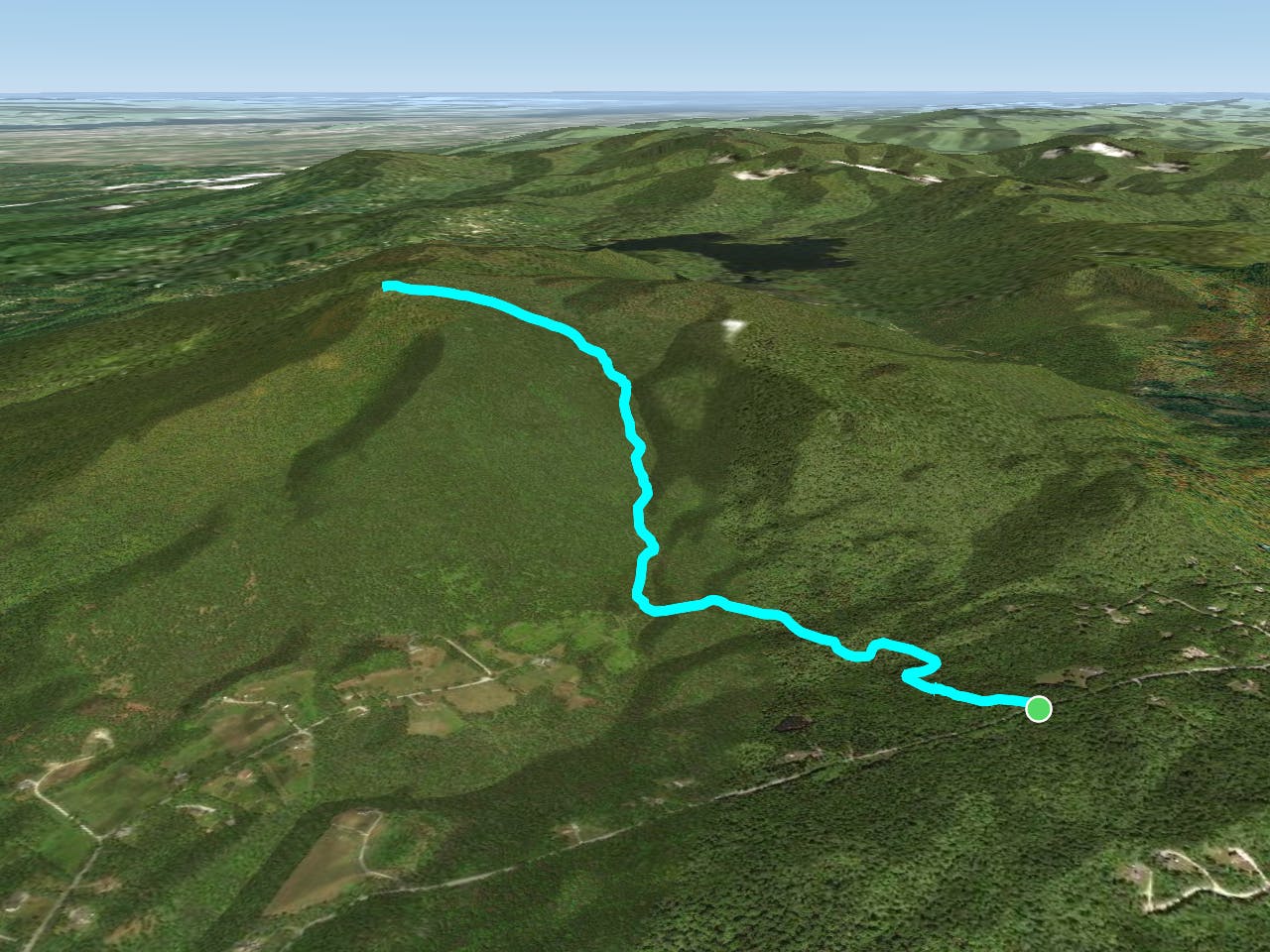
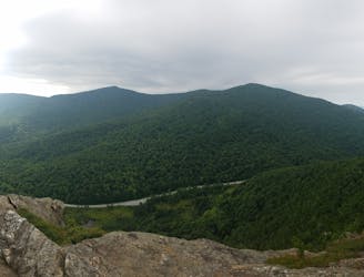
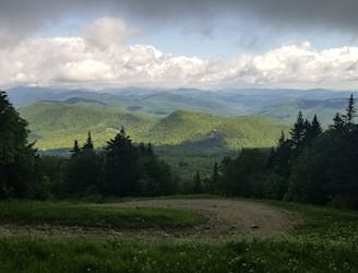
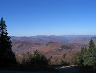
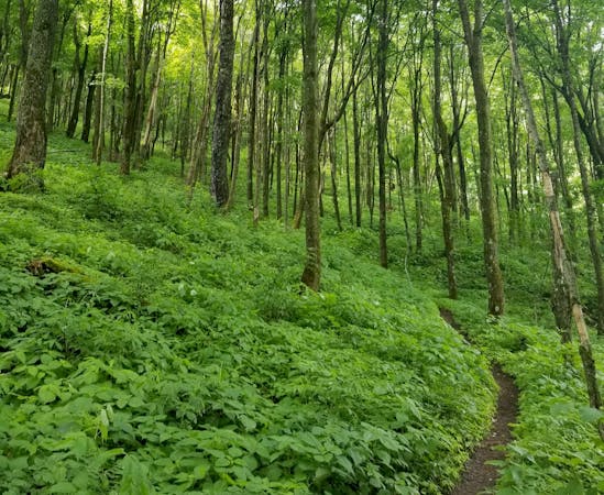
The Canty Trail to Blue Ridge Mountain is a classic summit hike and the only route to this 3,250' peak towering over Mendon. The official summit offers epic views, though look for a side trail leading west to an even better overlook of Rutland! Making this hike even more fantastic, there's even a spur trail that leads to a large cascade about 1.6-miles from the trailhead!
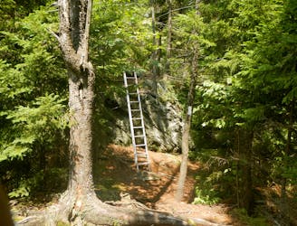
While this hike could be considered moderate to an experienced hiker, wet rocks and roots can still be difficult to negotiate. Mud is also likely in the spring, earning Vermont its nickname "Vermud" among thru-hikers on the Appalachian Trail. Despite its status as a summer hike, its speculated that some snowshoe the route during the winter. Early into the hike, you'll pass several abandoned cabins that are likely only used as winter warming huts, or as shelter from summer thunderstorms.
Parking is limited where the trail begins, but the town of Killington suggests finding a spot on the east side Old Turnpike Road, maybe closer to Rt. 4. Make sure you allocate extra time for the road walk, since it could add up to 30 minutes depending on where you park.
Sources: http://sadieshouseonwheels.blogspot.com/2011/08/blue-ridge-mountain-via-canty-trail.html https://www.killingtontown.com/vertical/sites/%7BE4345A2E-9636-47A3-9B74-2E6220745729%7D/uploads/HikingTrailGuide2018Back.pdf
Moderate
Hiking along trails with some uneven terrain and small hills. Small rocks and roots may be present.

The trail contains some obstacles such as outcroppings and rock which could cause injury.
Away from help but easily accessed.
2 km away
After departing from the AT, the Long Trail begins a grueling traverse across multiple high ridges and through a remote wilderness area.
Difficult Hiking
2 km away
A easily shuttled stretch of the AT, connecting Killington Mountain to the Connecticut River.
Difficult Hiking
3.3 km away
A beautiful loop around Pico Mountain to run, hike, or spend the night.
Severe Hiking
3.4 km away
A short, family-friendly hike to a popular overlook near Killington.
Moderate Hiking
5.2 km away
An approach trail up the west side of Killington Mountain.
Difficult Hiking
8.9 km away

A short hike near Rutland known for its panoramic views, summer wildflowers, and birdwatching opportunities.
Moderate Hiking

58 routes · Hiking
9 routes · Hiking
5 routes · Hiking
5 routes · Mountain Biking · Hiking · Trail Running