6.2 km away
Pinnacle Meadows Trail
Shorter route to the top of Stowe Pinnacle.
Difficult Hiking
- Distance
- 4.6 km
- Ascent
- 311 m
- Descent
- 310 m
Rewarding hike to a lesser-known summit of the mountains near Stowe.
Hiking Difficult

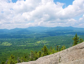
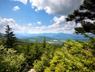
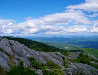
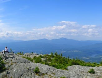
The Worcester Range is the rib of mountains between the towns of Stowe and Worcester. Worcester Mountain is the namesake peak, though it’s not the tallest in the range. Its 3,274-foot summit is high and rocky enough to be only sparsely vegetated; thus, the views are impressive on a clear day. You can see the Green Mountains to the west, and you can see quite far over the less mountainous landscape to the east. The next major range eastward is the White Mountains of New Hampshire, and they are obvious on the horizon.
Worcester Mountain Trail starts out rather mellow, gradually ascending a deeply forested valley with several flowing streams, some of which must be crossed. Thus, this trail becomes especially wet and muddy following snowmelt and rain. The incline increases sharply later in the hike, as the trail makes a deliberate ascent to the top of the mountain. Some sections are on bare rock and ledges, but the angle is generally less severe than what you’ll find on nearby summits like Stowe Pinnacle or Mount Hunger. Eventually, you’ll top out on the picturesque, but often cold and windy, summit of Worcester Mountain. Here the trail joins with Skyline Trail, which is a ridge walk that continues along the spine toward Mount Hunger.
Sources: https://fpr.vermont.gov/putnam-cc-state-forest https://www.summitpost.org/worcester-range/226785
Difficult
Hiking trails where obstacles such as rocks or roots are prevalent. Some obstacles can require care to step over or around. At times, the trail can be worn and eroded. The grade of the trail is generally quite steep, and can often lead to strenuous hiking.

The trail contains some obstacles such as outcroppings and rock which could cause injury.

Little chance of being seen or helped in case of an accident.
6.2 km away
Shorter route to the top of Stowe Pinnacle.
Difficult Hiking
7.7 km away

The trail to the top of Mount Hunger from the east side.
Severe Hiking
7.8 km away
A must-do hike in Stowe, to a granite dome with 360-degree views of the valley and surrounding mountains.
Difficult Hiking
8.3 km away
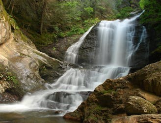
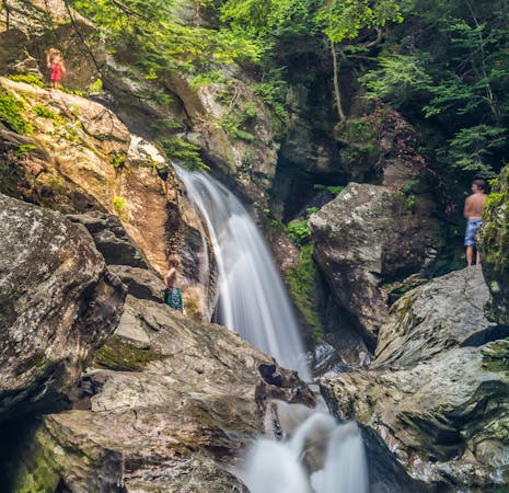
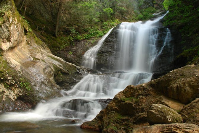
Short hike to a multi-tiered waterfall tucked in a granite gorge.
Easy Hiking
8.5 km away
Straight up the slope of Mount Hunger to its panoramic summit.
Difficult Hiking
8.5 km away
A committing traverse of the surprisingly rugged and varied peaks east of Stowe.
Severe Hiking
8 routes · Hiking
10 routes · Hiking