1 m away
Skyline Trail
A committing traverse of the surprisingly rugged and varied peaks east of Stowe.
Severe Hiking
- Distance
- 15 km
- Ascent
- 1.1 km
- Descent
- 1.1 km
Straight up the slope of Mount Hunger to its panoramic summit.
Hiking Difficult

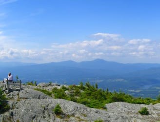
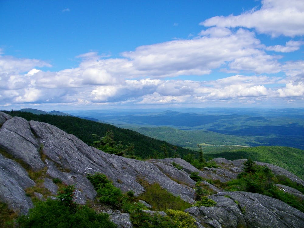
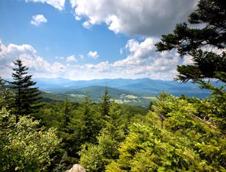
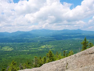
Mount Hunger is one of the taller mountains near Stowe, Vermont. Like other tall mountains in the region, it is capped by a subalpine zone of shrubby conifers and bare granite. This makes for incredible, 360-degree views during clear weather. From Mount Hunger, you can see up and down the spine of its range, and across the valley to the Green Mountains and Mount Mansfield—the tallest in the state.
There are a few ways to reach the top of Mount Hunger, but the one described here is the most direct route from the Stowe side. It is the Waterbury Trail, and it leads more or less straight up the mountainside–not very long but quite steep. You’ll quickly travel from lower elevation mixed hardwood forest up to the spruce-fir zone, and eventually into the wind-warped subalpine. All along the way are rocks and roots to step over, but nothing too difficult. At one point, you must cross a flowing stream, but it’s easy to step across on rocks unless flows are especially high. This trail should be avoided during the spring mud season or anytime after heavy rain because some sections become awash with water and mud. The trail’s final obstacle is a short section of low-angle scrambling guarding the summit, but it’s manageable if you’ve made it that far.
The mountaintop is broad and relatively flat, with plenty of room to spread out and enjoy the view. There is no shelter from the elements, though, so you may not want to linger for long. Expect chilly and windy conditions up high, even if the weather starts out pleasant at the trailhead.
Sources: https://fpr.vermont.gov/putnam-cc-state-forest https://www.summitpost.org/mount-hunger/213410
Difficult
Hiking trails where obstacles such as rocks or roots are prevalent. Some obstacles can require care to step over or around. At times, the trail can be worn and eroded. The grade of the trail is generally quite steep, and can often lead to strenuous hiking.

The trail contains some obstacles such as outcroppings and rock which could cause injury.
Away from help but easily accessed.
1 m away
A committing traverse of the surprisingly rugged and varied peaks east of Stowe.
Severe Hiking
4.1 km away
A must-do hike in Stowe, to a granite dome with 360-degree views of the valley and surrounding mountains.
Difficult Hiking
4.4 km away

The trail to the top of Mount Hunger from the east side.
Severe Hiking
4.5 km away
Shorter route to the top of Stowe Pinnacle.
Difficult Hiking
7 km away

Walk from Stowe's Main Street to a wooded park overlooking the village.
Moderate Hiking
7.5 km away
Unpaved recreation path through fields and along a river near Stowe Village.
Easy Hiking
8.5 km away

Rewarding hike to a lesser-known summit of the mountains near Stowe.
Difficult Hiking
9.9 km away
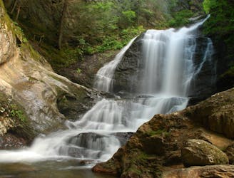
Short hike to a multi-tiered waterfall tucked in a granite gorge.
Easy Hiking
8 routes · Hiking
10 routes · Hiking