1 m away
Mount Hunger via Waterbury Trail
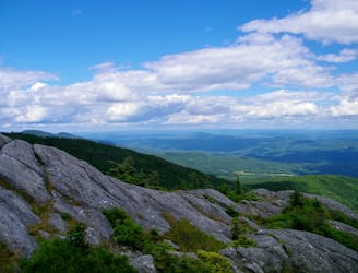
Straight up the slope of Mount Hunger to its panoramic summit.
Difficult Hiking
- Distance
- 5.6 km
- Ascent
- 696 m
- Descent
- 696 m
A committing traverse of the surprisingly rugged and varied peaks east of Stowe.
Hiking Severe

The Skyline Trail makes a partial traverse of the Worcester Range, which rises above Stowe Village to the east and south. These are the mountains that are most visible from town, even though the nearby Green Mountains are more famous. The Worcesters may not have the 4000-foot peaks or iconic skiing that the Greens have, but they are still an impressive string of mountains, and their bald summits are no less panoramic.
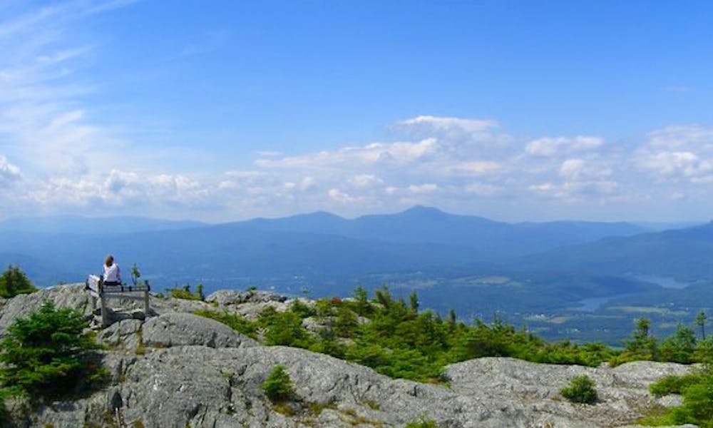
Atop Mount Hunger and Worcester Mountain, you’ll get 360-degree views of surrounding summits, lakes, and the green patchwork in between. These mountains share a granite ridgeline that’s nearly devoid of trees at its high points, granting dramatic views but also inviting extreme weather. The Skyline Trail connects these peaks and includes two other prominent summits in between.
Skyline is a difficult hike and not very well known. Therefore, it gets less traffic than surrounding trails, making it an even more challenging and adventurous endeavor. The trail takes many ups and downs along the ridgeline, navigating especially rugged terrain like boulders, ledges, and bogs without the assistance of ladders or boardwalks that you might find on more popular trails. It travels mostly in the shelter of trees, but sometimes it crosses exposed bare rock. If you’re prepared to spend several hours at the mercy of the elements on one of Vermont’s lesser-traveled mountain traverses, Skyline Trail could be for you.
Skyline does not have its own trailhead but connects the highpoints of other trails that ascend the mountains. To hike the full Skyline Trail, you’ll have to hike these other trails as well–one to go up and the other to go down, with a vehicle shuttle in between.
The western terminus of Skyline Trail is atop Mount Hunger, with the Waterbury Trail coming up from the Stowe side and the Middlesex Trail coming up from the Worcester side. The eastern terminus is on Mount Worcester, with Worcester Mountain Trail providing access. The approximate midpoint of Skyline Trail is on Hogback Mountain, which can be reached via Stowe Pinnacle Trail.
Sources: https://fpr.vermont.gov/putnam-cc-state-forest https://www.greenmountainclub.org/hiking/day-hikes-summer/
Severe
Hiking challenging trails where simple scrambling, with the occasional use of the hands, is a distinct possibility. The trails are often filled with all manner of obstacles both small and large, and the hills are very steep. Obstacles and challenges are often unexpected and can be unpredictable.

Some trail sections have exposed ledges or steep ascents/descents where falling could cause serious injury.
Little chance of being seen or helped in case of an accident.
1 m away
Straight up the slope of Mount Hunger to its panoramic summit.
Difficult Hiking
4.1 km away

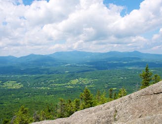
A must-do hike in Stowe, to a granite dome with 360-degree views of the valley and surrounding mountains.
Difficult Hiking
4.4 km away

The trail to the top of Mount Hunger from the east side.
Severe Hiking
4.5 km away
Shorter route to the top of Stowe Pinnacle.
Difficult Hiking
7 km away

Walk from Stowe's Main Street to a wooded park overlooking the village.
Moderate Hiking
7.5 km away

Unpaved recreation path through fields and along a river near Stowe Village.
Easy Hiking
8.5 km away

Rewarding hike to a lesser-known summit of the mountains near Stowe.
Difficult Hiking
9.9 km away
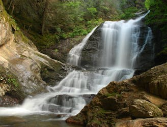
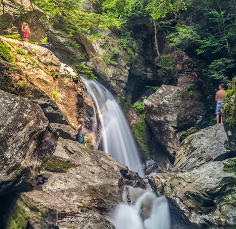
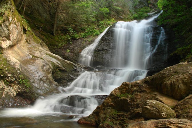
Short hike to a multi-tiered waterfall tucked in a granite gorge.
Easy Hiking
8 routes · Hiking
10 routes · Hiking