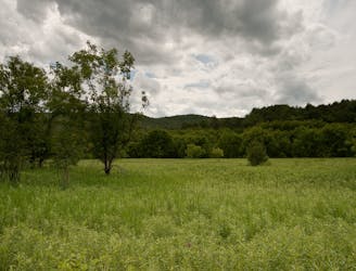
4.7 km away
Stowe Quiet Path
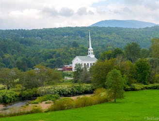
Unpaved recreation path through fields and along a river near Stowe Village.
Easy Hiking
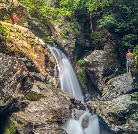
- Distance
- 2.6 km
- Ascent
- 18 m
- Descent
- 19 m
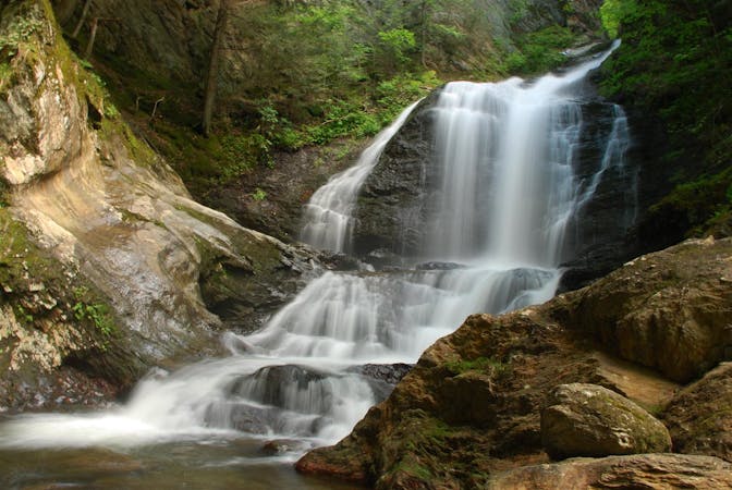
Short hike to a multi-tiered waterfall tucked in a granite gorge.
Hiking Easy

In the enchanting little gorge of Moss Glen Falls, you can stand in a light spray of cold mountain water, beneath overhanging ferns and a canopy of hemlock. The hike is short, but its strewn with rocks and roots and usually muddy. Soon you’ll reach a viewpoint of the waterfall, atop the rim of its canyon. If you brave the slippery rocks, you can get right down to the creek and the base of the falls. There are some small pools you can wade in, but nothing deep enough for swimming. If you follow the trail to get above the waterfall, you can explore an upper section of narrows. Up there, the trail becomes more strenuous and potentially more slippery as well. The falls have water year-round, but the hike is best in summer and fall. Avoid the spring “mud season” because of especially mucky and slick conditions.

Easy
Walking along a well-kept trail that’s mostly flat. No obstacles are present.

The trail contains some obstacles such as outcroppings and rock which could cause injury.

Close to help in case of emergency.
4.7 km away
Unpaved recreation path through fields and along a river near Stowe Village.
Easy Hiking
5.2 km away
Walk from Stowe's Main Street to a wooded park overlooking the village.
Moderate Hiking
5.5 km away
Shorter route to the top of Stowe Pinnacle.
Difficult Hiking
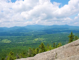
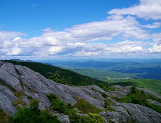
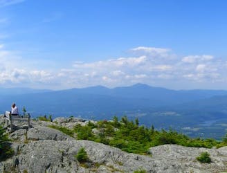
6.1 km away
A must-do hike in Stowe, to a granite dome with 360-degree views of the valley and surrounding mountains.
Difficult Hiking
8.1 km away
Short, family-friendly nature trail with a view of Vermont's tallest mountain and a chance at spotting wildlife.
Easy Hiking
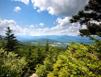
8.3 km away

Rewarding hike to a lesser-known summit of the mountains near Stowe.
Difficult Hiking
9.9 km away
Straight up the slope of Mount Hunger to its panoramic summit.
Difficult Hiking
9.9 km away
A committing traverse of the surprisingly rugged and varied peaks east of Stowe.
Severe Hiking
8 routes · Hiking
10 routes · Hiking