26 m away
Alex's Funnel

A narrow couloir that funnels through a steep, rocky chute
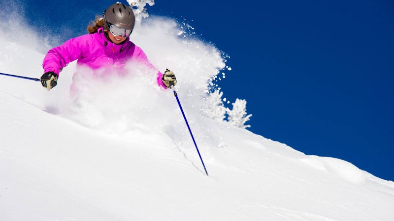
Severe Freeride Skiing
- Distance
- 415 m
- Ascent
- 0 m
- Descent
- 208 m
This short steep face is rarely skied due challenging route finding
Freeride Skiing Difficult

Even though East Shoulder is part of Hamburger Basin, it is only accessible when Southback is open. Enter the upper Southback gate at the summit of the Throne and work the ridge past Alex's Funnel to the steep, tree-d slope to the skier's right. Shimmy through the trees to the triangular slope below a cliff. Enjoy a few turns before hitting the traverse track, then work the trees and gullies below the traverse. End in the deep snow near the A-Basin Line. See description.
Difficult
Serious gradient of 30-38 degrees where a real risk of slipping exists.

As well as the slope itself, there are some obstacles (such as rock outcrops) which could aggravate injury.

Close to help in case of emergency.
26 m away
A narrow couloir that funnels through a steep, rocky chute
Severe Freeride Skiing
54 m away
Twin gullies that funnel through a narrow chute into Hamburger Basin.
Severe Freeride Skiing
56 m away

This short open glade is often deep and untracked
Difficult Freeride Skiing
93 m away

A long narrow chute that opens into a wide bowl.
Severe Freeride Skiing
109 m away

A broad face that narrows into a steep chute before opening into Avalanche Basin.
Severe Freeride Skiing
109 m away

This 600 vertical foot run starts as an open face and narrows into steep gullies before opening into a wide basin
Severe Freeride Skiing
109 m away

A long hourglass couloir that opens into a wide bowl
Difficult Freeride Skiing
115 m away

Long narrow chute that opens into a wide bowl.
Severe Freeride Skiing
142 m away

A wide steep chute that opens into an open bowl
Severe Freeride Skiing
171 m away

A narrow, shallow, steep chute above an open bowl
Severe Freeride Skiing
13 routes · Freeride Skiing · Ski Touring