1.8 km away
Pinnacle Peak
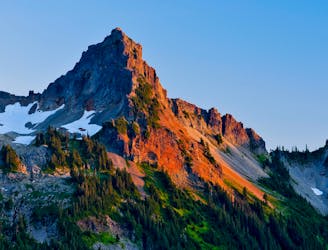
A steep hike and scramble to the summit of Pinnacle Peak.
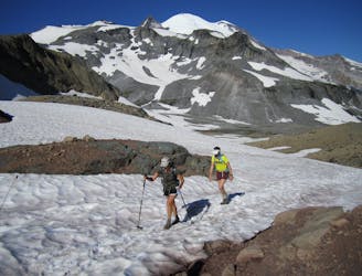
Extreme Hiking
- Distance
- 4.6 km
- Ascent
- 500 m
- Descent
- 499 m
Enjoy a high effort-to-view ratio on this beautiful hike to two alpine lakes.
Hiking Moderate
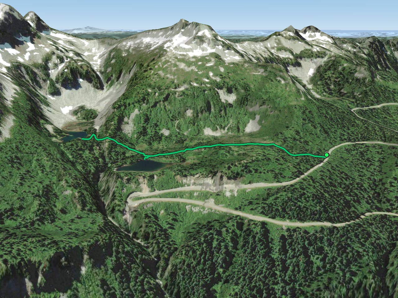
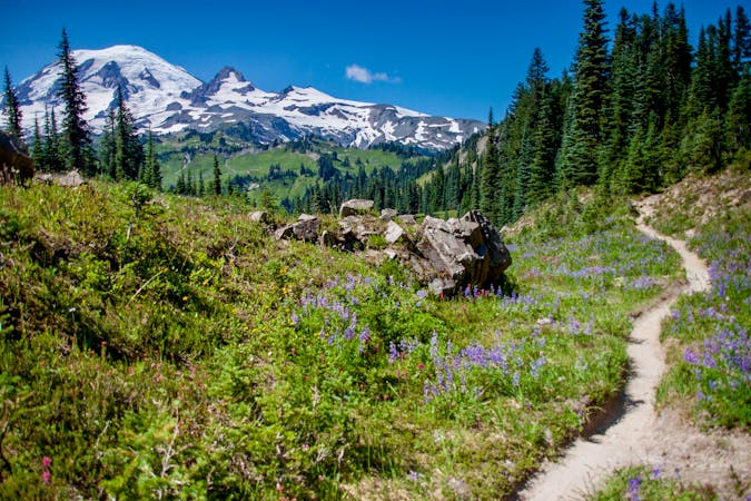
If you are looking for a short and easy hike that offers stunning views of Mount Rainier and two beautiful alpine lakes, the Bench and Snow Lakes Trail is a perfect choice. This 2.1-mile out-and-back trail in Mount Rainier National Park will take you through subalpine meadows, huckleberry shrubs and patches of forest, with a moderate elevation gain of 535 feet.
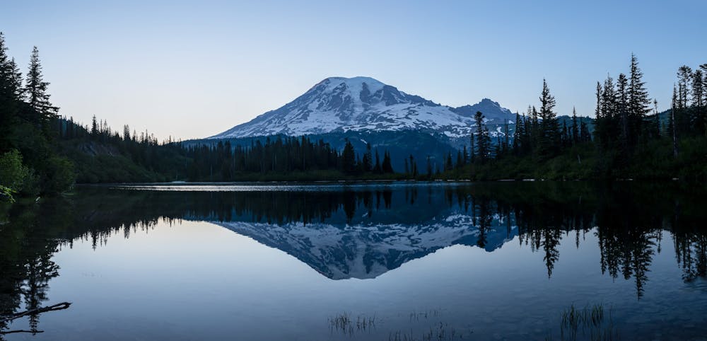
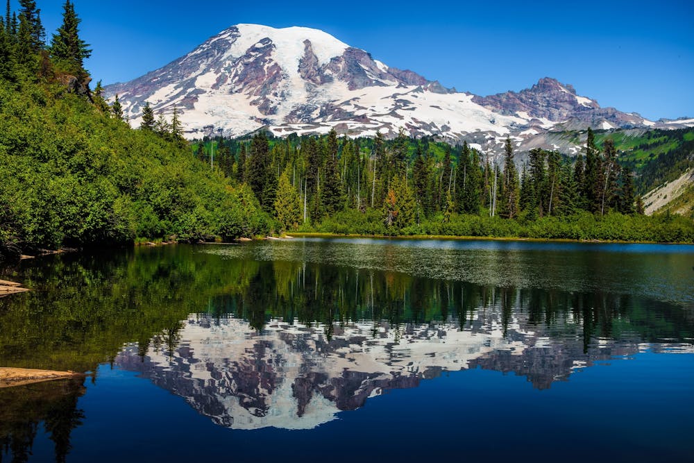
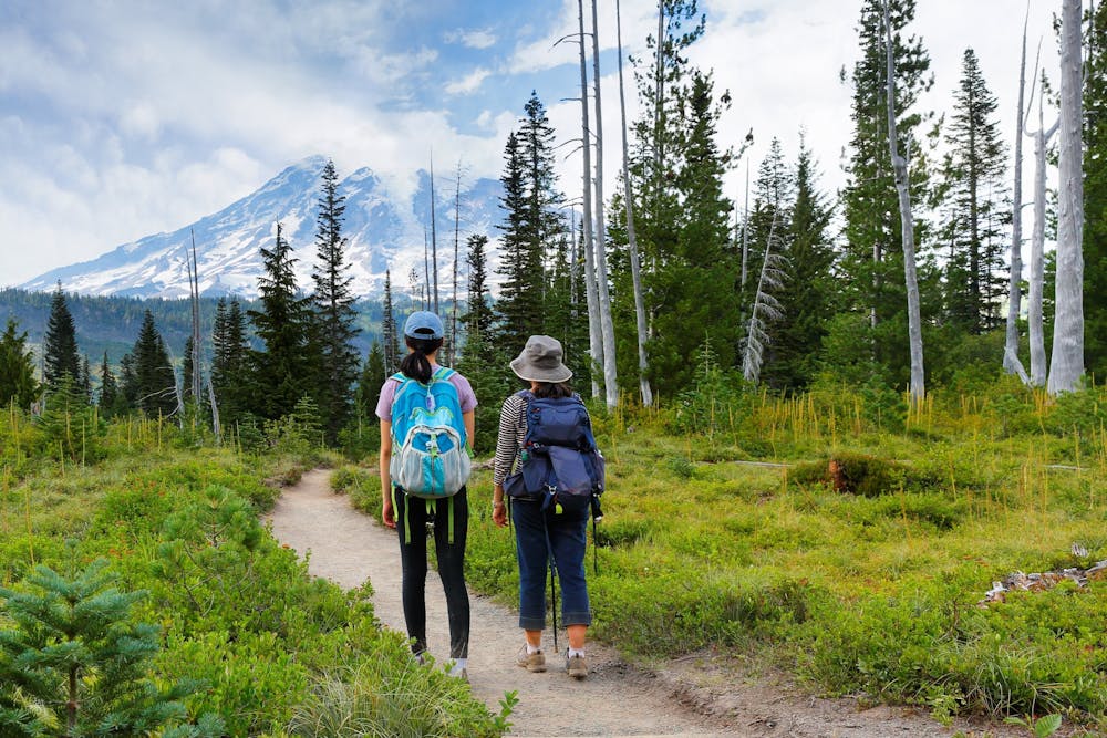
The trail starts from the Stevens Canyon Road, near Reflection Lakes. The first part of the trail climbs up to a natural bench, a flat shelf of land created by a lava flow about 91,000 years ago. Here you can take a spur trail to reach Bench Lake, where you can admire the reflection of Mount Rainier on the calm water. This is one of the most scenic spots in the park, so don't forget your camera.
Back on the main trail, continue to climb through the forest, with sections of steeper log steps. You will soon reach Snow Lake, tucked into a cirque of the Tatoosh Range and fed by snowmelt. Snow Lake is deeper and colder than Bench Lake, but equally picturesque. You can walk to the shallow end of the lake or explore the shore for a good lunch spot. There are also two campsites near the lake if you have a wilderness permit and want to stay overnight.
Source: Bench and Snow Lakes — Washington Trails Association. https://www.wta.org/go-hiking/hikes/bench-and-snow-lakes. Bench and Snow Lake Trail: Pics + Video (Underrated Mt Rainier Hike You .... https://inspiredroutes.com/bench-and-snow-lake-trail/. Bench And Snow Lake Trail: Wonderful Short Hike In Mt Rainier. https://wherearethosemorgans.com/bench-and-snow-lakes-trail-mt-rainier-hike/. Bench and Snow Lake Trail - National Park Service. https://www.nps.gov/mora/planyourvisit/bench-snow-lake-trail.htm. Conversation with Bing Chat
Moderate
Hiking along trails with some uneven terrain and small hills. Small rocks and roots may be present.

The trail contains some obstacles such as outcroppings and rock which could cause injury.
Away from help but easily accessed.
1.8 km away
A steep hike and scramble to the summit of Pinnacle Peak.
Extreme Hiking
3 km away
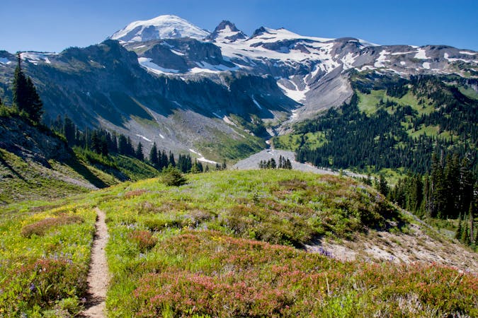
One of the most beautiful hikes in Washington State!
Moderate Hiking
3 km away
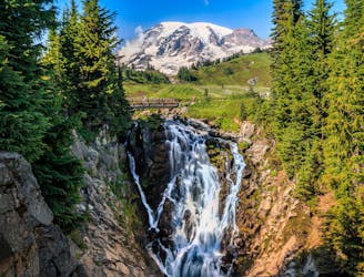
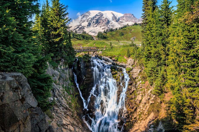
Reach a stunning view of Myrtle Falls framed by Mount Rainier.
Easy Hiking
3.1 km away
Hike down to a beautiful vista of this 168-foot waterfall.
Moderate Hiking
3.2 km away
An easy paved hike to a stunning overlook of a glacier-carved valley.
Easy Hiking
5.6 km away
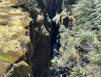
This narrow slot canyon is 180 feet deep, with a rushing river at the bottom!
Easy Hiking
8.2 km away
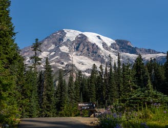
A 93 mile (150 kilometer) hiking trail that circumnavigates Mount Rainier, one of North America's most iconic peaks.
Difficult Hiking

6 routes · Hiking
10 routes · Hiking
5 routes · Hiking
5 routes · Hiking
3 routes · Hiking
8 routes · Hiking

19 routes · Hiking