1.4 km away
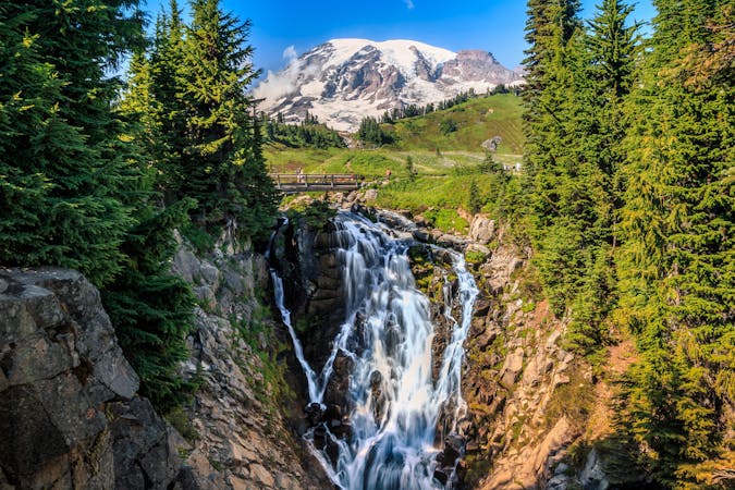
Narada Falls
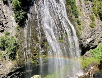
Hike down to a beautiful vista of this 168-foot waterfall.
Moderate Hiking
- Distance
- 432 m
- Ascent
- 31 m
- Descent
- 31 m
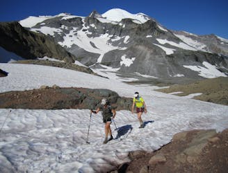
A steep hike and scramble to the summit of Pinnacle Peak.
Hiking Extreme

If you are looking for a short but challenging hike with stunning views of Mount Rainier and the surrounding peaks, the Pinnacle Peak hike is a great option. This 2.9-mile round-trip trail climbs over 1,600 feet to the summit of Tatoosh Range.
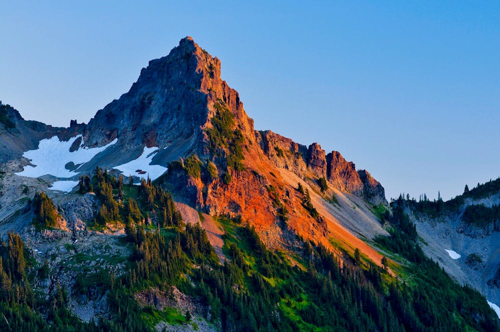
The trail starts at the Reflection Lakes parking area and ascends through subalpine meadows and forests. The trail can be rocky and snowy, so hiking boots are recommended. As you climb, you will get glimpses of Mount Rainier and the lakes below.
The designated trail ends at the saddle, where you will be rewarded with panoramic views of Mount Rainier, Paradise, Mount Adams, Mount St. Helens, and Mount Hood. You can also see the other peaks of the Tatoosh Range, such as Castle Peak and Unicorn Peak. This is a great spot to see wildlife, such as pikas, marmots, and birds.
Intrepid climbers will, of course, want to finish the climb by scrambling to the summit of Pinnacle Peak, or nearby Plummer Peak. However, be aware that these routes are steep and exposed, and require some climbing skills. For an easier hike, simply turn around at the saddle and return the way you came.
Sources: Pinnacle Peak Trail - Mount Rainier National Park (U.S. National Park .... https://home.nps.gov/mora/planyourvisit/pinacle-peak.htm. Pinnacle Peak Saddle Hike Route Guide- See Mount Rainier - 10Adventures. https://www.10adventures.com/hikes/mount-rainier-national-park/pinnacle-peak-saddle-trail/. Pinnacle Peak Trail. https://www.nps.gov/mora/planyourvisit/pinacle-peak.htm. Mount Rainier National Park Pinnacle Peak Trail. https://www.us-parks.com/mount-rainier-national-park/pinnacle-peak-trail.html. Conversation with Bing Chat
Extreme
Scrambling up mountains and along technical trails with moderate fall exposure. Handholds are necessary to navigate the trail in its entirety, although they are not necessary at all times. Some obstacles can be very large and difficult to navigate, and the grades can often be near-vertical. The challenge of the trail and the steepness of the grade results in very strenuous hiking. Hikes of this difficulty blur the lines between "hiking" and "climbing".

Some trail sections are extremely exposed where falling will almost certainly result in serious injury or death.

Little chance of being seen or helped in case of an accident.
1.4 km away
Hike down to a beautiful vista of this 168-foot waterfall.
Moderate Hiking
1.8 km away
Enjoy a high effort-to-view ratio on this beautiful hike to two alpine lakes.
Moderate Hiking
2 km away
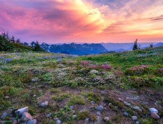
One of the most beautiful hikes in Washington State!
Moderate Hiking
2 km away
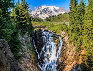
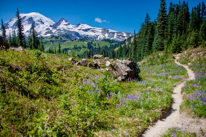
Reach a stunning view of Myrtle Falls framed by Mount Rainier.
Easy Hiking
2 km away
An easy paved hike to a stunning overlook of a glacier-carved valley.
Easy Hiking
6.5 km away
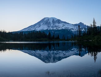
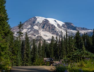
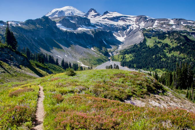
A 93 mile (150 kilometer) hiking trail that circumnavigates Mount Rainier, one of North America's most iconic peaks.
Difficult Hiking
7.3 km away
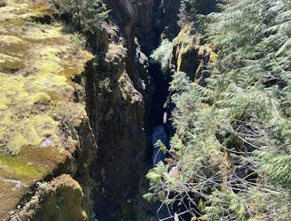
This narrow slot canyon is 180 feet deep, with a rushing river at the bottom!
Easy Hiking

6 routes · Hiking
10 routes · Hiking
5 routes · Hiking
5 routes · Hiking
3 routes · Hiking
8 routes · Hiking

19 routes · Hiking