5 m away
Mohawk -> Mullet
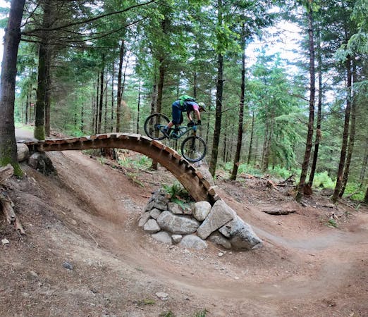
The biggest and baddest jumps on Galbraith!
Severe Mountain Biking
- Distance
- 12 km
- Ascent
- 350 m
- Descent
- 350 m
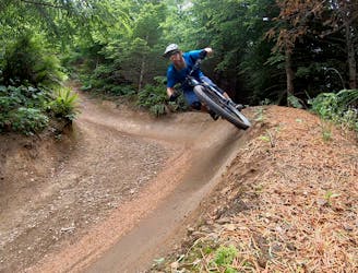
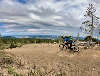
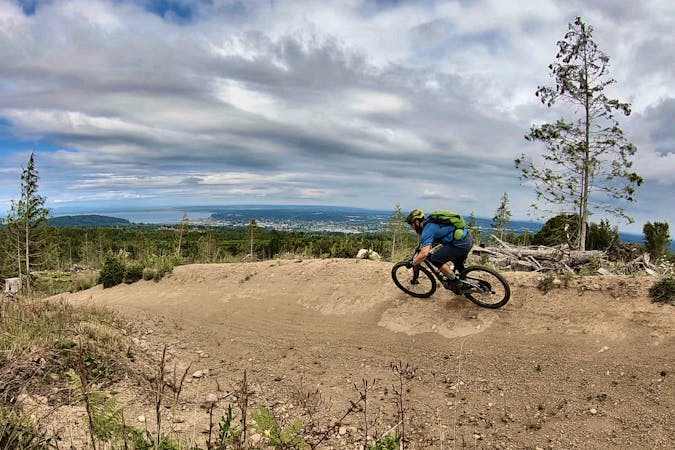
Unemployment Line is Galbraith's marquee jump trail, and is largely responsible for Galbraith's international fame.
Mountain Biking Severe

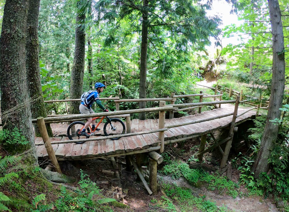
Unemployment Line is Galbraith's marquee jump trail, and is largely responsible for Galbraith's international fame. Unwilling to rest on their laurels, the local mountain bike club, WMBC, continues to reshape and improve Unemployment Line every few years. For 2019, many of the jumps were revamped and improved, and a visually-stunning over/under roll in feature was added to the trail entrance.
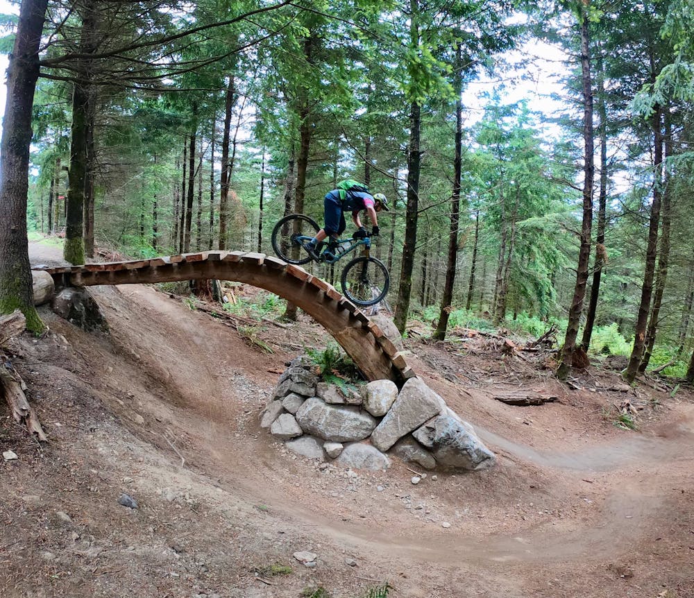
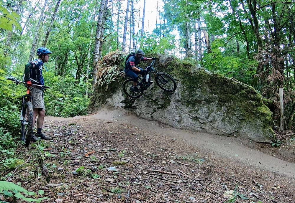
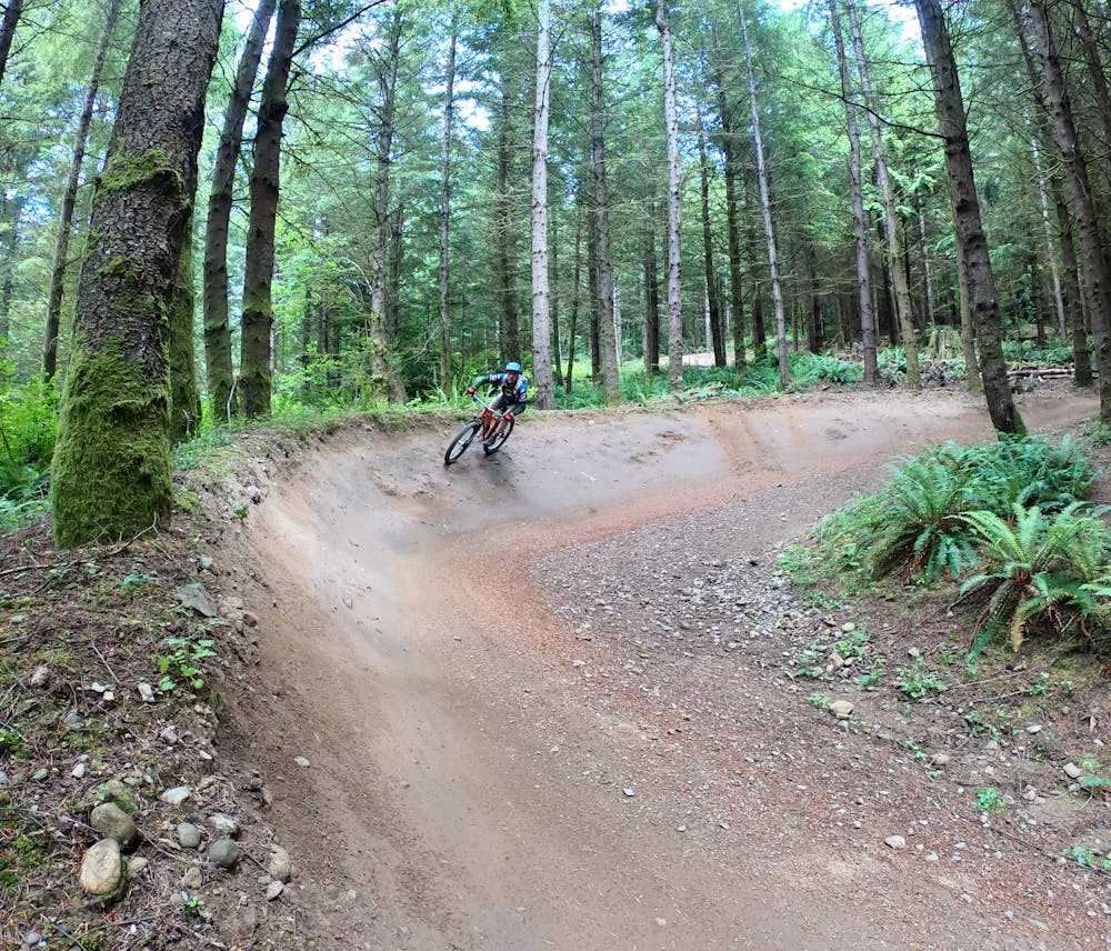
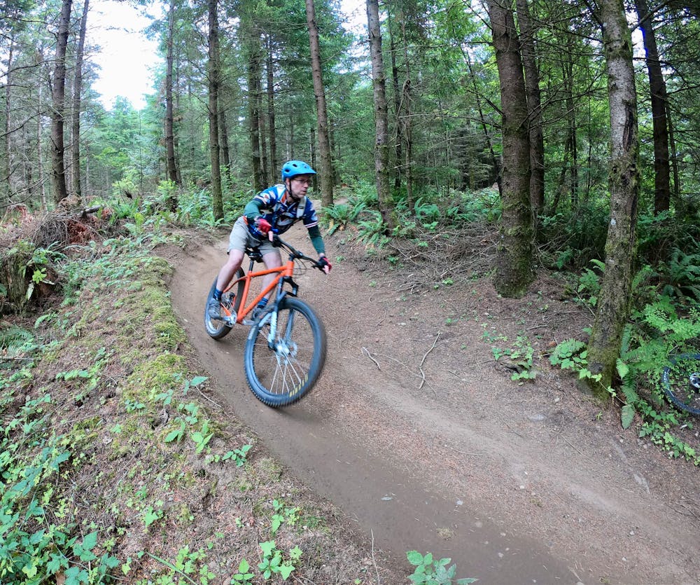
Unemployment Line offers tabletops and booters of a variety of sizes. While the takeoffs and landings have grown over the years, compared to the scope of jumps found in downhill bike parks, the jumps on Unemployment Line can demand sniper focus to hit perfectly. The tables are a bit narrower and the landings can sometimes be a bit shorter than you’d expect.
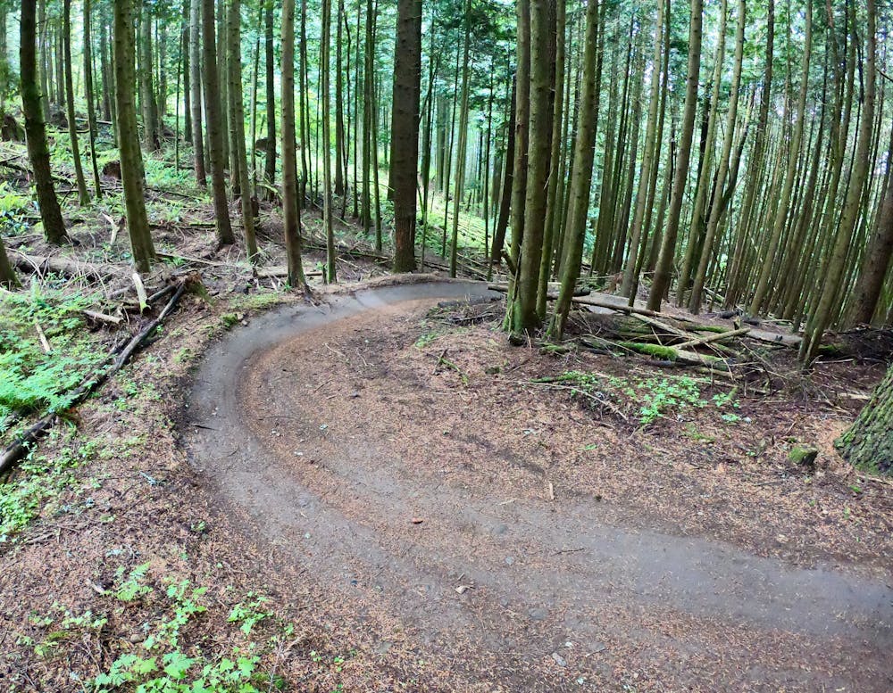
That said, advanced riders will soon be sending these jumps perfectly after just a couple of runs. The trail speed sets you up superbly for each hit, with massive bermed corners allowing you to easily maintain as much momentum as you need.
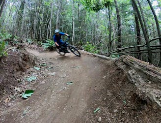
Mapped here is a complete loop ride for enjoying Unemployment Line to the utmost. This route follows the green Three Pigs climbing trail to the top. Then, it begins the downhill romp on Evolution—an excellent jump trail in its own right. Evolution dumps into Unemployment Line, the main feature. After Unemployment Line, pick up Atomic Dog for a riotous finish with a more natural feel.
After your first lap on Unemployment Line, feel free to mix it up with other trails to start and finish, like Scorpion, Radical Dragon, and Lair of the Bear. While the multitude of trails on Galbraith Mountain can be overwhelming at times, the beauty is that with this many options, the riding never gets old!
Severe
Widely variable, narrow trail tread with steeper grades and unavoidable obstacles of 15in/38cm tall or less. Obstacles may include unavoidable bridges 24in/61cm wide or less, large rocks, gravel, difficult root sections, and more. Ideal for advanced-level riders.

Some trail sections have exposed ledges or steep ascents/descents where falling could cause serious injury.

Away from help but easily accessed.
5 m away
The biggest and baddest jumps on Galbraith!
Severe Mountain Biking
6 m away
Build your skills on this mellow, flowy singletrack loop.
Easy Mountain Biking
5.8 km away
The best jump line on Galbraith's lesser-ridden north side.
Difficult Mountain Biking
5.8 km away
An XC-oriented figure-8 finishing with an entertaining flow trail descent.
Difficult Mountain Biking
7.3 km away
On this high-value loop, you'll pass a beautiful waterfall, idyllic Fragrance Lake, and traverse a beautiful stretch of singletrack.
Moderate Mountain Biking
9.3 km away
If you're tired of the sculpted berms and manicured trails of Galbraith Mountain, try the old-school gnar of Brown Pow on for size!
Severe Mountain Biking
5 routes · Mountain Biking

16 routes · Mountain Biking

10 routes · Mountain Biking
5 routes · Mountain Biking