44 m away
Chair Peak lower Eastern ridge
A great way to access Snow Lake but also a good run on its own
Moderate Ski Touring
- Distance
- 5.7 km
- Ascent
- 680 m
- Descent
- 681 m
What some may consider the safe way to access a great line in the Alpental Backcountry
Ski Touring Difficult

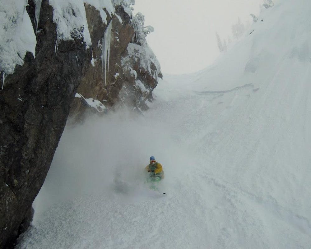
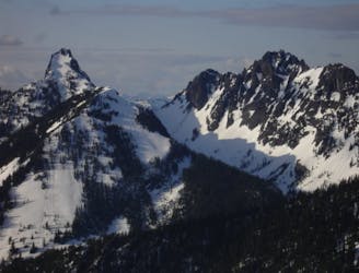
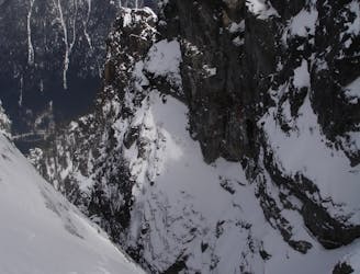
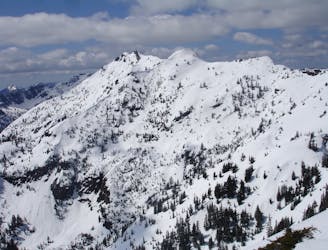
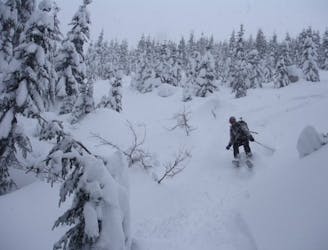
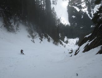
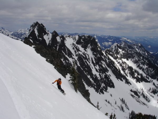
The Bryant Peak Couloir has gotten really popular over the past few years for obvious reasons. It is a beautiful and super aesthetic line which because it is a gully usually holds good snow. This route always causes a debate over the best way to access it. Basically the question is should you directly climb it or wrap around then drop in from up top. Because this place is soo popular in my opinion it is not safe to climb as you have no clue if someone is about to drop. With that being said I will write how to climb and ride the line in a way which minimises avalanche danger in an obviously avalanche prone area.
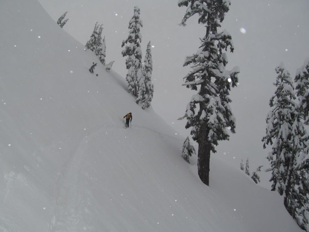
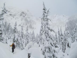
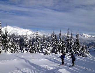
This tour starts in the Alpental Valley where you need to head northwest through the flats until arriving at Source Lake. Start heading west within the trees of the Alpental Ski resort backcountry. Make your way up through the trees until reaching the alpine just below Pineapple Pass. Start heading north from bench to bench carefully wrapping around the East side of Bryant Peak just underneath the summits rock wall. Be cautious as you are in a sketchy area but if the snow fills good make your way to the top of the couloir and climb the extra vert all the way to the col.
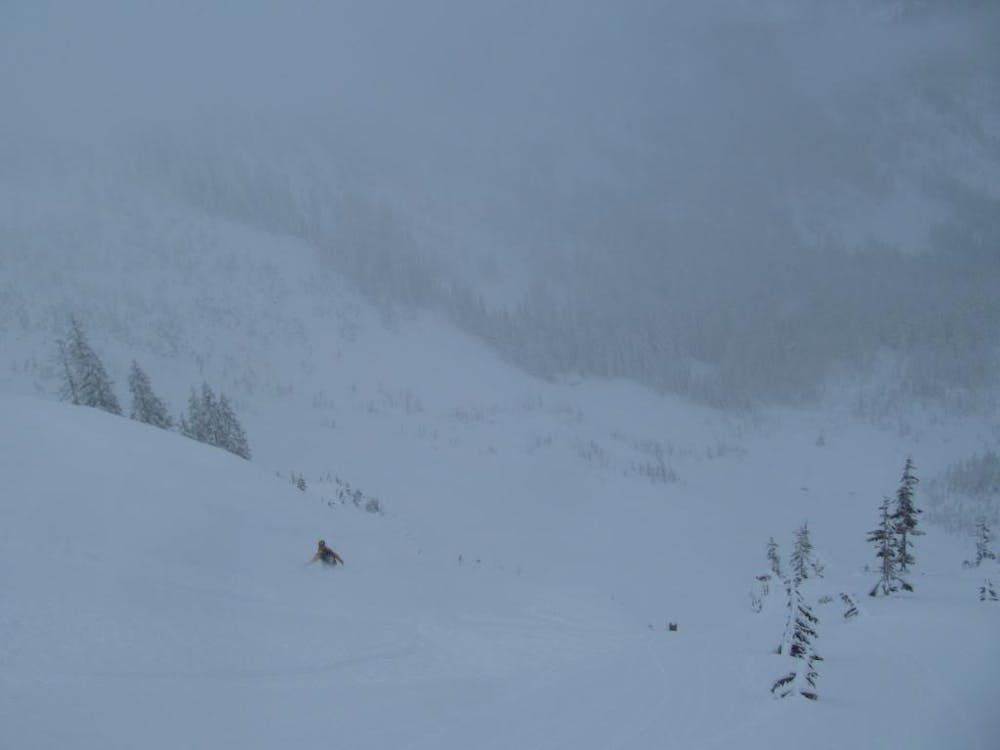
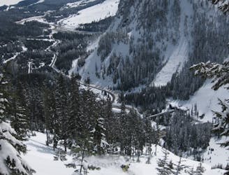
The first few turns are on an open slope which gives you a feel for what to expect while riding down. Once getting into the couloir itself make sure that you ride the line staggered and one person at a time traversing to the sidewall before your partner follows your tracks. Soon enough you will reach the end of the chute and into the open apron below. Once near the bottom of the valley make a hard cut to the skiers right and if high enough you will find yourself on the Alpental Backcountry return trail.
To see my trip in the area and more photos check out this link https://www.whereiskylemiller.com/snoqualmie-pass/bryant-peak-couloir/
Difficult
Serious gradient of 30-38 degrees where a real risk of slipping exists.

In case of a fall, death is highly likely.

Away from help but easily accessed.
44 m away
A great way to access Snow Lake but also a good run on its own
Moderate Ski Touring
148 m away
A Stunning route making the most of the terrain west of Snoqualmie Pass
Difficult Ski Touring
572 m away
Possibly the best tree skiing zone within the ski resort areas of Washington
Difficult Ski Touring
645 m away
One of if not the most popular ski tours within Snoqualmie Pass
Difficult Ski Touring
2.5 km away
A great link up of two lines in Commonwealth Basin
Difficult Ski Touring
2.7 km away
An option when avalanche conditions aren't good and you want to play it safe
Easy Ski Touring
2.7 km away
Snoqualmie Pass to Meany Lodge
Moderate Ski Touring
6.2 km away
A direct line fro Kendal Lakes to the Gold Creek Valley
Difficult Ski Touring
6.2 km away
A north facing slope stacked with chutes
Difficult Ski Touring

11 routes · Ski Touring
8 routes · Ski Touring