13 m away
Kendal Adventure Zone
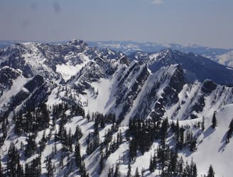
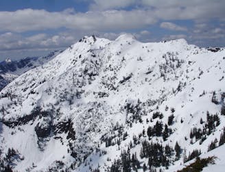
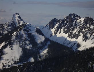
A north facing slope stacked with chutes
Difficult Ski Touring
- Distance
- 16 km
- Ascent
- 1.3 km
- Descent
- 1.3 km
A direct line fro Kendal Lakes to the Gold Creek Valley
Ski Touring Difficult

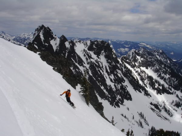
The Gold Creek Chute was a line that we spotted on the map wanting to make a good exit from the Kendal Ridge zone. It was a way to exit the area not wanting to deal with Forest service roads but deserves its own writeup as it is a great line. In my opinion this line should not be attempted if there is any questionability about avalanche conditions. Being that it goes from the summit ridge all the way to the valley it was formed by avalanches and you do not want to experience that. This is one of those “adventurous” tours as it goes all the way into the Gold Creek Valley so if you want a fast exit it is not the way to go.
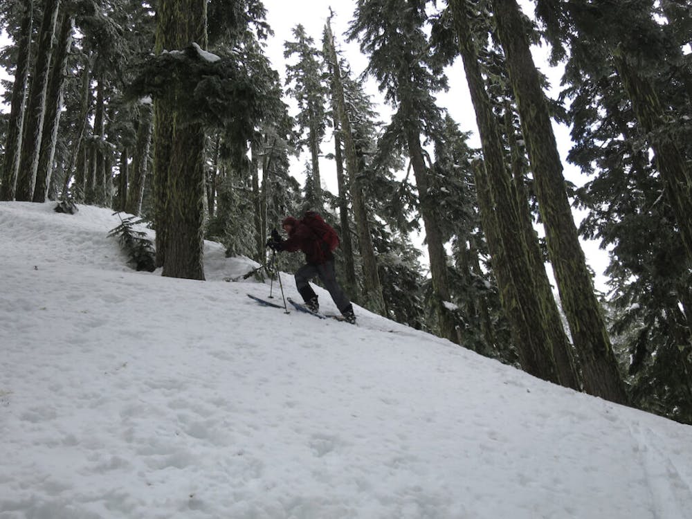
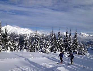
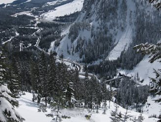
Starting at the Lake Mardee Road start skinning up Forest Road 9090 which soon changes names to 2235. The road is perfect as it is easy to navigate and is always gaining elevation until breaking off just above the Kendal Lakes area. Follow the logged slopes until dropping a few feet into the main basin and Lower Kendal Lake. Now head east making your way to the upper lake before heading southeast to a low col. Once on the col start going directly south until you reach the high point and it is the time you’ve been waiting for.
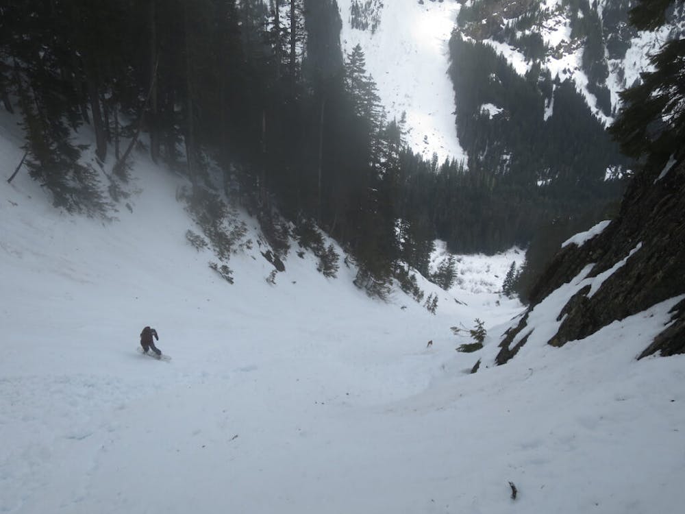
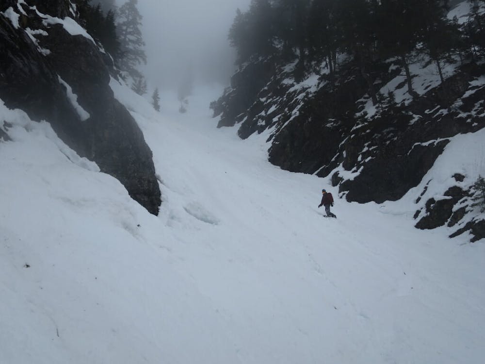
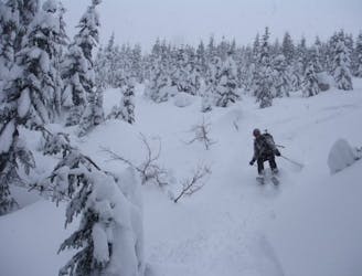
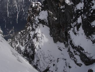
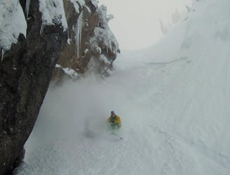
From the moment you drop south you are in the line of fire with the top section being the most dangerous. This line is one big terrain trap so it is best to ride with caution but not hang around for too long. As for a line it doesn’t get more direct then this with open slopes all the way to the Gold Creek Valley. If you keep enough speed you will be able to make it into the forested slopes before switching over to skinning.
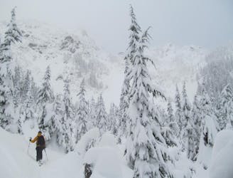
In the past I remembered the Gold Creek Valley to be a nightmare but this time it seemed long but relatively easy. I was nervous about crossing the creek but it was early enough in the season that I didn’t even get my shoes wet (March). Once on the other side we just followed the Gold Creek Road until hitting Forest Service Road 4832 and walking all the way back to the car. Sure it was a long exit but the line more than made up for it.
To see my trip in the area and more photos check out this link https://www.whereiskylemiller.com/snoqualmie-pass/kendall-peak-chutes/
Difficult
Serious gradient of 30-38 degrees where a real risk of slipping exists.

As well as the slope itself, there are some obstacles (such as rock outcrops) which could aggravate injury.

Little chance of being seen or helped in case of an accident.
13 m away
A north facing slope stacked with chutes
Difficult Ski Touring
3.5 km away
Snoqualmie Pass to Meany Lodge
Moderate Ski Touring
3.5 km away
An option when avalanche conditions aren't good and you want to play it safe
Easy Ski Touring
3.7 km away
A great link up of two lines in Commonwealth Basin
Difficult Ski Touring
5.7 km away
One of if not the most popular ski tours within Snoqualmie Pass
Difficult Ski Touring
5.7 km away
Possibly the best tree skiing zone within the ski resort areas of Washington
Difficult Ski Touring
6.1 km away
A Stunning route making the most of the terrain west of Snoqualmie Pass
Difficult Ski Touring
6.2 km away
What some may consider the safe way to access a great line in the Alpental Backcountry
Difficult Ski Touring
6.2 km away
A great way to access Snow Lake but also a good run on its own
Moderate Ski Touring

11 routes · Ski Touring
8 routes · Ski Touring