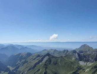
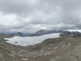
Gandeghütte - Breithorn - Trockener Stegg

Gandeghütte - Breithorn - Trockener Stegg
Extreme Hiking
- Distance
- 17 km
- Ascent
- 1.2 km
- Descent
- 1.3 km

Go hiking in Valais with curated guides of the best hikes across the region. With over 726 3D trail maps in FATMAP, you can easily discover and navigate the best trails in Valais.
No matter what your next adventure has in store, you can find a guide on FATMAP to help you plan your next epic trip.
Get a top hiking trail recommendation in Valais from one of our 73 guidebooks, or get inspired by the 726 local adventures uploaded by the FATMAP community. Start exploring now!
Gandeghütte - Breithorn - Trockener Stegg
Extreme Hiking

Gandeghütte - Breithorn - Trockener Stegg
Severe Hiking

Schönbielhütte - Hörnlihütte - Gandegghütte
Severe Hiking

Châtel - Morclan - Alage du Mouet - Col d'outane - La chappelle d'Abondance
Moderate Hiking
Randonnée sur 2 jours, ascension des Cornettes de Bise et du Grammont avec des vus remarquables et dégagées sur la Suisse et la France !
Moderate Hiking
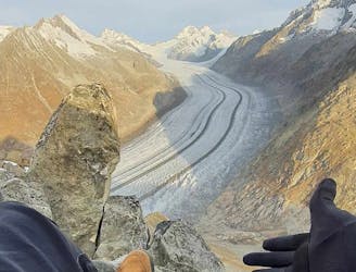
Randonnée/Bivouac en 2 jours, vue sur le plus grand glacier d'Europe: L'Aletsch Arena puis randonnée alpine pour gravir les sommets du Eggishorn et Bettmerhorn.
Difficult Hiking
Hike to the summit of Mont Bonvin (2995 m.s.m) from Cry d'Er and descent to Crans.
Difficult Hiking

Dent du Vélan et Cornettes de Bise
Difficult Hiking
Haute Cime (Dents du Midi, Valais) via le Lac de Salanfe et le Col de Susanfe.
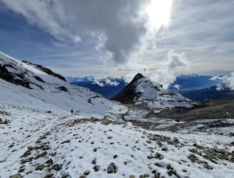
Severe Hiking

Trek alpin sur 2 jours avec passage sur glacier
Difficult Hiking
Randonnée d'une journée pour découvrir le glacier de la Plaine morte Pointe de la plaine morte (2927m) Bisse du Ro (randonnée de montagne T3)
Moderate Hiking

Hübschhorn Mountain (3192 meters) from the Simplon Pass
Difficult Hiking

Traverse of the French Alps oin opposite direction
Difficult Hiking

Trekking over the French Alps from the Geneva Lake to Mediterrian
Difficult Hiking
A great hike for circumnavigating sunny Verbier. 12 km 530m 3:30 - 4:30 hrs approx. 3/5 difficulty.
Difficult Hiking

A gentle hike with fantastic views and sculptures along the route. 2.5 km 0m 25-45 min one way. 1/5 difficulty
Easy Hiking