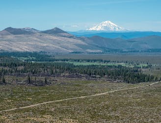
Miles 1377.4-1419 of the PCT: Along a panoramic rim with views to Mount Shasta, then down into a broad valley with entrenched creeks and the spectacle of Burney Falls.
Easy Hiking
- Distance
- 67 km
- Ascent
- 830 m
- Descent
- 1.3 km
Hike to the crest of a ridge for some of the finest views in the urban area.
Moderate Hiking
- Distance
- 2.4 km
- Ascent
- 77 m
- Descent
- 77 m
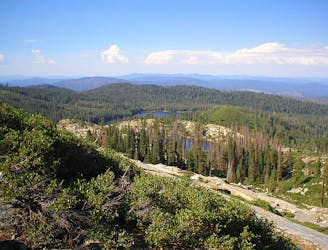
Miles 1350.1-1377.4 of the northbound PCT: Continuing through Lassen National Park, past backcountry lakes and views of volcanic peaks.
Moderate Hiking
- Distance
- 43 km
- Ascent
- 658 m
- Descent
- 1.1 km

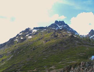
The long way to the top of Lincoln Mountain.
Moderate Resort Ski Touring
- Distance
- 3.3 km
- Ascent
- 597 m
- Descent
- 0 m

Easy uphill route with some transition practice.
Easy Resort Ski Touring
- Distance
- 2.1 km
- Ascent
- 231 m
- Descent
- 11 m

Uphill access from the main base area to the top of Roller Coast Express lift.
Moderate Resort Ski Touring
- Distance
- 1.6 km
- Ascent
- 230 m
- Descent
- 2 m
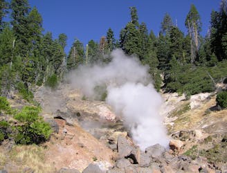
Miles 1331.1-1350.1 of the northbound PCT: Entering Lassen Volcanic National Park for a taste of hydrothermal features that are rare outside of Yellowstone.
Moderate Hiking
- Distance
- 30 km
- Ascent
- 1 km
- Descent
- 831 m

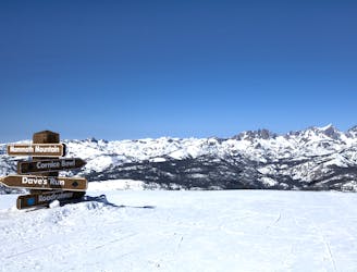
Skin to the top of Lincoln Peak from Canyon Lodge.
Moderate Resort Ski Touring
- Distance
- 2.5 km
- Ascent
- 518 m
- Descent
- 0 m

A two-way sprint for fitness and transition practice.
Easy Resort Ski Touring
- Distance
- 866 m
- Ascent
- 35 m
- Descent
- 76 m
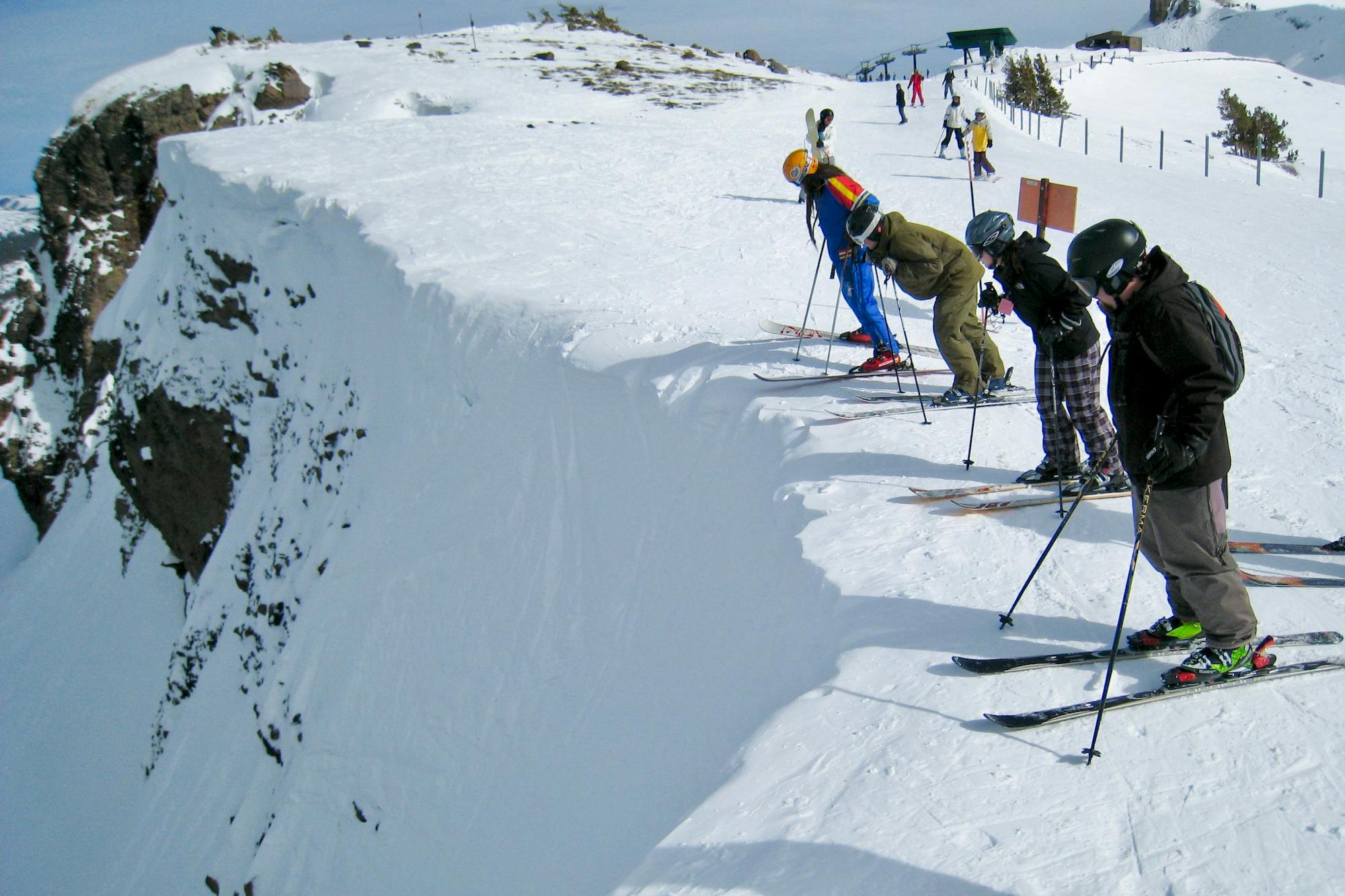
Skin to the summit of Mammoth Mountain on this quiet backside ski tour.
Difficult Resort Ski Touring
- Distance
- 4.8 km
- Ascent
- 666 m
- Descent
- 26 m

Miles 1287-1331.3 of the northbound PCT: A lengthy incline through the scar of the Dixie Fire, and reaching the midpoint of the trail between Mexico and Canada.
Difficult Hiking
- Distance
- 70 km
- Ascent
- 3 km
- Descent
- 2.2 km
Miles 1267.9-1287 of the northbound PCT: Up and over a lofty plateau, then abruptly down into a river gorge, within the burn scar of the Dixie Fire.
Difficult Hiking
- Distance
- 30 km
- Ascent
- 778 m
- Descent
- 1.8 km
Miles 1234.8-1267.9 of the northbound PCT: Through the burn zone of a 2020 wildfire, on a rolling ridgewalk punctuated by a sharp dip into a river gorge.
Moderate Hiking
- Distance
- 53 km
- Ascent
- 2.2 km
- Descent
- 2.5 km
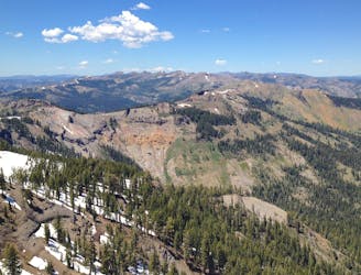
Miles 1195.4-1234.8 of the northbound PCT: A big climb from the river to the crest, then a stroll along ridges and forest mosaic to the edge of an extensive burn area.
Moderate Hiking
- Distance
- 61 km
- Ascent
- 2.8 km
- Descent
- 2.2 km
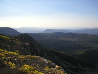
A meandering course over consecutive ridges and valleys, with no shortage of vast views or comfortable camps.
Moderate Hiking
- Distance
- 65 km
- Ascent
- 1.8 km
- Descent
- 2.6 km
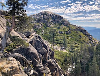
Miles 1124.8-1153.4 of the northbound PCT: Tracing a line across the sky above Lake Tahoe, on a bald crest of craggy peaks.
Difficult Hiking
- Distance
- 44 km
- Ascent
- 1.6 km
- Descent
- 1.8 km