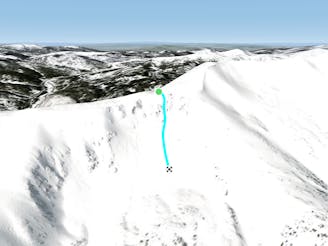
Crystal Peak South Face

Southeast face of Crystal peak
Difficult Ski Touring
- Distance
- 996 m
- Ascent
- 0 m
- Descent
- 405 m
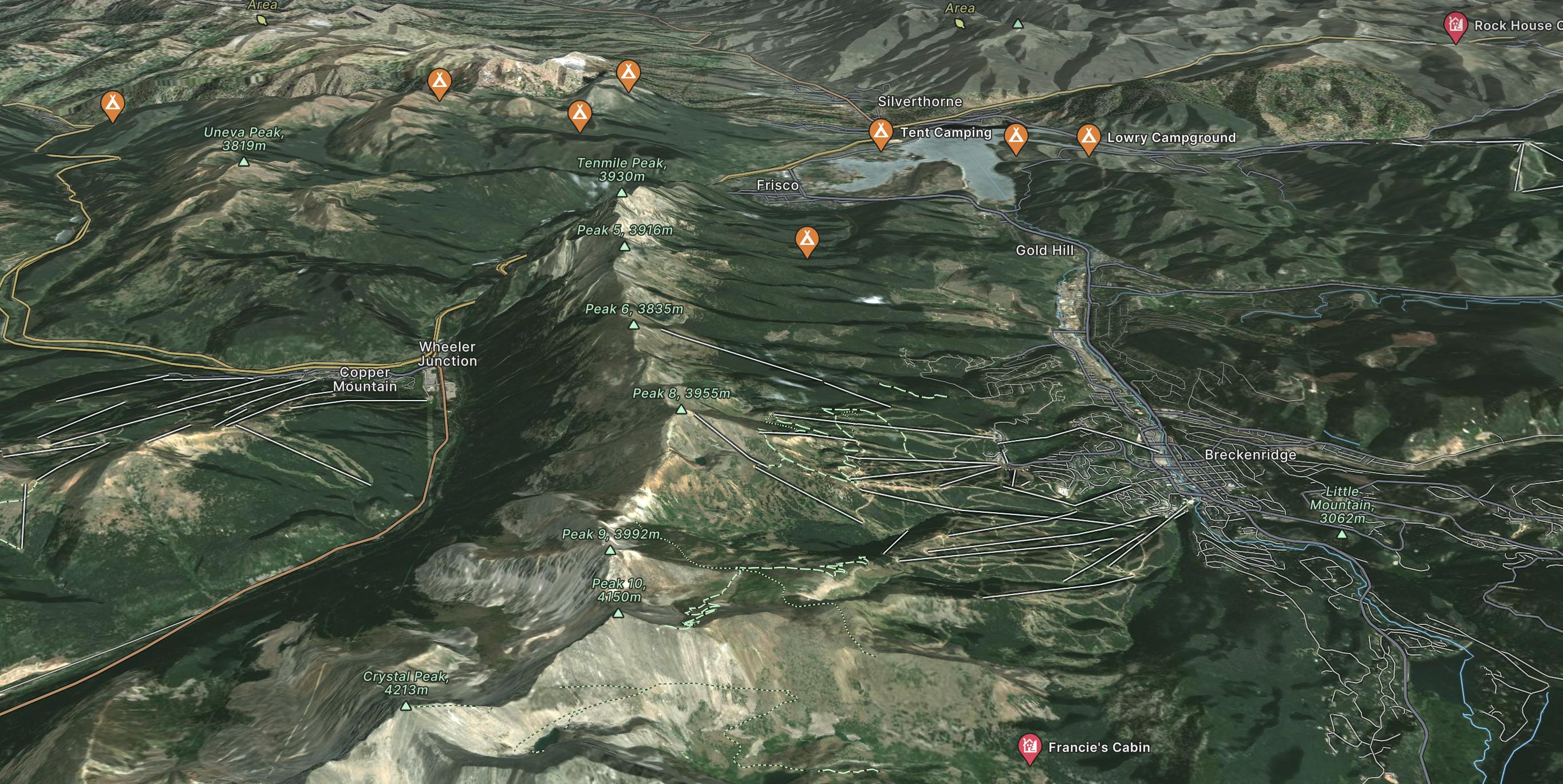
Only 80 miles from Denver, Breckenridge is nestled in Colorado's 10 Mile Range and is one of the most popular ski resorts in the US. Spanning nearly 6 peaks.
Explore Breckenridge with curated guides of the best hiking trails, mountain bike trails, ski routes, and more. With over 156 3D trail maps in FATMAP, you can easily discover and navigate the best trails in Breckenridge.
No matter what your next adventure has in store, you can find a guide on FATMAP to help you plan your next epic trip.
Get a top trail recommendation in Breckenridge from one of our 15 guidebooks, or get inspired by the 156 local adventures uploaded by the FATMAP community. Start exploring now!
Southeast face of Crystal peak
Difficult Ski Touring

Line that starts from peak 5 and goes down to the Conoco Gas Station
Difficult Ski Touring

Access to Peak 5 Chutes
Easy Ski Touring

Flat traverse out of the ballroom area
Easy Freeride Skiing

Bowl skiing off of Father Dyer
Difficult Ski Touring

Another option off the southside of Peak 10
Difficult Ski Touring

Another option near the summit of Peak 10
Difficult Ski Touring

North Chute off the Summit of Crystal Peak
Extreme Ski Touring

Peak 10 Summit High Alpine Bowl
Severe Ski Touring
Rock filled line off Peak 5
Difficult Ski Touring

Open Chute on Hawaii Couloirs
Severe Ski Touring

Second Tightest line in the Hawaii Couloir
Severe Ski Touring