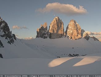
This route, destinated to be an educational essay, is an example of how a group of visitors would experience the mountains of Lavaredo through a hike enriched by narrations that link the physical landscape with its ecology, geology, historical and cultural aspects.
Moderate Hiking
- Distance
- 14 km
- Ascent
- 754 m
- Descent
- 754 m

Grado EE con pezzo in ferrata
Difficult Hiking
- Distance
- 15 km
- Ascent
- 905 m
- Descent
- 903 m
The first section of the multi-stage “Cortina Dolomiti Ultra Trekking” route, from the centre of Cortina to the mountain lodge Rifugio Son Forca.
Moderate Hiking
- Distance
- 26 km
- Ascent
- 1.7 km
- Descent
- 701 m
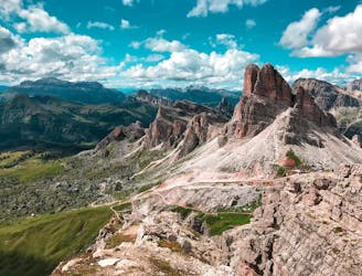
The Alta Via delle Dolomiti n. 1 winds along a path of 125 km and 7,300 m of altitude gain, consisting of 12 stages, which connects Lake Braies (BZ) with Belluno.
Difficult Hiking
- Distance
- 124 km
- Ascent
- 7.6 km
- Descent
- 8.7 km

Passo Giau - Lago delle Baste - Monte Mondeval
Moderate Hiking
- Distance
- 4.2 km
- Ascent
- 368 m
- Descent
- 155 m
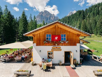
A panoramic walk that runs through several traditional settings with a warm Alpine atmosphere and authentic traditional cuisine.
Easy Hiking
- Distance
- 4.3 km
- Ascent
- 177 m
- Descent
- 178 m
A pleasant walk along the river Boite in the Pian de Ra Spines forest.
Easy Hiking
- Distance
- 6.8 km
- Ascent
- 122 m
- Descent
- 123 m
Starting from the town centre, this easy walk explores traditional hamlets and an evocative forest.
Easy Hiking
- Distance
- 5.9 km
- Ascent
- 221 m
- Descent
- 218 m
This easy walk with a minimal vertical distance is ideal for all, and provides unexpected views over Cortina’s grasslands and peaks.
Easy Hiking
- Distance
- 4 km
- Ascent
- 100 m
- Descent
- 100 m
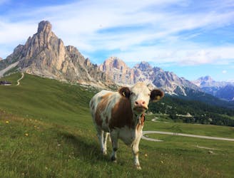
An itinerary set amidst the peaks and grasslands of the famous Giau Pass
Easy Hiking
- Distance
- 1.1 km
- Ascent
- 13 m
- Descent
- 13 m
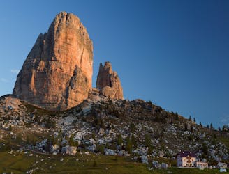
A hike at the foot of the Cinque Torri peaks, surrounded by history, Alpine climbing and breath-taking views.
Moderate Hiking
- Distance
- 5.6 km
- Ascent
- 301 m
- Descent
- 300 m
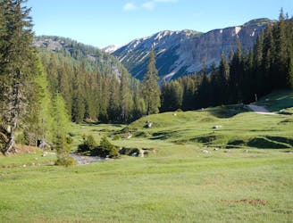
A walk in the Dolomiti d'Ampezzo Nature Park, reaching the enchanting mountain hut Malga Ra Stua
Easy Hiking
- Distance
- 6.3 km
- Ascent
- 333 m
- Descent
- 331 m
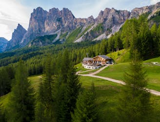
A circular walk to the Ampezzo valley’s first mountain lodge
Moderate Hiking
- Distance
- 11 km
- Ascent
- 624 m
- Descent
- 624 m
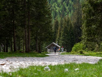
A walk through the largest larch forest in Europe, one of the finest in the Dolomites
Easy Hiking
- Distance
- 4.7 km
- Ascent
- 152 m
- Descent
- 153 m
An easy walk in the heart of the Dolomites, on a route brimming in magic
Easy Hiking
- Distance
- 4.1 km
- Ascent
- 188 m
- Descent
- 197 m
Easy walk at high altitude on the tracks crossing the front lines of the First World War.
Easy Hiking
- Distance
- 1.7 km
- Ascent
- 52 m
- Descent
- 52 m

